-
Hello, please take a minute to check out our awesome content, contributed by the wonderful members of our community. We hope you'll add your own thoughts and opinions by making a free account!
You are using an out of date browser. It may not display this or other websites correctly.
You should upgrade or use an alternative browser.
You should upgrade or use an alternative browser.
Severe March 1st Severe Weather Threat
- Thread starter Storm5
- Start date
Webberweather53
Meteorologist
Well you know how that saying goes "it's 5 o'clock somewhere"...Where? .. LOL
Oh yea - Alaska and Manitoba .......

GTWXAlum
Member
The new Day 1 Outlook has a much larger Enhanced Risk area, now including much of Indiana. SPC noted a few strong tornadoes are possible in Arkansas, Missouri, and Illinois.
ForsythSnow
Moderator
Not liking the looks of the NAM, as it shows several nasty looking cells and 1000+ CAPE into North Georgia and only gets worse back west into Alabama, Mississippi, and Tennessee. Looks like some tornadoes are definitely becoming likely.
Cardall07
Member
I am a teacher in Northwest Georgia (Dalton area) and I was wondering what you guys think the timeline is going to be for strong storms tomorrow (Wednesday). I am a little worried about the buses getting home before the storms. Also, does it seem like Northwest Georgia may get only severe storms or are tornadoes possible as well? Thanks!
Webberweather53
Meteorologist
I am a teacher in Northwest Georgia (Dalton area) and I was wondering what you guys think the timeline is going to be for strong storms tomorrow (Wednesday). I am a little worried about the buses getting home before the storms. Also, does it seem like Northwest Georgia may get only severe storms or are tornadoes possible as well? Thanks!
It's going to be close, mid-late afternoon seems like a pretty good bet... We'll probably know more precise timing by tomorrow once we actually have a fully developed squall line
Webberweather53
Meteorologist
It's worth re-iterating here that this is primarily an overnight threat for the ozarks, IN, western KY, etc. because its liable to take a really long time for the convection to overcome the capping inversion enhanced by all of the upper level descent/sinking in the right exit region of a powerful 150+ knot jet streak in the southern plains.
4k NAM trying to pop a few discrete cells in NE Ark, SEMo this evening

MichaelJ
Member
I personally do not like severe season (beacuse of the death and destruction it can bring to us or our neighbors) but think this one could be a lot like this past winter, very underwhelming for those in the SE. Because of the inabilty of the cold to move out of the West for the most part this Winter, it is likely to continue (persistence wins out again) through Spring and early Summer, giving us much above normal and stable temps leading to less cyclogenesis. The one exception I see as being likely would be the Western Tn, Ky, and western deep south (the biggest focus IMO will be the lower midwest and westward). I am not saying there won't be some potentially severe storms here, but just not to an abnomally higher than average level. That would be just fine with me too
Cardall07
Member
It's going to be close, mid-late afternoon seems like a pretty good bet... We'll probably know more precise timing by tomorrow once we actually have a fully developed squall line
Thank you!
Looking at the NAMs today it confirms my thoughts that the highest concentration/best tornado threat might be in Missouri and Illinois while down toward Ark it might be 1 or 2 isolated supercells rolling across the state
Since it was the cool thing to do on twitter this morning

Sent from my SM-G928V using Tapatalk

Sent from my SM-G928V using Tapatalk
Webberweather53
Meteorologist
SPC upgraded much of the mid MS Valley to a moderate risk... Again this is liable to be mainly an overnight threat except in the far NW areas...

pcbjr
Member
Not pretty

Storm5
Member
New day 2

Sent from my iPhone using Tapatalk

Sent from my iPhone using Tapatalk
RollTide18
Member
Not pretty
If I'm not mistaken, the STP is maxed out over a large area...jeez
pcbjr
Member
Yup ...If I'm not mistaken, the STP is maxed out over a large area...jeez
Bama Ravens
Member
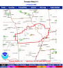
New moderate risk area on the day 1 outlook.
15% hatched tornado risk within the moderate risk
15% hatched tornado risk within the moderate risk
Webberweather53
Meteorologist
Via Randy Bowers, sounding from Little Rock, AR vs HRRR forecast for 18z... You can clearly see the HRRR is way too moist, & thus has too much CAPE, and the inversion aloft is much stronger than forecast. While they are not in the sweet spot for this storm, they're upstream of the airmass that's being advected into the MDT risk area and this sounding is important to see how high resolution models are handling the overall environment here. Thus far, looks lackluster...

ForsythSnow
Moderator
Some cells are firing up in Missouri and Iowa, but the one in Missouri looks like something to watch.
2 watching coming from SPC. I am most interested in the watch for Il, could be some big hail in that one
Webberweather53
Meteorologist
Tornado watch has been hoisted
URGENT - IMMEDIATE BROADCAST REQUESTED
Tornado Watch Number 41
NWS Storm Prediction Center Norman OK
215 PM CST Tue Feb 28 2017
The NWS Storm Prediction Center has issued a
* Tornado Watch for portions of
Southern and West-Central Illinois
Extreme Southeast Kansas
Central and Southern Missouri
* Effective this Tuesday afternoon and evening from 215 PM until
900 PM CST.
* Primary threats include...
A few tornadoes likely with a couple intense tornadoes possible
Scattered large hail likely with isolated very large hail events
to 3 inches in diameter possible
Scattered damaging wind gusts to 70 mph possible
SUMMARY...Widely scattered thunderstorms are expected to affect the
watch area this afternoon and evening, with a few severe storms
likely. Very large hail and isolated tornadoes will be possible in
the more intense storms.
The tornado watch area is approximately along and 70 statute miles
north and south of a line from 10 miles west northwest of Joplin MO
to 25 miles south southeast of Mount Vernon IL. For a complete
depiction of the watch see the associated watch outline update
(WOUS64 KWNS WOU1).
PRECAUTIONARY/PREPAREDNESS ACTIONS...
REMEMBER...A Tornado Watch means conditions are favorable for
tornadoes and severe thunderstorms in and close to the watch
area. Persons in these areas should be on the lookout for
threatening weather conditions and listen for later statements
and possible warnings.
&&
AVIATION...Tornadoes and a few severe thunderstorms with hail
surface and aloft to 3 inches. Extreme turbulence and surface wind
gusts to 60 knots. A few cumulonimbi with maximum tops to 450. Mean
storm motion vector 25035.
Attachments
Webberweather53
Meteorologist
1st severe t'storm warning of the day in south-central MO
That one has potential and looks to be heading towards or just south of St. Louis, if it holds together1st severe t'storm warning of the day in south-central MO
Confirmed tornado on the ground southwest of Aurora Il
Sent from my SM-G928V using Tapatalk
Sent from my SM-G928V using Tapatalk
Then another warning right behind it. The cell to the NW of Peoria looks like it might need a tornado warning soonConfirmed tornado on the ground southwest of Aurora Il
Sent from my SM-G928V using Tapatalk
Sent from my SM-G928V using Tapatalk
Had a nice BWER on the IL cell earlier
Sent from my SM-G928V using Tapatalk
Sent from my SM-G928V using Tapatalk
The new MD's from SPC are both pretty ominous for Missouri, Arkansas and Illinois
That cell in Missouri looks like an animal
Sent from my SM-G928V using Tapatalk
Sent from my SM-G928V using Tapatalk
Webberweather53
Meteorologist
Those supercells in south-central MO generated a lot of attention lol, and the main event is only just about to get underway...

pcbjr
Member
That cell in Missouri looks like an animal
Sent from my SM-G928V using Tapatalk

Webberweather53
Meteorologist
yea the moderate risk just got a lot bigger in the new outlook

Sent from my SM-G920V using Tapatalk
Webberweather53
Meteorologist
The bounded weak echo region in the storm near Ava is insane. Southern end of town likely obliterated
ForsythSnow
Moderator
Definnitely a lot of rotation on the storm relative.The bounded weak echo region in the storm near Ava is insane. Southern end of town likely obliterated

Webberweather53
Meteorologist
yea the debris ball was over 1.6 miles wide. This storm is following an eerily similar track to the tri-state tornado of 1925

ForsythSnow
Moderator
Hope I am reading this right, but off the CC radar, you can see debris balls, correct? If so, there it is very close to that path you posted, but a few miles north of it.yea the debris ball was over 1.6 miles wide. This storm is following an eerily similar track to the tri-state tornado of 1925
View attachment 276

Webberweather53
Meteorologist
Yea it is, there was a clear WBER w/ this supercell and debris was being lofted 25-30,000 feet in the air!
Bama Ravens
Member
The storm in southern Illinois had an incredible TDS a few minutes ago.