• Hello, please take a minute to check out our awesome content, contributed by the wonderful members of our community. We hope you'll add your own thoughts and opinions by making a free account!

Severe Jan 8-11 2024 System Severe

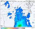
The modeled wind fields are insane at 850mb, even seeing 70-80kts at that level.
Most of the modeling have those ahead of the expected QLCS (but most also have it's own secondary maxima.. )

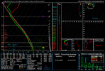
All severe modes are possible. Discreet cells out ahead tapping into that momentum and very large, curved clockwise hodographs. KCHS noted some progs up to 500m²/s² for Tuesday!

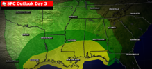
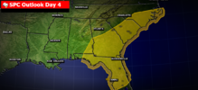
I expect ENHANCED risk outlooks with potentials for a small window of MODERATE categorical risk somewhere in the Eastern Carolinas Tuesday with this level.

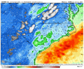
As noted by others, the winds outside of any convection still look in the order of potential max gusts over 50mph, which wind advisories will likely be warranted come Tuesday.
 
How’s the severe look towards Alabama?
 
How’s the severe look towards Alabama?
It'll depend on if the warm front gets pinned south by the initial surge of rain late Monday evening. I'd think the best chance would be bham south but 50+ dews may make it to hsv which would put that area from bhm north in some risk
 
I dont havevthe itch to chase severe. So what are expected wind gust outside of storms Tuesday. Id pull up on euro,but models over inflate. Thanks in advance
 
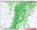
The NAM is making a change I do not really like in that it is cutting back on rainfall ahead of the squall line. This would give temps a chance to perhaps rise another few degrees in the warm sector and produce more CAPE. More CAPE with this would be trouble with all of the shear.
 
NWS has rain and snow showers in the forecast for the morning of the 12th for my zip (28103). First I’ve seen that since 2022. Not saying it will happen but it’s something.
 
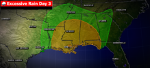
...0830Z Excessive Rainfall Discussion...

Southeast...
An anomalously deep cyclone for early to mid January -- near
record for January at the surface near the AR/MO/TN border
junction -- moves across the Southern Plains towards the Lower to
Mid Mississippi Valley Monday into early Tuesday. A deep layer
flow becomes increasingly out of the Gulf of Mexico with time.
From a model diagnostics standpoint, the 00z NAM was a bit of an
outlier with the cyclone mass field-wise, but even so, it's not
terribly dissimilar from a QPF perspective, perhaps too narrow
with the heavy rain signal along the Gulf Coast and too poleward
with 1.5-2.5" amounts across northern AL and central TN. As this
system is quite a bit stronger than the one that just passed
through, surface based instability should make inroads along the
immediate coast as far east as Florida with sufficient MUCAPE
values -- 500-1000 J/kg -- for a decent period of time north of
I-10, in LA northward past I-20 on more limited time scales. The
amount of low-level convergence and its strength (at 850 hPa) is
impressive, rising to 50-75 kts over a broad area. Precipitable
water values rise to 1.5-1.75" over a fairly wide area. IVT
values are significant, rising to 1400 kg/m/s, and the broad
moisture plume emerging from the Gulf can be identified as an
atmospheric river
. There's little question that the atmosphere
will be saturated or that any convection that forms could become
organized over a 3-6 hour period at any particular location.
Because of the breadth of the moisture and instability near the
Gulf Coast, there is a concern for cell mergers between organized
and disorganized convection, and with the increasingly deep layer
south to southwest flow, concerns for short periods of cell
training as well. Hourly rain totals to 2.5" with local amounts
to 6" seems a conservative bet. While the 00z Canadian Regional
is much wetter than the remainder of the guidance suite, its local

maxima can't be ruled out, given the above ingredients. Rainfall
over the past 24 hours should have brought the past week's
rainfall closer to average, particularly in southern MS/southern
AL and southwest LA, but other locations near the Gulf Coast may
end up still being below average over the past week; urban centers
are expected to be more sensitive to possible flash flooding, as
usual. The Slight Risk depicted is a higher end one, given the
ongoing ingredients and the 00z Canadian output
. Continuity was
generally maintained.
 
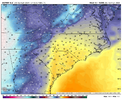
This is getting serious now. The NAM is starting to show CAPE ahead of the line in North and South Carolina. It shows 425 CAPE at 7pm Tuesday in Monroe NC with the line about to move in there. It has gradient winds of 50-60+ for most of NC and SC too, along with 1-2 inches of rain for many of us.

Edit:
It looks like the GFS is going to have CAPE too with this run. It has 181 of CAPE over me at 1pm Tuesday with the line moving through with dewpoints into the low 60's. It shows 356 of CAPE at FLO in SC at 4 pm. Gradient winds are still at 50-60+ on the GFS too with an 80mph max north of Augusta GA, along with 2-4 inches of rain.

I'm going to say we get at least an enhanced risk from the SPC from about I-77 east by Monday morning for Tuesday unless things change.
 
Last edited:
Back
Top