No wonder the GFS weakens it, as the storm heads West, it shows the anticyclone atop td5 just collapsing, and it crashing into tutt, but literally the anticyclone atop TD5 just completely gets shredded apart, so the storm wouldn’t breath well
-
Hello, please take a minute to check out our awesome content, contributed by the wonderful members of our community. We hope you'll add your own thoughts and opinions by making a free account!
You are using an out of date browser. It may not display this or other websites correctly.
You should upgrade or use an alternative browser.
You should upgrade or use an alternative browser.
Tropical Hurricane Dorian
- Thread starter Metwannabe
- Start date
BHS1975
Member
No wonder the GFS weakens it, as the storm heads West, it shows the anticyclone atop td5 just collapsing, and it crashing into tutt, but literally the anticyclone atop TD5 just completely gets shredded apart, so the storm wouldn’t breath well
Yeah there’s another TUTT right behind that one.
Sent from my iPhone using Tapatalk
Models have been pretty chaotic with the long range pattern but there is enough there to believe that anything would have a chance to approach the southeast coast in about 8-12 days. That being said the bigger question becomes is there anything left to approach the SE coast. With the islands and a tutt in its path I'm not sold on this surviving the trip.Uh-huh.....possibly becoming an easy coast (Carolinas?) thang....
Sent from my SM-G975U using Tapatalk
Yeah that tutt really destroys any environment for the system. For this thing to stay alive it really needs to slow or gain some northward movement and possibly shoot the gap between the tutts north of the islands.No wonder the GFS weakens it, as the storm heads West, it shows the anticyclone atop td5 just collapsing, and it crashing into tutt, but literally the anticyclone atop TD5 just completely gets shredded apart, so the storm wouldn’t breath well
Sent from my SM-G975U using Tapatalk
Brent
Member
Tropical Storm Dorian is official as of the 5 PM update.
DEPRESSION STRENGTHENS INTO THE FOURTH TROPICAL STORM OF THE 2019 ATLANTIC HURRICANE SEASON...
LOCATION: 10.7N 49.1W
ABOUT: 725 MI ESE OF BARBADOS
MAXIMUM SUSTAINED WINDS: 40 MPH
PRESENT MOVEMENT: W AT 12 MPH
MINIMUM CENTRAL PRESSURE:1008 MB
DEPRESSION STRENGTHENS INTO THE FOURTH TROPICAL STORM OF THE 2019 ATLANTIC HURRICANE SEASON...
LOCATION: 10.7N 49.1W
ABOUT: 725 MI ESE OF BARBADOS
MAXIMUM SUSTAINED WINDS: 40 MPH
PRESENT MOVEMENT: W AT 12 MPH
MINIMUM CENTRAL PRESSURE:1008 MB
Last edited:
pcbjr
Member
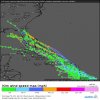
Like for the news, but not for the news, if you get the drift ...EPS tracks go towards Florida a few hurricane members but a lot of weak ones too definitely not a clear cut major threat atmView attachment 21924
Tropical Storm Dorian is official as of the 5 PM update.
DEPRESSION STRENGTHENS INTO THE FOURTH TROPICAL STORM OF THE 2019 ATLANTIC HURRICANE SEASON...
LOCATION: 10.7N 49.1W
ABOUT: 725 MI ESE OF BARBADOS
MAXIMUM SUSTAINED WINDS: 40 MPH
PRESENT MOVEMENT: W AT 12 MPH
MINIMUM CENTRAL PRESSURE:1008 MB

NHC Intensity Forecast:
12H: 45 MPH
24H: 50 MPH
36H: 60 MPH
48H: 65 MPH
72H: 75 MPH
96H: 85 MPH
120H: 80 MPH...INLAND
Brent
Member
If this thing is really 80 mph over Hispanola lookout
However i have doubts
However i have doubts
pcbjr
Member
Doubts ... you and I ... but ... if 5 days from now the front that is modeled to come through stalls and retreats north, it's got a bulls eye for a place one of us calls home ... big if, but ...If this thing is really 80 mph over Hispanola lookout
However i have doubts
Shaggy
Member
Like for the news, but not for the news, if you get the drift ...... north of the islands is a bad omen on this one ... look at the atmosphere ... could ramp if that happens ...
The talk of possible RI is interesting. Would hate to be a forecaster for the islands right now. If this thing cranks up their not gonna have a ton of time.
Stronger sooner mean north of the islands? Could have ramifications down stream for intensity and threat to land.
ForsythSnow
Moderator
Stronger sooner would definitely pull it north of the islands. However if it gets very strong and maintains that it might just go OTS.The talk of possible RI is interesting. Would hate to be a forecaster for the islands right now. If this thing cranks up their not gonna have a ton of time.
Stronger sooner mean north of the islands? Could have ramifications down stream for intensity and threat to land.
pcbjr
Member
BINGO! Great on spot post, FS!Stronger sooner would definitely pull it north of the islands. However if it gets very strong and maintains that it might just go OTS.
But not too strong and a receding front ... 5 - 6 days from now ... could be ouch ... operative words are "BINGO" and "could" ...
Shaggy
Member
Stronger sooner would definitely pull it north of the islands. However if it gets very strong and maintains that it might just go OTS.
Sure of course that's possible. My concern is that all the models that are making up the consensus right now dont do much with it and weaken or kill it. That's certainly possible but then to hear the NHC talk about possibility of RI makes you guess if those models are seeing it for what it might really be in reality and how that effects track
BHS1975
Member
Sure of course that's possible. My concern is that all the models that are making up the consensus right now dont do much with it and weaken or kill it. That's certainly possible but then to hear the NHC talk about possibility of RI makes you guess if those models are seeing it for what it might really be in reality and how that effects track
It’s gonna have to gain a ton of latitude to go north of the islands being only 10N now.
Sent from my iPhone using Tapatalk
Storm actually looks like it low level center is organizing decently fast right now, it’s a small center, a small storm, wouldn’t suprise me if it spun up quickly into a strong ts very quick, I’m here now because something actually formed lol
Shaggy
Member
It’s gonna have to gain a ton of latitude to go north of the islands being only 10N now.
Sent from my iPhone using Tapatalk
Yeah the lesser antilles wont be missed I was more referring to PR and hispaniola. If it misses the greater antilles then land interaction would be less of a problem.
Shaggy
Member
ICON tries to take it North of the Antilles fwiwView attachment 21927
Yeah that's kind of my point. Over PR is alot dofferent than over Hispaniola.
Henry2326
Member
From Levi today:
Levi Cowan
@TropicalTidbits
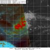
So far, signs favor short-term intensification of #Dorian (currently east of the Caribbean). Microwave data today has shown convection wrapping around a small, tight center. This configuration can easily lead to strengthening if uninterrupted by shear or dry entrainment.

Levi Cowan
@TropicalTidbits
So far, signs favor short-term intensification of #Dorian (currently east of the Caribbean). Microwave data today has shown convection wrapping around a small, tight center. This configuration can easily lead to strengthening if uninterrupted by shear or dry entrainment.


