Pattern Freezing Ferocious February

  • Hello, please take a minute to check out our awesome content, contributed by the wonderful members of our community. We hope you'll add your own thoughts and opinions by making a free account!
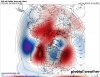
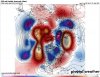
When you're in a NIÑA with a feeble subtropical jet you can create these setups wherein a trough comes out of the southwestern US if your northern stream wave enters the US at the right spot and divebombs far enough to the south and west to generate a decent moisture fetch off the Gulf. The early December event was the closest to a classic SE US setup with a s/w that dove south along the west coast and came into California along the spine of the Cascades and the Sierra Nevada instead of the Pacific. The longwave pattern that favors SE US overrunning events is also least favorable for s/ws to smack into California or the Baja Peninsula. This feature is often a missing key element in NIÑA winter overrunning threats, while the SE Canada vortex is usually absent during El Niños even though we tend to have more southern stream systems to work with. In a nutshell this means in a relative sense against climatology, moisture is often lacking during La Ninas relative to normal, while cold air is the missing relatively more often in NINOs even if the seasonal surface temperatures are colder than La Niñas. As discussed several weeks ago, while the observational record may not necessarily flesh this out due to sampling issues, if you assume the pattern will be cold in a La Niña and likewise in an El Niño and/or could reproduce a wide array of NINO and NINA winters hundreds of thousands of times and select the subset of years in both background states, you'd probably find that arctic outbreaks in the coldest NINA winters are actually more intense than those in the coldest El Niños thanks to the tendency for a blocking high epicenter near Alaska, the Bering Sea and NE Eurasia in La Ninas that's not favored as frequently in El Niños and allows Siberian air to be dumped into North America. The seasonal ENSO mean patterns from modern observations don't tell the entire story.
Hey Eric, I noticed that there are sometimes we do cash in with a California s/w even in either enso state. Examples like February 2010, January 2011, etc. Come to mind. So is it kinda like a balancimg act with something coming out of the southern stream at just the right time regardless? Also, are there any instances in the past where we have had southern stream system storms that we're big without a SE Canada vortex? If so, can you show some examples? Thanks.
 
January brings the all snow events their usually lighter totals and bring the powder snow. February seems to always have the big storms sometimes they can be a mix but their big. March no matter what it seems to always be big it may only come once every 5 years but it's the biggest storm in that 5 year span. That's what it always seems like at least for middle Georgia
I'd say that's a pretty good analogy there buddy.
 
Frankly, I'm excited at the prospect of the next time it gets cold. Let's get a California s/w when that happens asap! I think the bigger storms come with those, like the Atlanta Snowjam 82', the amazing 2011 winter storm, etc. Bring it on!

I think someone said a split flow might develop this time when we go back into the refrigerator which will mean a better chance for a Miller A occuring.
 
  • Like
Reactions: BPATL
My post was yesterday; today's run indeed looks better, as you point out. Been too busy to update today ... ;)
Ok. I was wondering about that. Whenever you see anything look bad just wait a day. The cold is winning out this year! :cool:
 
Whenever you see anything look bad just wait a day
Patience is indeed a virtue, but I have not been canonized yet ... :cool:
~~~~~~~~
EDIT - PNA has been forecasted negative for many days; I'm also of the opinion not to let a positive "blimp" today get me overly excited (which I dare say is in keeping with your observation; heads/tails) ... ;)

Also - some of the MJO models looked a little juicy today, but we'll wait and see where that goes (though there is cautious optimism from your Curmudgeon!).
 
Last edited:
  • Like
Reactions: GaStorm
Starting to look like the beginning of February will favor more of the Mid South with storm tracks going over the apps or cold chasing moisture events. I think once we get into Mid February, other parts of the SE like the Carolina's get more into the mix with a favorable jet stream leading to a better classic GOM through FL storm track, atleast that's what i am hoping for.
 
I see the Happy Hour got drunk off of it's delicious wines. ;)

Edit: If this run were to verify our guys like olhausen and others in that area are going to be happy. It's still a bit out there though.
 
I see the Happy Hour got drunk off of it's delicious wines. ;)

Edit: If this run were to verify our guys like olhausen and others in that area are going to be happy. It's still a bit out there though.
Must be drunk on the strongest liquor our there!
gfs_mslp_pcpn_frzn_us_41.png