Several high res models are showing some light ZR and freezing drizzle over the Triad and/or Charlotte, and I personally can't remember a time where a CAD event has underperformed nor do I think the SREF is reliable at all... Also given how cold it has been of late if there's any precip it's going to cause issues on major roadways, even if we see only several hundredths of an inch of precip. They should pull out the advisories anyway if nothing happens big deal but if they say nothing and we end up with even 0.05-0.1" of ZR it's going to stick to everything even treated roadwaysCLT SREF is < 10%
Wintry January 8-9, 2018 Ice threat
- Thread starter ForsythSnow
- Start date
-
Hello, please take a minute to check out our awesome content, contributed by the wonderful members of our community. We hope you'll add your own thoughts and opinions by making a free account!
You are using an out of date browser. It may not display this or other websites correctly.
You should upgrade or use an alternative browser.
You should upgrade or use an alternative browser.

Several high res models are showing some light ZR and freezing drizzle over the Triad and/or Charlotte, and I personally can't remember a time where a CAD event has underperformed nor do I think the SREF is reliable at all... Also given how cold it has been of late if there's any precip it's going to cause issues on major roadways, even if we see only several hundredths of an inch of precip. They should pull out the advisories anyway if nothing happens big deal but if they say nothing and we end up with even 0.05-0.1" of ZR it's going to stick to everything even treated roadways
Well my local office is using the SREF and keeping WWA/mention of ZR out of the forecast. Spotty at best the further East you go, imo barring some last minute changes.
Here it wouldn't be a big deal if the advisory didn't verify because it's freezing drizzle or light freezing rain but I agree this could be a disaster if there's even 0.1" or slightly less ZR because of how unusually cold we've been of late. Temps falling into the single digits the last several nights turns the ground into a block of iceAmen. NWS has gone ultra conservative in their issuance of advisories lately (mainly speaking of NWS-RAH but perhaps it is across the board?) and it has bit them in the rear quite a few times. A few hundredths of precipitation will be an absolute disaster for an unsuspecting public. It'll literally be the hundredth of an inch disaster.
Sounds like they’re searching for what is showing the least. I can promise you if it was showing .10-.25 of ice they wouldn’t be using it. It’s horrendous.Well my local office is using the SREF and keeping WWA/mention of ZR out of the forecast. Spotty at best the further East you go, imo barring some last minute changes.
000
FXUS62 KCAE 071938
AFDCAE
Area Forecast Discussion
National Weather Service Columbia SC
238 PM EST Sun Jan 7 2018
.SHORT TERM /MONDAY THROUGH TUESDAY NIGHT/...
The models continue to indicate just shallow moisture in a low-
level onshore flow with more significant moisture and lift
associated with the upper trough staying south of the forecast
area over the Gulf Coast and Florida Region. Lift associated
with a northern stream system is also forecast to stay north of
the area Monday and Monday night. The guidance is in good
agreement with just low pops and little or no qpf. The chance
of freezing rain is still too low to include in the forecast.
The NAM, GFS, and ECMWF MOS keep temperatures above freezing.
Believe any precipitation will hold off until well in the
afternoon and be light with limited evaporative cooling
potential. The SREF guidance has been consistent indicating the
chance of measurable freezing rain less than 10 percent.
Followed the guidance consensus for the low temperature
forecast. Readings should finally remain above freezing for the
first time since just after Christmas. Cloudiness favored the
lower high temperature guidance.
I feel worse after seeing it for myself.000
FXUS62 KCAE 071938
AFDCAE
Area Forecast Discussion
National Weather Service Columbia SC
238 PM EST Sun Jan 7 2018
.SHORT TERM /MONDAY THROUGH TUESDAY NIGHT/...
The models continue to indicate just shallow moisture in a low-
level onshore flow with more significant moisture and lift
associated with the upper trough staying south of the forecast
area over the Gulf Coast and Florida Region. Lift associated
with a northern stream system is also forecast to stay north of
the area Monday and Monday night. The guidance is in good
agreement with just low pops and little or no qpf. The chance
of freezing rain is still too low to include in the forecast.
The NAM, GFS, and ECMWF MOS keep temperatures above freezing.
Believe any precipitation will hold off until well in the
afternoon and be light with limited evaporative cooling
potential. The SREF guidance has been consistent indicating the
chance of measurable freezing rain less than 10 percent.
Followed the guidance consensus for the low temperature
forecast. Readings should finally remain above freezing for the
first time since just after Christmas. Cloudiness favored the
lower high temperature guidance.
I don't think anything is going to fall until evening if at all tomorrow in the CAE NWS area but why use the SREF lol?
The short-rangers are for a better put, concerning though for the CAD areas and places like Southeast Tennessee.
The short-rangers are for a better put, concerning though for the CAD areas and places like Southeast Tennessee.
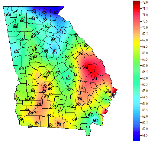
Where can I find this map?You can clearly see the wedge and the winds out of the ENE in Atlanta is never good..This was at 420 pm.
I just got home from work half an hour ago and I see were under a WWA. I knew it was inevitable that it would be extended into the metro area. It was just a matter of two reasons: 1 - the threat for ice has gotten more serious since last night's models or 2 - it's more out of precaution for tomorrow, not just for the game, but several schools (including Atlanta) are supposed to be going back in session tomorrow from Winter Break. Pretty sure it's balanced mix of both scenarios from what I've caught up and read in this thread today.
Our county is apparently taking the threat serious or they are scared from sending the kids to school when we got the foot of snow. Got the call that Paulding county schools are closed tomorrow
Yep and all state offices closed tomorrow in ATL. Governor ain’t got time to work when everyone’s preparing for UGA’s victory! GO DAWGS!!!!!!
The HRRR is not indicating much precipitation for Atlanta tomorrow morning. When it finally gets close to something, it's already above freezing.
For a light glazing of ice ?My county has canceled school!
For a light glazing of ice ?
Quite a few metro counties have now closed for tomorrow. Good call in my opinion. Roads have pretty much been exposed to freezing air consistently since 1/1. Any precipitation that’s falls is going to be ice on contact. Even a small amount is going to cause chaos on backroads especially that aren’t treated.
Sent from my iPhone using Tapatalk
Won't take much with soil temps below freezing several feet deepFor a light glazing of ice ?
It’s back down to 31 here now. East wind just started blowing gusting to around 10. DP is actually 14 this hour.
Sent from my iPhone using Tapatalk
Sent from my iPhone using Tapatalk