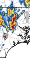
On the large scale this is one of the setups in this area that can really produce this time of year. Backdoor front moving into a seasonally hot airmass with some glancing jet help can really fire up some decent wind/hailers. The big detractor becomes if the flow veers WNW or NW and we start mixing out or advecting in a lot of dry air which may be the case tomorrow. Additionally we may have a little subsidence in the wake of the weak mcv that rolls through early tomorrow to suppress things even more. Hires models probably have it right with the best chance of a severe storm being tied closer to the lift and along any moisture pooling ahead of the BD front. Will be interesting to see where we are around noon tomorrow