Jessy89
Member
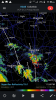
Does the Hrrr update every hour?
Yep every hour!Does the Hrrr update every hour?
well doneYour SST analysis with regard to this TC is deceptive imo. Why? First of all, the projected track is well west of those very slightly below normal blue colors off SW FL (which by the way are still ~83 F). The models/NHC track is way out in the Gulf near 87W, which is within the warmer than normal area. I checked SSTs out in the middle of the Gulf where this TC is projected to track and they are way up in the bathwater 29-30C (84-86F) range, which is normal for August/early Sep! Backing this up is a buoy at 26.0N, 85.6W which is at a whopping 85F or near 29.5C! Normal by this late in the season is down to only ~82F. Furthermore, the most notable thing is that SSTs from there northward all the way up to the FL Panhandle are in the 84-85 F (29-29.5C) range. Backing this up are a buoy at 28.8N, 86.0W, which is at 84 F, and Panama City Beach, which is at 85 F. By now, they should have cooled off from summer highs a decent number of degrees. Instead, thanks to the incredibly persistent heat in Sep and early Oct, they remain near summer highs! What's normal there now? Only ~80 and often by now they're in the high 70s! So, they're running some 5 F warmer than normal, which is likely at record warmth for early Oct. Even the normal for mid Sep is only ~83.
This means that shear (which the GFS and Euro have as quite light by the way) and dry air will have to be relied on to keep this in check as SSTs certainly won't do so like they often can in October in the northern Gulf. Instead, this TC is going to be crossing Gulf SSTs all the way to FL that are about as warm or warmer than that of any TC on record that has crossed this area during Oct. 9-11. Hopefully the models are properly taking this into account.
Normals for Oct:
View attachment 6712
In contrast, current SSTs are 29-30C (the bright green) in practically the entire GOM, which is not at all a normal situation there in early Oct:
View attachment 6713
Yep, they are taking into account the high resolution models which show a band of high winds coming through the area today. I look for some of our school systems to be cancelling classes today. We'll see....So I am now under a tropical storm warning.
I’m not trying to pick on you and I fully agree with you about the unusually warm SSTs being a major factor, but for the record it wasn’t ~90 F. It was 29-30C or 84-86F all the way to the landfall, which was near record SSTs for early October (thanks to the unseasonable heat) and more like August normals. I know because I’ve been watching the SST maps and buoys for many days. I kept reading some folks saying the lower OHC there wouldn’t allow him to get very strong, but I countered by saying the unusually warm SSTs were all that was needed due to steady movement.
") But there is a lot of different guidance showing much higher gusts than that.
But there is a lot of different guidance showing much higher gusts than that. Pouring rain now, winds not an issue here, 20mph gusts at best, with the remnant, strongest band near the eyewall