• Hello, please take a minute to check out our awesome content, contributed by the wonderful members of our community. We hope you'll add your own thoughts and opinions by making a free account!

Wintry Winter 26-27

He unfortunately got burned out from last January

Ah yes the one week we had winter

I keep thinking it can't possibly be any worse than that but I dunno. But again even as bad as last winter was some places in this state still had double digit snowfall. It just proves the warmth may not even matter
 
Last edited:
What’s your call for Jackson, TN this winter? Any frozen precip events? Do you really think warm pacific air from December- March?

I’ll do Huntsville, I know I’ll be wrong but fun to try.

December: 2°F above normal. No winter weather events.


January: 1° F below normal. Small snowfall for MLK day.

Feb 2°F below normal. Two events, one bigger >4”.

March- one more good shot. It snowed like a whiteout for 10 mins on March 16 this year, it was 36° and melted immediately. If it did it once, it can do it better next time.


Good luck to us all.
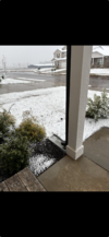
03/16/26. Latest season snow I’ve seen in thr southeast. I was 10 years old during the blizzard of 1993, that was March 12-13.
 

Attachments

  • View recent photos.png
    View recent photos.png
    3.4 MB · Views: 32
What’s your call for Jackson, TN this winter? Any frozen precip events? Do you really think warm pacific air from December- March?

I’ll do Huntsville, I know I’ll be wrong but fun to try.

December: 2°F above normal. No winter weather events.


January: 1° F below normal. Small snowfall for MLK day.

Feb 2°F below normal. Two events, one bigger >4”.

March- one more good shot. It snowed like a whiteout for 10 mins on March 16 this year, it was 36° and melted immediately. If it did it once, it can do it better next time.


Good luck to us all.
I'd bet a lot of money the bolded above is his forecast. ;)
 
You have never called for cold or snow even when it was cold and snowing.
I was literally gonna say something to the same effect today. It’s fine to be realistic and put everything in perspective and weigh the pros and cons in the balance, but most of the time it’s really a buzzkill and just like most fans don't go to watch their favorite team play college football just to immediately expect a loss, nobody is coming in here looking to constantly gripe about how bad the Pacific jet is gonna be without any ray of hope and call this winter over before it even starts.
 
Latest Bulletin highlights from judah! Had a good blog write up. I'm curious to see what he's thinking a month or so from now on getting a rhythmic pattern of these stretched out PV's.

"What is a tantalizing question for me - does this stretched PV have any significance beyond this early October event. Is it one and done or a preview of the winter? Somewhere in between? I don’t know and I assume no one else does either but if you do, please fill me in! My own (along with collaborators) analysis has shown that stretched PVs have been increasing in frequency. To me a critical year or a pivotal shift in PV behavior is 2013. Let’s say between 2000 and 2013 PV behavior was dominated by SSWs coupled with the canonical response of Greenland blocking/negative -NAO and the cold temperatures focused in Northern Eurasia and then since 2013, PV behavior has been dominated by PV stretching and North Pacific blocking and a negative North Pacific Oscillation with the cold focused in East Asia and central North America. These two statements are of course generalizations and are not true for all winters in those periods but seem to me to be true on average. And this change in PV behavior has contributed to different temperature patterns across the Northern Hemisphere. So, is winter 2026/27 going to follow the trend? As much as I like to write the trend is your friend, obviously I don’t know.

Since 2013 there was one moderate El Niño in winter 2023/24 and a Super El Niño in 2015/16. While there was PV stretching in both winters, the overall winter does not fit the generalization I just described above and, in both winters, North America was quite mild and the winters fit the typical El Niño temperature pattern. There was also a weak El Niño in 2018/19 and that winter I think fits nicely my generalization of PV stretching dominant winters (though I admit an impressive SSW did occur in January 2019, so it is a bit more complicated than my simple categorization).

So, while it might be easy to jump on the PV stretching train based on the forecast, I am resisting the temptation for now and I want to see more. But I do think this early PV stretch at least teases with what is possible. But recent El Niño in winters argue for something different. But if nothing else to me the winter forecast is not straightforward.

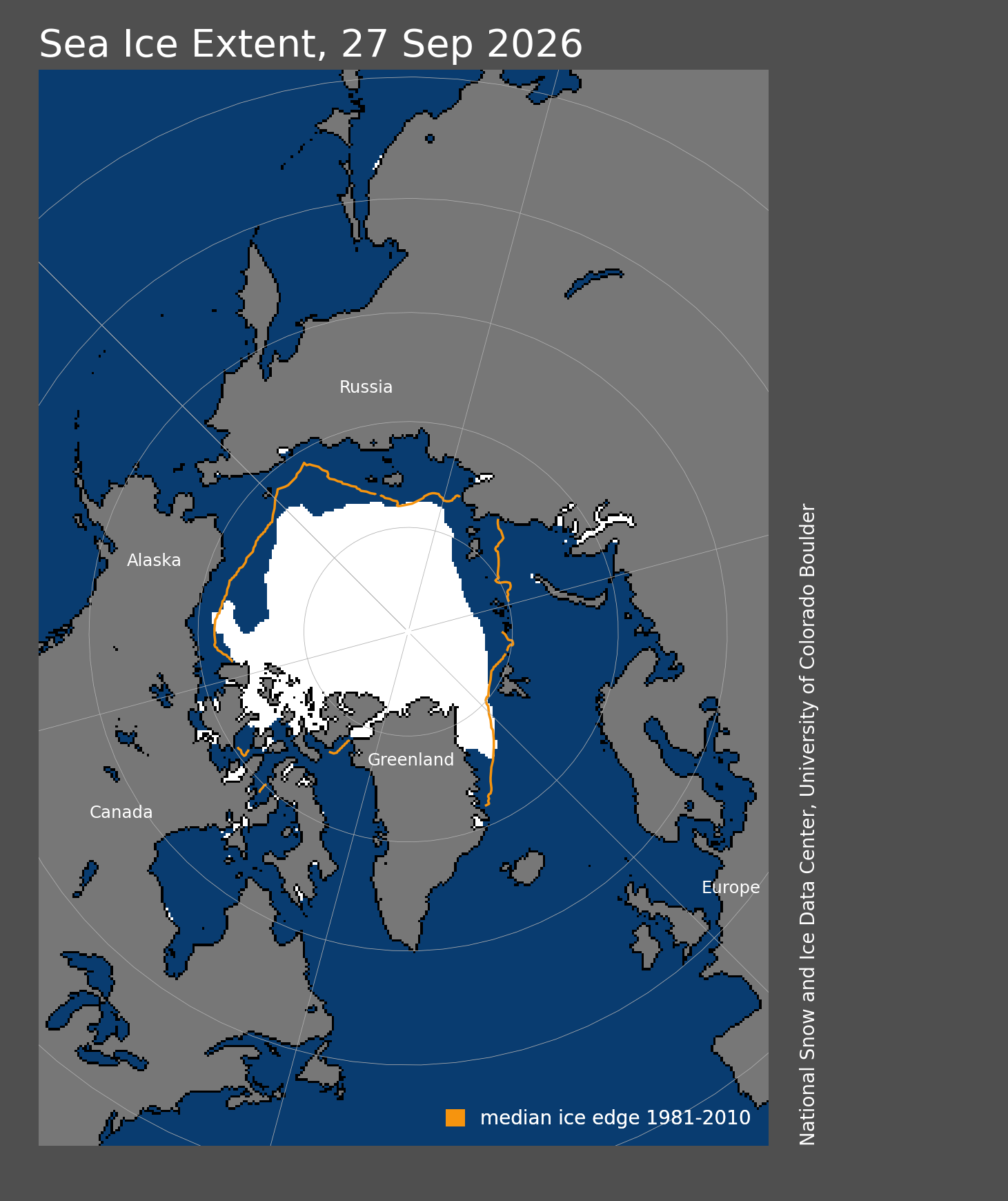
As I mentioned in the previous blog, my expectations were that the end of the sea ice melt season was imminent. The sea ice minimum was called right around the publication of the blog and as I also wrote the looked very similar to the Arctic sea ice minimum of last year, and indeed they were nearly identical at 4.6 million sq/km2. Sea ice is well below normal both in the North Pacific side of the Arctic and North Atlantic sector of the Arctic (see Figure iii). It has been shown that less sea ice in the North Atlantic sector of the Arctic weakens the polar vortex while less sea ice in the North Pacific sector strengthens the polar vortex. Sea ice should grow much faster in the North Pacific sector of the Arctic in the coming weeks and months, but again probably best not to make too many conjectures at this time. I will just note that last fall sea ice grew much faster on the North Pacific side of the Arctic and in late fall and during the winter anomalies were strongly focused in the North Atlantic. For now, I see little reason to expect something different this fall and winter.
image004.png
Figure iii. Arctic sea ice cover extent for 27 Sep 2026. White depicts ice covered areas and the orange contour the climatological extent of Arctic sea ice for the date. Plot taken from: https://nsidc.org/sea-ice-todayWith October beginning this week, my attention will of course be turning to Siberian snow fall. Currently the story is mixed but it is very early. I do think the potential exists for a rapid start to the month but forecasting snow in Siberia is challenging so you can’t use the models to predict too far into the future. El Niño falls tend to favor more extensive advances of Siberian snow cover, though over the past six years the variability has flatlined, so I think where the final number ends up is an open question. I will just end that I am becoming more convinced that it is not just the total number that is important but the pattern of snow cover. Last winter I think the pattern of snow cover was a better predictor than the total number."
 
I find it interesting that the high Arctic continues to follow the trend of being below average as it has since May. In fact, the region hasn't been this cold heading into October in more than twenty years. (2010 & 2011 are close)

If nothing else, this has to be good for an early refreeze of the polar ice cap and promotes October Siberian snow cover growth. Not saying this means a cold winter, but it's interesting nonetheless.
View attachment 198335
To me this kind of thing promotes the colder Februarys in the southeast along with the dying 'Nino by that time
 
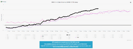
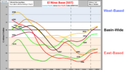
Don't think it can be understated how strong this El Nino looks. Any ENSO parameter you look at shows it. Here is 2026 in black which is notably warmer (3.4 SSTs) than 2 of the warmest El Ninos on record (2015 &1997). Hard to imagine the weather across N America not being interesting in some fashion for winter / spring.

Sep 30 SSTs.png


Previously posted...

Here are the all-time highest ENSO tri-monthly values from Eric Webb's ENSO Ensemble ONI Index research back to 1850 (+2.4 or greater shown):
1877-1878: +2.6 (OND), +2.7 (NDJ), +2.7 (DJF)
1982-1983: +2.4 (NDJ), +2.4 (DJF)
1997-1998: +2.4 (SON), +2.5 (OND), +2.6 (NDJ), +2.5 (DJF)
2015-2016: +2.6 (OND), +2.7 (NDJ), +2.5 (DJF)

 
Don't think it can be understated how strong this El Nino looks. Any ENSO parameter you look at shows it. Here is 2026 in black which is notably warmer (3.4 SSTs) than 2 of the warmest El Ninos on record (2015 &1997). Hard to imagine the weather across N America not being interesting in some fashion for winter / spring.

View attachment 198352


Previously posted...

Here are the all-time highest ENSO tri-monthly values from Eric Webb's ENSO Ensemble ONI Index research back to 1850 (+2.4 or greater shown):
1877-1878: +2.6 (OND), +2.7 (NDJ), +2.7 (DJF)
1982-1983: +2.4 (NDJ), +2.4 (DJF)
1997-1998: +2.4 (SON), +2.5 (OND), +2.6 (NDJ), +2.5 (DJF)
2015-2016: +2.6 (OND), +2.7 (NDJ), +2.5 (DJF)
Thanks for the analysis. Looking forward to your posts again this upcoming winter season.
 
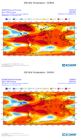
Overnight CFS has ole Jack Frost paying us a visit around Oct 20th /right on que. Then has single digit air crossing into the northern plains last week of Oct as the H5 anomally map evolves into a thing of beauty last few frames with ridging on west coast up into Alaska
Wouldn’t get to excited yet. Just single run . Sure it will get pushed back if nothing else
 
This is a good looking pattern for us in the southeast..


Sent from my iPhone using Tapatalk


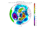
For fun, IMO, it looks like a very active pattern, alot of moisture, and probably cool with the potential -AO. But I'm not sure how cold it would get with the big eastern pacific vortex so close to the west coast. It just looks like it's pumping pacific air into the CONUS. But if there were some Canadian vortexes to sink and get trapped into SE Canada to create a 50/50 low and forming a strong -NAO maybe that could work.

I think what we want to see in that general depiction is the pacific blob shifting way west, allowing a ridge to form on the west coast bringing colder air from Canada/Alaska into the CONUS, OR, a big blue ball east of Greenland showing the true/strong -NAO. Somehow the cold has got to be delivered.
 
For fun, IMO, it looks like a very active pattern, alot of moisture, and probably cool with the potential -AO. But I'm not sure how cold it would get with the big eastern pacific vortex so close to the west coast. It just looks like it's pumping pacific air into the CONUS. But if there were some Canadian vortexes to sink and get trapped into SE Canada to create a 50/50 low and forming a strong -NAO maybe that could work.

I think what we want to see in that general depiction is the pacific blob shifting way west, allowing a ridge to form on the west coast bringing colder air from Canada/Alaska into the CONUS, OR, a big blue ball east of Greenland showing the true/strong -NAO. Somehow the cold has got to be delivered.
I do agree. I don’t think the EPO is gonna be anything better than transient negative on a few occasions this winter. We are gonna have to work with other things to get what we want. That being said, a stout + PNA is statistically what correlates most for snowfall in the southeast according to the data that Jonathan Wall has shared recently. If we can net some blocking mid to late winter with a +PNA and the EPO is at least not aggressively positive, I think many of us can accomplish what we’re looking for.
 
I’m doing a research project at NCSU where I have access to idealized ENSO amplitude experiments. So I get to play around with ~200 years of super El Niño and La Niña data. I might be able to get some temperature, precip, and snowfall distributions by year and that could give us some more insight beyond just our 4 super El Niño sample size.
 
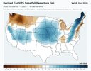
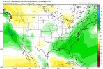
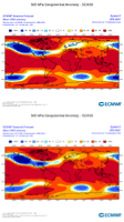
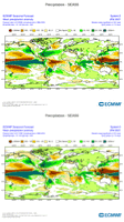
Euro Seasonal updated for Oct is banging the California > Gulf > off SE Coast storm track here for Jan-Mar if you can find enough cold air on occasion. Trend on last 2 runs shown:

View attachment 198443

View attachment 198444


View attachment 198445
Do you think we can have a couple opportunities this year to score big here in the deep south? I understand it's hard to have consistent cold during a strong Nino but I would assume a few big cold can bleed through
 
Do you think we can have a couple opportunities this year to score big here in the deep south? I understand it's hard to have consistent cold during a strong Nino but I would assume a few big cold can bleed through
I’m hoping so. Where is Jackson, AL? Are you in Jackson county? Scottboro area?
 
Do you think we can have a couple opportunities this year to score big here in the deep south? I understand it's hard to have consistent cold during a strong Nino but I would assume a few big cold can bleed through
My guess is that this will be the best pattern for gulf lows that we've seen since the 2009-2010 winter...suspect the cold air part will be challenging...but hope we can sneak in a few legit chances, deep south included in the mix
 
Last edited:
82-83 gaining some traction makes me feel bad for staff in December but gives some hope for Jan Feb Mar
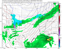
Agree SD. 82-83 is one to aspire for. Warm Dec, but the split flow w/ southern waves and gulf lows really cranked after mid-Jan. Some winter storms for the forum, a few biggies.

7 Feb 1983.png
 

Well at least it did snow here more than once (I'm looking at you last year!) but none of them were that great either. Several advisory level snows

Oh and we had a tornado on Christmas Eve morning in 1982! That's fantastic

Somehow it's still better than 15-16 or 97-98 though
 
Back
Top