The "warmest summer" will be coming to a close. But gradually, with no drama.
We still are looking at perhaps another 7 to 8 days of warm/hot temperature averages around the lower 48 states, with an obvious concentration in the southern third of the nation and in the Great Plains. This has been the general idea for the national pattern in JJA, which will probably translate to the most heated JJAS quarter before autumn awakes and starts to return summer lovers to reality. Namely, that El Nino will assert itself in altering the 500MB longwave pattern. As in eliminating the persistent hybrid of the Sonoran Heat Ridge and the Bermuda High.
There are two possible features that will conspire to alter the upper air configuration. One will be tropical, either from the Mexican pacific shoreline or (more likely) from the Caribbean Sea/Gulf of Mexico. The strength of this feature is likely to be undecided for the next few days, but I am confident it will be involving western Cuba and Florida in the later medium range. The circulation and convective field should open up a weakness aloft, enabling the shortwave in the polar westerlies to descend/dig into the Mississippi Valley as we start the longer term period. That will crack the ridge, while another low emerges in the southern branch from California on southward. The tendency for blocking may enable a deeper storm in the Southwest, which is showing up as a cool deviation near the "Four Corners". The warmest values likely would shift into the Pacific Northwest, northern Intermountain Region and Great Plains.
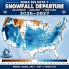
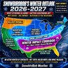
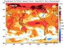
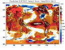
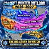
Now about the El Nino. You can easily see that the episode has plateaued, and the CFS series has backed off from the absurdly high warmth projected in Sector 3.4 (from +4.0 deg C to closer to +3.0 deg C). More and more this hydrothermal array looks very close to what happened in 1997-98, but with the caveat that the signature will undergo rapid collapse starting in December. I would not get excited about some La Nina projections in Spring 2027 (way too early....), but a negative/neutral placement is certainly possible. October and November may have many neutral/cool outcomes in the USA, but the reality of all that warmth to start likely means a very mild December and much of January. But I need to repeat the idea that the numerical models are seeing something that would cause an end to the "warm rush" in a hurry. I am toying with the scenario of a deep Kona Low and frequent -EPO/-AO/-NAO ridging, which would mean a very mild northern 2/3 of the country with a neutral, stormy south running into a speed bump around and after Dr. King's Birthday in the New Year.
I will try to conceal my excitement for the weather in the coming months. And at the same time remind people that it is a "strong" and not necessarily a "Super" El Nino. You know how much I hate hype, right?
Prepared by Meteorologist LARRY COSGROVE on
Saturday, September 12, 2026 at 11:20 P.M. CT






 but even that....the last time we were this hot this late it was an ugly winter







 )
)