• Hello, please take a minute to check out our awesome content, contributed by the wonderful members of our community. We hope you'll add your own thoughts and opinions by making a free account!

Wintry Winter 26-27

Last edited:
This is just your typical niño pattern. Cooler due to rain and cloud over. If the niño is strong as forecasted, we should really hope its more central based or east central based, and not east based. Imo
Not seeing a lot artic intrusions this winter , apparently the pros don’t either , with the warmer than average temps expected in upper Midwest and plains
 
Not seeing a lot artic intrusions this winter , apparently the pros don’t either , with the warmer than average temps expected in upper Midwest and plains
Warmer that average temps north/west of us can still be cold enough to produce winter storms in the SE. It really matters how much intrusion of Pacific air gets pushed into south/west Canada. If we can keep this at bay (+PNA) I'll feel good about our chances, even if there isn't a lot of cross arctic flow (-AO). Lots of the forecast focus on January and February as the highest chances for wintery periods for the SE. This would be when North America could produce enough cold (itself) to supply eastern winter storms. It'll be close. I can imagine/envision maybe CAD setups, with foothills snow and piedmont mixing events. If we get too much warm air into Canada, we'll still get CADs but it'll be lots of 35-40 degree cold rains. Keep rooting for +PNA...
 
Not seeing a lot artic intrusions this winter , apparently the pros don’t either , with the warmer than average temps expected in upper Midwest and plains
I'll be surprised if the MJO parks in the warm phases all winter and the Pac low sits off the coast of CA all winter.

There will be snow chances in the SE.
 
With el nino, we'll probably get numerous "good" storm tracks. The question then will be if we have the cold.
I am sure we could, especially if we get a -AO/-NAO pattern where we get cross-Arctic flow from Siberia.

ECMWF's Seasonal depicted a stronger stratospheric jet but still displaced a bit...I'm hoping that'd be enough to favor something.
 
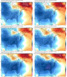
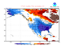
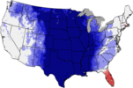
CFSv2 10 day run mean is still not backing off of a cold Feb in a large portion of the US, especially corridor from SE US to C Plains where most areas are a whopping 5-7.5F BN though I’d prefer Alaska and NW Canada be AN:
IMG_1668.png


Compare this to the same for Feb of 2024 from about the same 10 day mean in Aug of 2023:
IMG_1669.png
 
Last edited:
CFSv2 10 day run mean is still not backing off of a cold Feb in a large portion of the US, especially corridor from SE US to C Plains where most areas are a whopping 5-7.5F BN though I’d prefer Alaska and NW Canada be AN:
View attachment 197397


Compare this to the same for Feb of 2024 from about the same 10 day mean in Aug of 2023:
View attachment 197398
What I like seeing is the neutral temps (compared to warm in 2024) showing in west Canada. That's still really cold air and would be a sufficient cold air source for us.
 
There’s going to be a ton of 38-45 degree cold rains east of the apps this winter. I don’t expect to see the sun much this winter. Not sure on winter weather. El Niños have been feast or famine, especially on this side of the mountains. Moisture will be plentiful. Cooler than normal air, is likely just due to the fire hose. Arctic air though? No idea
 
There’s going to be a ton of 38-45 degree cold rains east of the apps this winter. I don’t expect to see the sun much this winter. Not sure on winter weather. El Niños have been feast or famine, especially on this side of the mountains. Moisture will be plentiful. Cooler than normal air, is likely just due to the fire hose. Arctic air though? No idea

We need a Gulf low spreading a shield of precip across the Carolinas dropping 1-2" every week from Thanksgiving to Valentines Day and we might get back to neutral drought status.
 
There’s going to be a ton of 38-45 degree cold rains east of the apps this winter. I don’t expect to see the sun much this winter. Not sure on winter weather. El Niños have been feast or famine, especially on this side of the mountains. Moisture will be plentiful. Cooler than normal air, is likely just due to the fire hose. Arctic air though? No idea
It only takes 1 to be above average!!
 
It only takes 1 to be above average!!

Yeah true. We got to average last year despite almost the warmest winter on record and hardly a flake outside of one weekend haha. I mean really it was 87 degrees the Saturday after Christmas. It had never been that hot in December by a still shocking 7 degrees... 4 weekends later it was snowing

If you have told me that last year in August we would get 8 inches of snow in one storm despite that I would have never believed you

Granted it's easier out here to get big flips like that but still

That being said I'm going into this winter with no expectations for a lot of reasons. I'm not gonna have high hopes and then we have a repeat where nothing happens for 2 months otherwise
 
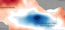
I was just reading about the Atlantic Nino. This might have real consequences on our upcoming winter. I'm no expert on this, but it's interesting. Supposedly the Atlantic Nino is much rarer than the Pacific switches between cold/warm phases.


Below map copied from this video:

1786970793544.png

Google search on Atlantic Nino:""
When the equatorial area of the Atlantic Ocean is colder than normal—a climate phenomenon known as an Atlantic Niña—it ripples through global atmospheric circulation, shifting the Intertropical Convergence Zone (ITCZ) and altering jet streams. While its sister pattern (the Pacific La Niña) dictates North American winters more heavily, an Atlantic Niña acts as a secondary atmospheric gear that modifies global seasonal weather, precipitation, and storm patterns.
An Atlantic Niña can cause the following winter weather consequences:

Altered Jet Streams and High-Latitude Shifts
  • Weakened Polar Jet Stream: Colder equatorial waters reduce the temperature contrast between the tropics and mid-latitudes, occasionally weakening the thermal driving force behind the winter jet streams. [1, 2, 3, 4]
  • Increased Atmospheric Blocking: A weaker jet stream can encourage high-pressure "blocking" patterns over the North Atlantic (such as a negative North Atlantic Oscillation, or NAO). [1, 2, 3]
  • Arctic Outbreaks: These atmospheric blocks frequently disrupt the polar vortex, sending waves of freezing Arctic air plunging southward into eastern North America and Western Europe.
 
The unprecedented very cold SE US CFSv2 progs for Feb continue! For example, last 10 days/40 runs of CFSv2 runs average out to ~8F BN for their Feb ‘27 prog at ATL or ~40.3F! That would be its coldest month since the very cold Jan of 2014. Are y’all ready? :) ;)

Are we headed for perhaps one of the worst seasonal prog busts of all time, a truly Fab Feb, or something in between? This is fun to dream about:

IMG_1691.pngWe’ll know in 6 months:
 
Last edited:
I'm a doubting Thomas.
February, you just don't have the potential to be anything other than a wimpy Springish month anymore. You used to have some winter punch but you've been completely stripped of any viability and credibility. I laugh at your pathetic designation as a ... WINTER month. I'm calling you out.
 
The unprecedented very cold SE US CFSv2 progs for Feb continue! For example, last 10 days/40 runs of CFSv2 runs average out to ~8F BN for their Feb ‘27 prog at ATL or ~40.3F! That would be its coldest month since the very cold Jan of 2014. Are y’all ready? :) ;)

Are we headed for perhaps one of the worst seasonal prog busts of all time, a truly Fab Feb, or something in between? This is fun to dream about:

View attachment 197416We’ll know in 6 months:
Feb 2021 when the PV dropped over Texas and Arkansas was the last memorable Feb cold event for me.1786981212359.png
 
This is somewhat informative. I just asked ChatGPT the following:


“For each of the last 10 years, what did CFSv2/NMME/ECMWF predict in August for the coming DJF, what actually happened, and how accurate was each forecast?”

The reply:

I went back through the NOAA/NMME and CFSv2 archives and the ECMWF seasonal verification material. The important thing is that there is no official NOAA table giving an annual “CFSv2 score” and “ECMWF score” for each August forecast. So I reconstructed the comparison using the August-issued DJF temperature signal and then verified it against the observed DJF pattern, with particular attention to the Southeast/Mid-South because that’s the region relevant to your North Alabama location.


NOAA’s archives explicitly preserve the August forecast runs and their subsequent DJF verification, and NMME’s verification system labels August → DJF as a specific lead-4 seasonal forecast.


August → DJF: last 10 winters


Legend:
🟢 = good directional forecast
🟡 = mixed/partially useful
🔴 = poor
Score is my directional verification of the Southeast/Mid-South temperature signal, not an official HSS/RPSS value.

August forecastCFSv2 signalNMME meanECMWFWhat actually happenedOverall
2016 → DJF 16-17Warm East/SoutheastWarm EastWarm North AmericaVery warm South/East; LA/TX record warm🟢 Good
2017 → DJF 17-18Warm East/SouthWarm East/SouthWarm EastWarm winter overall; East particularly warm🟢 Good
2018 → DJF 18-19Warm Southeast / mixed WestWarm South/EastWarm East, colder WestSoutheast very warm; AL/TN among top-10 warmest🟢 Good SE
2019 → DJF 19-20Warm CONUSWarm CONUSWarm CONUS6th-warmest CONUS winter; East very warm🟢 Excellent
2020 → DJF 20-21Warm Southeast, colder centralWarm East/South, mixed centralWarm East/North, mixed centralSoutheast warm overall but huge Feb Arctic outbreak🟢/🟡 Good seasonal mean
2021 → DJF 21-22Warm SoutheastWarm Southeast/EastWarm Southeast/EastSoutheast warm; GA/SC 7th-warmest🟢 Good
2022 → DJF 22-23Warm Southeast/EastWarm EastWarm EastSouth/East warm; several states top-10 warmest🟢 Good
2023 → DJF 23-24Very warmVery warmVery warmWarmest U.S. winter on record🟢 Excellent
2024 → DJF 24-25Warm South/EastWarm South/EastWarm South/EastWarm winter; Southeast/Gulf Coast warm🟢 Good
2025 → DJF 25-26Warm South/West, colder NortheastWarm South/WestWarm South/West2nd-warmest CONUS winter; South 2nd warmest

A few of these are particularly telling


2016-17: ECMWF explicitly reported that its seasonal forecast captured the broad warm anomalies over North America reasonably well. The actual winter had exceptionally warm conditions from the Southern Plains to the East Coast, with Louisiana and Texas recording their warmest winters on record.


2018-19: This is a very useful case for you. The winter ended up warm across the Southeast despite some spectacular cold episodes. Alabama, Georgia, Tennessee and Florida all had top-10 warm winters. ECMWF’s verification, however, shows that it had trouble with the broader North American pattern—particularly the cold Canadian/western U.S. anomaly.


2019-20: One of the easiest winters for the models because the large-scale signal was strongly warm. The actual CONUS winter was the 6th warmest on record, with much-above-normal temperatures across most of the East.


2020-21: This illustrates why a seasonal mean can be misleading for snow. The winter averaged warm across the CONUS, including portions of the Southeast, but February produced the extraordinary Texas/Deep South cold outbreak. A model can therefore get the DJF mean direction correct while completely missing a major snow/ice-producing month.


2021-22: Again, the Southeast signal was quite good. The actual winter was above normal across much of the Lower 48, with Georgia and South Carolina having their 7th-warmest winter on record.


2022-23: The models correctly anticipated the broad warm East/Southeast background despite La Niña. Actual winter temperatures were above normal from the southern Plains through the East Coast; several eastern states had their second-warmest or top-10 warmest winter. ECMWF’s own review says its forecast did predict the warm U.S. signal, although it overdid the north-south temperature gradient.


2023-24: This was another relatively easy case because of the strong El Niño/global warmth. The actual DJF was the warmest winter on record for the Lower 48.


2024-25: The actual winter averaged 1.9°F above normal for the CONUS, with much of the country near or above normal.


2025-26: This one is particularly interesting because it is the most recent analogue. Despite significant January cold and major wintry weather across the South and East, the seasonal mean ended up 4.9°F above the 20th-century average and second-warmest on record, with the NOAA South region ranking second warmest.

 
Back
Top