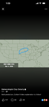
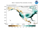
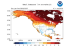
I am taking a very long look at weather progression in this strong El Nino environment. Once you push away the hype and the baseless commentary, you have to understand that at some point you must try and predict just what impacts will occur regionally, nationally, and globally. The JANUS research team (special thanks to Dr. Judah Cohen) has compiled a temperature baseline for this summer so far, showing where the strongest thermal anomalies are. So far, my earlier predictions have done well, with the western half of the USA, western and southern Europe, the Middle East and Central Asia verifying extreme heat and dryness. The trouble spots are equatorial Africa (active ITCZ with multiple strong tropical waves) and the eastern Pacific Basin (marginal output of tropical cyclones and no impacts on Hawaii as of yet).
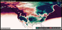
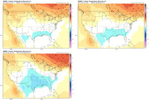
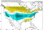
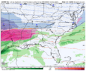
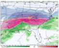
If I had to look for signs of change, probably the best place to start would be the western/central Pacific Ocean. The Asian monsoon has been weak to moderate, making no major advances into the Indus Valley. That has allowed a shroud of hellish heat to envelop the Middle East, and Persia east and northeast into central Asia. While only one of the named storms along and west of the International Dateline has tracked just east of Japan to pump up blocking signatures in Alaska and western Canada, the rest of the storms have pushed into the northern Philippines and China. At some point in September, the multitude of disturbances associated with either the monsoonal fetch or the Madden-Julian Oscillation will link with the polar westerlies. At the same time, the formative southern branch below Hawaii will be set to create a split flow and activate storm threats to California and the south central states in the last week of next month. Both the ECMWF monthly and SON temperature prognoses show this effect, which will have "down the road" impacts on weather in the lower 48 states.
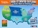
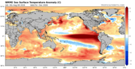
On that note, I want you to pay attention to the prediction of a collapse of the El Nino, which looks to start around mid-December. It is clearly shown on most of the model guidance, and I suspect will have something to do with an impulse out of the MJO or from typhoon injection syndrome (starting in the Marianas Chain and then rolling east of Japan into the Aleutian Islands). It is all conjecture at this point, and it would be unwise to write a more intricate outlook until after Labor Day. But if what is seen now is correct, the winter ahead in North America could have some wild surprises. A veritable roller-coaster ride that gets really crazy after a warm start near Christmas and culminates in a major storm and temperature shift in February and/or March.
Prepared by Meteorologist LARRY COSGROVE on
Saturday, August 8, 2026 at 11:55 P.M. CT