• Hello, please take a minute to check out our awesome content, contributed by the wonderful members of our community. We hope you'll add your own thoughts and opinions by making a free account!

Wintry Winter 26-27

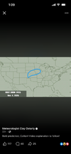
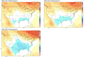
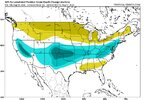
I don't like how it shows the coldest anomalies will be in March. I just hope the cold doesn't wait until Late February which will be too late for snow lovers in most areas.
On the other hand, slightly below average in January can get it done. Verbatim, CanSIPS and CFS forecast progressively colder anomalies as the 2026-2027 winter progresses. That said, 12/20-01/20 is my favorite time frame for lasting winter precip.
 
1. This almost sounds like sarcasm from Maue. Otherwise, this sounds like it’s overly dramatic looking for likes/clicks. But I’m not trying to downplay this upcoming extraordinary event either as it’s projected to obliterate the previous on record strongest Nino.
Opinions about Maue here?

2. He originally said this way back in April:

Weather expert fears this year’s ‘mega El Nino’ could rival 1877 record

Meteorologist Ryan Maue says the upcoming 'mega El Niño' could be the strongest since the 1877 event that wiped out 4% of the Earth's population due to heat waves, drought and pestilence


From seeing his other Tweets, I do think he trieds to be edgy for engagement farming purposes. Everything is historic, etc.

i.e.

 
Mild butting up against the polar vortex is really something
How does the SE always end up in the battle zone!?🤔
Warm rain vs cold rain?
 
From seeing his other Tweets, I do think he trieds to be edgy for engagement farming purposes. Everything is historic, etc.

i.e.


I’ve often wondered if we had social media back in the day, how they would have reacted or hyped the major historical storms in the past. Like for example, if we got a Blizzard 93 scenario now, how crazy would they hype it considering they hype stuff now that’s no where close?
 
RDU snow weenies cannot endure a repeat of last winter.
angry-chewing.gif
 
Niño winters don't seem to be kind to the coastal plains of SC/NC snow wise looking back at history. In the last 20 years Niña winters have given us the big snow numbers owing to the deep cold pools keeping storm tracks just far enough offshore to prevent warm air intrusion.
 
Niño winters don't seem to be kind to the coastal plains of SC/NC snow wise looking back at history. In the last 20 years Niña winters have given us the big snow numbers owing to the deep cold pools keeping storm tracks just far enough offshore to prevent warm air intrusion.

SAV measurable snow/sleet since 1980:

1985-6: 1.4” Niña
1988-9: 1” Niña
1989-90: 3.6” neutral
1992-3: 0.2” Nino
1995-6: 0.2” Nina
2009-10: 0.9” Nino
2017-8: ~2” Nina (~0.5” sleet)
2024-5: ~3” Nina (mainly sleet!!)
2025-6: 0.5” Nina

So, since 1980:
-~8” during Nina with ~half of this sleet
-3.6” during neutral
-1.1” during Nino
 
Last edited:
Gonna fire up early up here! Build the snowpack!!!IMG_6187.png
 
I am taking a very long look at weather progression in this strong El Nino environment. Once you push away the hype and the baseless commentary, you have to understand that at some point you must try and predict just what impacts will occur regionally, nationally, and globally. The JANUS research team (special thanks to Dr. Judah Cohen) has compiled a temperature baseline for this summer so far, showing where the strongest thermal anomalies are. So far, my earlier predictions have done well, with the western half of the USA, western and southern Europe, the Middle East and Central Asia verifying extreme heat and dryness. The trouble spots are equatorial Africa (active ITCZ with multiple strong tropical waves) and the eastern Pacific Basin (marginal output of tropical cyclones and no impacts on Hawaii as of yet).

If I had to look for signs of change, probably the best place to start would be the western/central Pacific Ocean. The Asian monsoon has been weak to moderate, making no major advances into the Indus Valley. That has allowed a shroud of hellish heat to envelop the Middle East, and Persia east and northeast into central Asia. While only one of the named storms along and west of the International Dateline has tracked just east of Japan to pump up blocking signatures in Alaska and western Canada, the rest of the storms have pushed into the northern Philippines and China. At some point in September, the multitude of disturbances associated with either the monsoonal fetch or the Madden-Julian Oscillation will link with the polar westerlies. At the same time, the formative southern branch below Hawaii will be set to create a split flow and activate storm threats to California and the south central states in the last week of next month. Both the ECMWF monthly and SON temperature prognoses show this effect, which will have "down the road" impacts on weather in the lower 48 states.

On that note, I want you to pay attention to the prediction of a collapse of the El Nino, which looks to start around mid-December. It is clearly shown on most of the model guidance, and I suspect will have something to do with an impulse out of the MJO or from typhoon injection syndrome (starting in the Marianas Chain and then rolling east of Japan into the Aleutian Islands). It is all conjecture at this point, and it would be unwise to write a more intricate outlook until after Labor Day. But if what is seen now is correct, the winter ahead in North America could have some wild surprises. A veritable roller-coaster ride that gets really crazy after a warm start near Christmas and culminates in a major storm and temperature shift in February and/or March.


Prepared by Meteorologist LARRY COSGROVE on
Saturday, August 8, 2026 at 11:55 P.M. CT

 
I am taking a very long look at weather progression in this strong El Nino environment. Once you push away the hype and the baseless commentary, you have to understand that at some point you must try and predict just what impacts will occur regionally, nationally, and globally. The JANUS research team (special thanks to Dr. Judah Cohen) has compiled a temperature baseline for this summer so far, showing where the strongest thermal anomalies are. So far, my earlier predictions have done well, with the western half of the USA, western and southern Europe, the Middle East and Central Asia verifying extreme heat and dryness. The trouble spots are equatorial Africa (active ITCZ with multiple strong tropical waves) and the eastern Pacific Basin (marginal output of tropical cyclones and no impacts on Hawaii as of yet).

If I had to look for signs of change, probably the best place to start would be the western/central Pacific Ocean. The Asian monsoon has been weak to moderate, making no major advances into the Indus Valley. That has allowed a shroud of hellish heat to envelop the Middle East, and Persia east and northeast into central Asia. While only one of the named storms along and west of the International Dateline has tracked just east of Japan to pump up blocking signatures in Alaska and western Canada, the rest of the storms have pushed into the northern Philippines and China. At some point in September, the multitude of disturbances associated with either the monsoonal fetch or the Madden-Julian Oscillation will link with the polar westerlies. At the same time, the formative southern branch below Hawaii will be set to create a split flow and activate storm threats to California and the south central states in the last week of next month. Both the ECMWF monthly and SON temperature prognoses show this effect, which will have "down the road" impacts on weather in the lower 48 states.

On that note, I want you to pay attention to the prediction of a collapse of the El Nino, which looks to start around mid-December. It is clearly shown on most of the model guidance, and I suspect will have something to do with an impulse out of the MJO or from typhoon injection syndrome (starting in the Marianas Chain and then rolling east of Japan into the Aleutian Islands). It is all conjecture at this point, and it would be unwise to write a more intricate outlook until after Labor Day. But if what is seen now is correct, the winter ahead in North America could have some wild surprises. A veritable roller-coaster ride that gets really crazy after a warm start near Christmas and culminates in a major storm and temperature shift in February and/or March.


Prepared by Meteorologist LARRY COSGROVE on
Saturday, August 8, 2026 at 11:55 P.M. CT
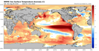
Going back to what Greg Fishel said in his latest el nino forecast, I'm really interested in the large blob of warm water east of China. I'm weak in knowledge on how this would help (SE = colder) but I can Imagin it could enhance lows moving into the Aleutian Island area. Maybe we get that +PNA and the el nino storm tracks.

Somebody else previously posted Greg's update. Go to ~minute 9:27:
 
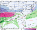
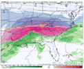
It appears all we will have to worry about this winter is if all the snow piles in parking lots melt by the end of April. Just imagine 4 straight GOM storms moving from Jacksonville fla to 50 miles se of ILM WITH Raleigh at 27 and heavy snow.
Here's your anthem:


Either that or Debbie Gibson has one for you...
 
It appears all we will have to worry about this winter is if all the snow piles in parking lots melt by the end of April. Just imagine 4 straight GOM storms moving from Jacksonville fla to 50 miles se of ILM WITH Raleigh at 27 and heavy snow.

So many things factor in to that. We've lucked out with cold Nina air masses chilling the continental shelf waters the last 2 winters and favorable positioning of the Gulf Stream further offshore to get more than 20" of snow locally in my part of Horry county. "Usually" with Nino years the baroclinic zone is closer to the coast and we get warm nosed to death. Never say never though.
 
Back
Top