Downeastnc
Member
To be or not to be, to fish or not to fish.....these are the questions.
Dang...

Dang...
To be or not to be, to fish or not to fish.....these are the questions.
Dang...
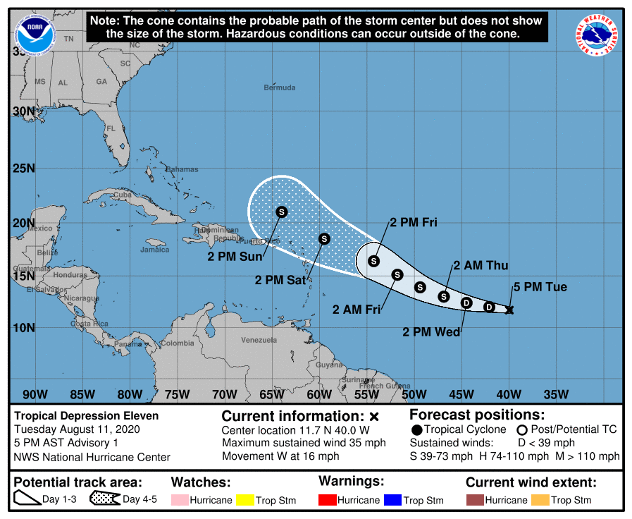
View attachment 46309
Another question to add: will it become a TD+ without recurving but then later dissipate over open water once it gets close to or just N of the Caribbean?
I’m leaning toward this option with a TS being designated within a couple of days before future struggles without recurving.
This is a tropical depression already imo. The strong, confined, nearly continuous bursting pattern over the same exact part of its larger wave envelope on infrared is a giveaway to this as a strong area of surface low pressure is generating enough PGF and surface heat fluxes to resupply moist entropy that allows new thunderstorms to immediately replace decaying predecessor convection
Looks like a fish storm .