• Hello, please take a minute to check out our awesome content, contributed by the wonderful members of our community. We hope you'll add your own thoughts and opinions by making a free account!

Tropical TS Isaias

How much wind inland has a lot to do with how healthy the core is....could be a fairly small area of peak winds....the other issue is how dry air and the jet stream hinder and help mix winds down....typically these will lower winds on the west side and boost winds on the east side.

Lastly the tornado threat is gonna be huge on the east side well away from the center.
 
Had a tornado go through the back yard in Atlanta or north of Atlanta in Roswell during Opal.


Sent from my iPhone using Tapatalk

I experienced Opal in Dunwoody. It was really bad. It was scary at times. The amount of trees knocked down and resulting outages all over the ATL area was extreme although the Blizzard of 1993 knocked down quite a few (along with plentiful outages), itself, due to the combo of high wind gusts and snow.

At this point, I’m not expecting anything of the sort as Opal for ATL, thank goodness, since I don’t think this will be as strong when it landfalls and the strongest winds may stay well W of ATL depending on track obviously. After all, Opal was close to the tropical storm of the century for ATL in terms of winds. Hopefully I’m not going to end up wrong on this as nothing is certain.
 
HMON and HAFS definitely pound it with shear approaching the coast. Quite a change from yesterday. Gonna be a lot of variables with this.

Can definitely see a world where it’s an ugly looking Hurricane (barely) at landfall

October Hurricanes can really go either way, for every Michael and Opal there’s a Nate
 
12Z UKMET is at its strongest of any run so far at landfall with 979 mb at 12Z on Sat at AL/MS border. Then it heads N along the border followed by NNW/NW into MS. The center is in NW MS as of GA/AL gametime. Tornadoes look like a problem in much of N Fl/AL/GA while heavy rain and strong winds hit N MS/Memphis area Sat afternoon/evening due to the tightest gradient in that area at that time. Interesting.
 
Last edited:
I don't think I've ever seen such a spread in hurricane models this close before landfall. We literally have the HAFSB showing a weak, barely organized tropical storm and the HWRF showing a mid-level Cat 3 at landfall.
 
I wonder if this could be as bad as Opal in 1995. Major damage in Georgia from that storm.
No way!!! That storm was cat 3 at landfall and had tremendous 17 mph fwd speed.. on the right quadrant.. add the forward speed to those gusts.. unless this thing gets out of hand.. I think it won’t even be close..
 
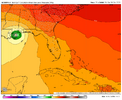
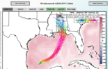
12z Google Deepmind didn't budge

1791397931849.png
 
Back
Top