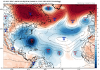
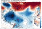
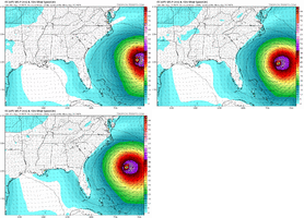
Definetly the biggest shift I've seen.Hilarious 3 run change
View attachment 174206
-
Hello, please take a minute to check out our awesome content, contributed by the wonderful members of our community. We hope you'll add your own thoughts and opinions by making a free account!
You are using an out of date browser. It may not display this or other websites correctly.
You should upgrade or use an alternative browser.
You should upgrade or use an alternative browser.
Tropical TS Erin
- Thread starter SD
- Start date
Henry2326
Member
Hilarious 3 run change
View attachment 174206
GFS hasn't caught up yet.
Euro AI 3 run change. Not as big but it was already close enough and still shifted west.
Henry2326
Member
In more recent memory....Helene hit South GA at 100 mph. Valdosta GA, my family is there, was demolished. It was supposed to go up the west side of the state to Atlanta. It goes the east side of the state and destroys Augusta, then takes out NC.while i know what you mean, should be noted that this was 7 years ago and models have indeed improved a little and newer hurricane models have been introduced since then- in some cases probably to better prognosticate storms like michael
No, respectfully disagree, it hasn't gotten any better.
Henry2326
Member
Dang, look at the spread. Not even close to a general idea.Might have 1-2 actual landfalls on the EPS and about 5 very close calls. This definitely got more interesting
View attachment 174209
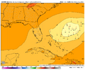
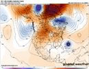
Wonder if that ridge over the US/Can would have been able to flex more without that little trough embedded in the middle over MN/WI, and make it even harder for her to turn north. Atlantic ridge flex/bridge with CONUS ridge had more to do with the western shift this run, but could be something to watch

GeorgiaGirl
Member
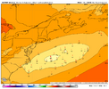
If that Euro run were to verify, you could actually prob argue for hurricane warnings on the OBX. Was thinking so privately, and just saw a met on storm2k say there'd probably be hurricane force gusts there with this track.
Def a yikes, and I will say the GFS seems a bit out to lunch for now with how low Erin is tracking. She's probably just a bit above 16N.
Def a yikes, and I will say the GFS seems a bit out to lunch for now with how low Erin is tracking. She's probably just a bit above 16N.
Henry2326
Member
Wonder if that ridge over the US/Can would have been able to flex more without that little trough embedded in the middle over MN/WI, and make it even harder for her to turn north. Atlantic ridge flex/bridge with CONUS ridge had more to do with the western shift this run, but could be something to watch
View attachment 174211
To your point, 4 days ago Euro AI published this 8/9 00z.
Edit: just read the post from Webb. This also demonstrates what he is saying.
