Belle Lechat
Member
- Joined
- Aug 29, 2021
- Messages
- 935
- Reaction score
- 711
Ticking south
View attachment 152702
Not long until the first M.
Ticking south
View attachment 152702
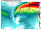
Lowest pressure on its path for 12z is now 974 compared to 980s in past run. Still not low enough.Interestingly, the 12Z Icon is a bit further N and about the furthest N of any Icon yet with it close to Sarasota vs recent runs near Port Charlotte.
GFS looks stronger and further south
It still pulls north of Tampa putting them on the bad side
I have numerous family members in Bradenton and Tampa.....most of them will not leave during hurricanes.....they are "set" in their waysPretty concerned about my aunts here.
They live in the Sarasota - Bradenton area and one was telling my dad about how the water rising was freaking her out with Helene a couple days ago.
That one will probably need to leave and find refuge at least with my aunt and step uncle, although they're both in a bad spot because I'm not sure there's been enough time for the water to subside from Helene.
Exiting closer to Jacksonville as wellLandfalls way up only a little SE of Cedar Key! Significantly N of last 2 runs.
Looks like the Ga. coast is set to get tropical storm conditions once again. The storm will be transitioning extratropical with an expanded wind field as it comes off of the Fla. E coast. Yikes.Landfalls way up only a little SE of Cedar Key! Significantly N of last 2 runs.

It maybe a mix of both good and bad.I think I see why the mean over FL is further south. The 12Z guidance’s initialization is at 22.5N, 94.9W, which makes sense since that’s where recon found the center. Compare that to the 5AM EDT NHC track’s latitude of 23.0N 5AM through 2PM. That means the storm in reality is a half a degree further S than the 5AM track.
If anything, this may be good news for Tampa though bad news for SW FL.
