-
Hello, please take a minute to check out our awesome content, contributed by the wonderful members of our community. We hope you'll add your own thoughts and opinions by making a free account!
You are using an out of date browser. It may not display this or other websites correctly.
You should upgrade or use an alternative browser.
You should upgrade or use an alternative browser.
Tropical Tropical Storm Barry
- Thread starter accu35
- Start date
Philstorm91
Member
Yeah, it's kind of surreal down here with Barry. Not much rain last night. In an otherwise healthy storm, the rains should have begun yesterday afternoon with solid banding etc. At least we'll get less time with tropical storm conditions with Barry.I don’t remember seeing a storm classified as a hurricane that has zero convection around any side of the immediate c of c. Pretty amazing actually.
BHS1975
Member
I don’t remember seeing a storm classified as a hurricane that has zero convection around any side of the immediate c of c. Pretty amazing actually.
That’s what bathwater temps gets you.
Sent from my iPhone using Tapatalk
Yeah, that’s about right normally. It’s radar presentation currently looks like an organizing depression or minimal tropical storm.Yeah, it's kind of surreal down here with Barry. Not much rain last night. In an otherwise healthy storm, the rains should have begun yesterday afternoon with solid banding etc. At least we'll get less time with tropical storm conditions with Barry.
Brent
Member
Well barely and it looks bizarre but i believe this is the first July hurricane landfall since 2008
GeorgiaGirl
Member
NoSnowATL
Member
Not seeing anything that screams cat 1. Kinda feels like NHC just wanted the 1st out of the way.
Sent from my iPhone using Tapatalk
Sent from my iPhone using Tapatalk
Brent
Member
I've never seen a hurricane landfall with no rain lol

Philstorm91
Member
Well, they did have some verified wind reports on the LA coast to verify the decision, but I do see a little bias on their part to check off the first hurricane for 2019, maybe.Not seeing anything that screams cat 1. Kinda feels like NHC just wanted the 1st out of the way.
Sent from my iPhone using Tapatalk
Brent
Member
Well, they did have some verified wind reports on the LA coast to verify the decision, but I do see a little bias on their part to check off the first hurricane for 2019, maybe.
Recon did kind of support it but just barely
accu35
Member
- Joined
- Jan 5, 2017
- Messages
- 8,415
- Reaction score
- 9,890
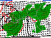
According to TWC center still 40 to 50 miles off shore lol.I've never seen a hurricane landfall with no rain lol
View attachment 21088
NoSnowATL
Member
According to TWC center still 40 to 50 miles off shore lol.
It all depends on which swirl you want to pick. This thing is ugly,
Sent from my iPhone using Tapatalk
That’s what bathwater temps gets you.
Sent from my iPhone using Tapatalk
Wait. Do what?
Philstorm91
Member
Anybody here from west Alabama to report on the outer banding setting up from Barry this morning?
I don’t remember seeing a storm classified as a hurricane that has zero convection around any side of the immediate c of c. Pretty amazing actually.
Ive never seen a hurricane with so many different vorts and circulations. Ive seen naked swirl hurricanes with strong convection on one side, but this thing is indeed ugly.
Philstorm91
Member
What's a little unsettling to me is that Barry's CDO has yet to fully come ashore. This area is likely to have the heaviest rains and highest winds, especially in the area of convection closest to the center. I just hope Barry doesn't stall over the area.
accu35
Member
- Joined
- Jan 5, 2017
- Messages
- 8,415
- Reaction score
- 9,890
I'm in the training bandAnybody here from west Alabama to report on the outer banding setting up from Barry this morning?
Agree! Almost a “ pity “ naming! It’s radar and satellite presentation , doesn’t scream HurricaneNot seeing anything that screams cat 1. Kinda feels like NHC just wanted the 1st out of the way.
Sent from my iPhone using Tapatalk