I swear this is the year of the dusting for middle Tennessee. If this works out it will be the 6th snow event that at least coated the ground this winter. I’d rather have a big snow but this still beats the heck out of the last few first haves of winter.
National Weather Service Nashville TN
641 PM CST Sun Jan 17 2021
TNZ005>011-026>034-062>066-075-077>080-181200-
Stewart-Montgomery-Robertson-Sumner-Macon-Clay-Pickett-Cheatham-
Davidson-Wilson-Trousdale-Smith-Jackson-Putnam-Overton-Fentress-
Rutherford-Cannon-De Kalb-White-Cumberland-Bedford-Coffee-Warren-
Grundy-Van Buren-
Including the cities of Dover, Clarksville, Springfield,
Hendersonville, Gallatin, Goodlettsville, Lafayette, Celina,
Byrdstown, Ashland City, Kingston Springs, Nashville, Lebanon,
Mount Juliet, Hartsville, Carthage, South Carthage, Gordonsville,
Gainesboro, Cookeville, Livingston, Jamestown, Allardt,
Murfreesboro, Smyrna, La Vergne, Woodbury, Smithville, Sparta,
Crossville, Shelbyville, Tullahoma, Manchester, McMinnville,
Altamont, Coalmont, and Spencer
641 PM CST Sun Jan 17 2021
...Snowfall Accumulation Possible Around and East of I-24
Corridor Tonight...
...Greatest Amounts Highest Elevations Upper Cumberland Region...
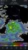
For locations generally around and east of the I-24 Corridor, as
an upper level disturbances moves across mid state region tonight,
mid evening scattered rain and snow shower mix will transition to
mainly scattered snow showers late evening into the overnight
hours. For locations around the Nashville Metropolitan Area, a
few tenths of an inch of snowfall accumulations will be possible.
Snowfall accumulations from around a half of an inch up to an
inch will be possible mainly across Highland Rim and Upper
Cumberland Plateau Regions. In highest elevations of Upper
Cumberland Region, snowfall accumulations around an inch will
be possible. Exercise caution while traveling on area roadways
especially bridges and overpasses tonight.
$$
JB Wright