
NE gulf. Might be choosin texas



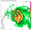


Keep it to the west. I am sitting on the beach in North Myrtle this week.As Levi pointed out in his 91L update yesterday, the stronger the system manages to get, the further west it should move as the steering influence of the 500MB high currently located in the Southern Great Plains becomes dominant rather than the southerly surface flow from the Bermuda high.
The system does seem to be developing rather steadily, implying that a more westerly motion, giving the system more time over water, is now favored.
The latter is my take.

See previous postNow it is TD 2

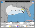
They just don't ground kids they way they used toShould NC be worried? Probably not.
But I think the SLGT risk is warranted.
Agree. I think it may not make landfall along the LA coast and instead hit TX as a hurricane.As Levi pointed out in his 91L update yesterday, the stronger the system manages to get, the further west it should move as the steering influence of the 500MB high currently located in the Southern Great Plains becomes dominant rather than the southerly surface flow from the Bermuda high.
The system does seem to be developing rather steadily, implying that a more westerly motion, giving the system more time over water, is now favored.
The latter is my take.
Talk about a perfect doomsday track angle for the city below sea level. Thankfully its not forecasted to be a cane
Alright then. In a normal summer I would say no but yeah it hasn't stopped raining out here yet... I mean it's supposed to but it was supposed to do a lot of things

 All depends on if it can avoid Louisiana or not. The ceiling is high IF it does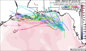
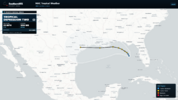
For the first time in 7 runs, the UKMET doesn’t have a TS from this: it dissipates in the NW GOM similarly to the prior run
TROPICAL DEPRESSION 02L ANALYSED POSITION : 28.0N 84.9W
ATCF IDENTIFIER : AL022026
LEAD CENTRAL MAXIMUM WIND
VERIFYING TIME TIME POSITION PRESSURE (MB) SPEED (KNOTS)
-------------- ---- -------- ------------- -------------
0000UTC 20.07.2026 0 28.0N 84.9W 1009 23
1200UTC 20.07.2026 12 28.5N 85.5W 1008 22
0000UTC 21.07.2026 24 28.3N 85.7W 1006 27
1200UTC 21.07.2026 36 28.9N 85.6W 1005 32
0000UTC 22.07.2026 48 29.7N 86.1W 1005 31
1200UTC 22.07.2026 60 30.3N 86.8W 1008 28
0000UTC 23.07.2026 72 CEASED TRACKING
NEW TROPICAL CYCLONE FORECAST TO DEVELOP AFTER 84 HOURS
FORECAST POSITION AT T+ 84 : 28.5N 90.9W
LEAD CENTRAL MAXIMUM WIND
VERIFYING TIME TIME POSITION PRESSURE (MB) SPEED (KNOTS)
-------------- ---- -------- ------------- -------------
1200UTC 23.07.2026 84 28.5N 90.9W 1009 25
0000UTC 24.07.2026 96 28.7N 91.7W 1010 24
1200UTC 24.07.2026 108 28.8N 93.4W 1012 28
0000UTC 25.07.2026 120 CEASED TRACKING


Yeah the satellite this morning is rough too... I'm definitely starting to wonder if it even becomes a real threat. The official track has also shifted more inland as well
This intensity forecast
still remains sensitive to the ultimate track, though it is notable
that the latest Google DeepMind ensemble mean only tracks the
cyclone out to 72 h, suggesting the majority of its members
dissipate the system beyond that period. The NHC intensity forecast
is a little lower than the previous cycle after 72 h, but it
wouldn't be surprising if future adjustments are needed if more
guidance trends towards a further inland solution
Jim Cantore thinks it will become Bertha:
That’s what she saidNames are given out like candy now. It will be Bertha. Looks like trash. Dry air and shear will eat it up, but it will still bring some gusts, downpours and will chop up the seas a bit. Not a lot of real estate between the one inchers and the 6 inchers in terms of rainfall.
