• Hello, please take a minute to check out our awesome content, contributed by the wonderful members of our community. We hope you'll add your own thoughts and opinions by making a free account!

Tropical TD2

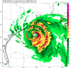
Satellite imagery appears to suggest two competing circulations with the broader weak circulation. One is likely an MLC, near 28N and 83W, and the other near 25.5N and 84.5W. Again, just eyeballing visible imagery.

Should this system consolidate farther south than previously thought, that would make things far more interesting.
 
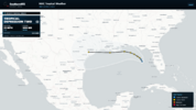
The 12Z UKMET was the 4th full run (full runs are at 0Z/12Z) that developed this into a mainly W moving full fledged TS. The last 2 runs developed it into a TD by early tomorrow morning! Landfall near TX/LA border:

NEW TROPICAL CYCLONE FORECAST TO DEVELOP AFTER 18 HOURS

FORECAST POSITION AT T+ 18 : 27.1N 84.9W


LEAD CENTRAL MAXIMUM WIND

VERIFYING TIME TIME POSITION PRESSURE (MB) SPEED (KNOTS)

-------------- ---- -------- ------------- -------------

1200UTC 19.07.2026 24 27.5N 84.9W 1010 25

0000UTC 20.07.2026 36 28.1N 85.2W 1006 28

1200UTC 20.07.2026 48 28.2N 86.0W 1004 30

0000UTC 21.07.2026 60 28.1N 86.1W 1002 33

1200UTC 21.07.2026 72 28.4N 86.1W 1000 38

0000UTC 22.07.2026 84 29.2N 86.2W 997 50

1200UTC 22.07.2026 96 29.6N 86.9W 998 51

0000UTC 23.07.2026 108 29.3N 87.8W 996 52

1200UTC 23.07.2026 120 28.9N 88.8W 999 44

0000UTC 24.07.2026 132 28.7N 90.0W 999 40

1200UTC 24.07.2026 144 29.0N 92.0W 1001 36

0000UTC 25.07.2026 156 29.3N 94.2W 1004 37

1200UTC 25.07.2026 168 CEASED TRACKING
 
Last edited:
0Z UKMET: 5th run in a row with a TD, which it has forming today, and a TS, which it has upgraded to Mon night, but doesn’t get as strong as prior 2 runs; mainly WNW movement to SE LA Wed night

NEW TROPICAL CYCLONE FORECAST TO DEVELOP AFTER 12 HOURS
FORECAST POSITION AT T+ 12 : 27.4N 85.2W

LEAD CENTRAL MAXIMUM WIND
VERIFYING TIME TIME POSITION PRESSURE (MB) SPEED (KNOTS)
-------------- ---- -------- ------------- -------------
1200UTC 19.07.2026 12 27.4N 85.2W 1011 23
0000UTC 20.07.2026 24 28.0N 85.1W 1008 25
1200UTC 20.07.2026 36 27.7N 85.5W 1007 27
0000UTC 21.07.2026 48 28.0N 85.4W 1005 31
1200UTC 21.07.2026 60 28.6N 86.1W 1004 36
0000UTC 22.07.2026 72 28.9N 86.6W 1004 38
1200UTC 22.07.2026 84 29.7N 88.3W 1004 46
0000UTC 23.07.2026 96 28.9N 89.5W 1006 36
1200UTC 23.07.2026 108 29.4N 90.7W 1009 35
0000UTC 24.07.2026 120 CEASED TRACKING
 
Last edited:
Northern Gulf of America and near Florida (AL91):
Recent satellite-wind data and nearby surface observations indicate
that an area of low pressure located over the northeastern Gulf of
America is slowly becoming better defined. However, its associated
shower and thunderstorm activity remains disorganized. Regardless,
gradual development of this system is forecast, and a tropical
depression could form over the next couple of days as the system
moves slowly northward or northwestward. Interests along the
northern Gulf coast from Florida, Alabama, Mississippi, to Louisiana
should monitor the progress of this system as it is expected to
bring heavy rain to portions of that region during the next several
days. An Air Force Reserve reconnaissance aircraft is scheduled to
investigate the system later today, if necessary.

* Formation chance through 48 hours...medium...60 percent.
* Formation chance through 7 days...medium...60 percent.
 
Tropical Weather Outlook
NWS National Hurricane Center Miami FL
800 AM EDT Sun Jul 19 2026

For the North Atlantic...Caribbean Sea and the Gulf of America:

Northern Gulf of America and near Florida (AL91):
An area of low pressure located over the northeastern Gulf of
America continues to become better defined and the associated shower
and thunderstorm activity is gradually increasing. Continued
gradual development is expected, and a tropical depression is likely
to form later today or on Monday as the system moves slowly
northward or northwestward. Interests along the northern Gulf coast
from Florida, Alabama, Mississippi, and Louisiana should monitor
the progress of this system, as tropical storm watches or warnings
could be required for portions of the area later today. In
addition, this system is expected to bring heavy rains to portions
of the northern Gulf coast during the next several days. An Air
Force Reserve reconnaissance aircraft is scheduled to investigate
the low pressure area later today.
* Formation chance through 48 hours...high...80 percent.
* Formation chance through 7 days...high...80 percent.

$$
Forecaster Cangialosi
 
As Levi pointed out in his 91L update yesterday, the stronger the system manages to get, the further west it should move as the steering influence of the 500MB high currently located in the Southern Great Plains becomes dominant rather than the southerly surface flow from the Bermuda high.

The system does seem to be developing rather steadily, implying that a more westerly motion, giving the system more time over water, is now favored.

The latter is my take.
 
As Levi pointed out in his 91L update yesterday, the stronger the system manages to get, the further west it should move as the steering influence of the 500MB high currently located in the Southern Great Plains becomes dominant rather than the southerly surface flow from the Bermuda high.

The system does seem to be developing rather steadily, implying that a more westerly motion, giving the system more time over water, is now favored.

The latter is my take.
Keep it to the west. I am sitting on the beach in North Myrtle this week.
 
12Z UKMET: 6th run in row with TS but dissipates off TX

TROPICAL DEPRESSION 02L ANALYSED POSITION : 27.1N 85.2W

ATCF IDENTIFIER : AL022026

LEAD CENTRAL MAXIMUM WIND
VERIFYING TIME TIME POSITION PRESSURE (MB) SPEED (KNOTS)
-------------- ---- -------- ------------- -------------
1200UTC 19.07.2026 0 27.1N 85.2W 1012 22
0000UTC 20.07.2026 12 27.9N 84.9W 1009 22
1200UTC 20.07.2026 24 27.6N 85.5W 1008 27
0000UTC 21.07.2026 36 28.2N 85.5W 1005 30
1200UTC 21.07.2026 48 28.8N 85.7W 1004 35
0000UTC 22.07.2026 60 29.3N 86.0W 1003 35
1200UTC 22.07.2026 72 29.4N 87.1W 1004 46
0000UTC 23.07.2026 84 29.2N 88.2W 1004 40
1200UTC 23.07.2026 96 28.0N 90.7W 1002 48
0000UTC 24.07.2026 108 28.1N 93.9W 1005 33
1200UTC 24.07.2026 120 CEASED TRACKING
 
As Levi pointed out in his 91L update yesterday, the stronger the system manages to get, the further west it should move as the steering influence of the 500MB high currently located in the Southern Great Plains becomes dominant rather than the southerly surface flow from the Bermuda high.

The system does seem to be developing rather steadily, implying that a more westerly motion, giving the system more time over water, is now favored.

The latter is my take.
Agree. I think it may not make landfall along the LA coast and instead hit TX as a hurricane.
 
Alright then. In a normal summer I would say no but yeah it hasn't stopped raining out here yet... I mean it's supposed to but it was supposed to do a lot of things 😜

Delete this. That's how you get gas rationing with the current state of things. :mad:
 
For the first time in 7 runs, the UKMET doesn’t have a TS from this: it dissipates in the NW GOM similarly to the prior run

TROPICAL DEPRESSION 02L ANALYSED POSITION : 28.0N 84.9W

ATCF IDENTIFIER : AL022026

LEAD CENTRAL MAXIMUM WIND
VERIFYING TIME TIME POSITION PRESSURE (MB) SPEED (KNOTS)
-------------- ---- -------- ------------- -------------
0000UTC 20.07.2026 0 28.0N 84.9W 1009 23
1200UTC 20.07.2026 12 28.5N 85.5W 1008 22
0000UTC 21.07.2026 24 28.3N 85.7W 1006 27
1200UTC 21.07.2026 36 28.9N 85.6W 1005 32
0000UTC 22.07.2026 48 29.7N 86.1W 1005 31
1200UTC 22.07.2026 60 30.3N 86.8W 1008 28
0000UTC 23.07.2026 72 CEASED TRACKING

NEW TROPICAL CYCLONE FORECAST TO DEVELOP AFTER 84 HOURS
FORECAST POSITION AT T+ 84 : 28.5N 90.9W

LEAD CENTRAL MAXIMUM WIND
VERIFYING TIME TIME POSITION PRESSURE (MB) SPEED (KNOTS)
-------------- ---- -------- ------------- -------------
1200UTC 23.07.2026 84 28.5N 90.9W 1009 25
0000UTC 24.07.2026 96 28.7N 91.7W 1010 24
1200UTC 24.07.2026 108 28.8N 93.4W 1012 28
0000UTC 25.07.2026 120 CEASED TRACKING
 
For the first time in 7 runs, the UKMET doesn’t have a TS from this: it dissipates in the NW GOM similarly to the prior run

TROPICAL DEPRESSION 02L ANALYSED POSITION : 28.0N 84.9W

ATCF IDENTIFIER : AL022026

LEAD CENTRAL MAXIMUM WIND
VERIFYING TIME TIME POSITION PRESSURE (MB) SPEED (KNOTS)
-------------- ---- -------- ------------- -------------
0000UTC 20.07.2026 0 28.0N 84.9W 1009 23
1200UTC 20.07.2026 12 28.5N 85.5W 1008 22
0000UTC 21.07.2026 24 28.3N 85.7W 1006 27
1200UTC 21.07.2026 36 28.9N 85.6W 1005 32
0000UTC 22.07.2026 48 29.7N 86.1W 1005 31
1200UTC 22.07.2026 60 30.3N 86.8W 1008 28
0000UTC 23.07.2026 72 CEASED TRACKING

NEW TROPICAL CYCLONE FORECAST TO DEVELOP AFTER 84 HOURS
FORECAST POSITION AT T+ 84 : 28.5N 90.9W

LEAD CENTRAL MAXIMUM WIND
VERIFYING TIME TIME POSITION PRESSURE (MB) SPEED (KNOTS)
-------------- ---- -------- ------------- -------------
1200UTC 23.07.2026 84 28.5N 90.9W 1009 25
0000UTC 24.07.2026 96 28.7N 91.7W 1010 24
1200UTC 24.07.2026 108 28.8N 93.4W 1012 28
0000UTC 25.07.2026 120 CEASED TRACKING

Yeah the satellite this morning is rough too... I'm definitely starting to wonder if it even becomes a real threat. The official track has also shifted more inland as well

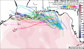
This intensity forecast
still remains sensitive to the ultimate track, though it is notable
that the latest Google DeepMind ensemble mean only tracks the
cyclone out to 72 h, suggesting the majority of its members
dissipate the system beyond that period. The NHC intensity forecast
is a little lower than the previous cycle after 72 h, but it
wouldn't be surprising if future adjustments are needed if more
guidance trends towards a further inland solution
 
already have an ensemble envelope will-it-or-will-it-not wishbone this season! the gulf has hot water and a southern track would be spicier. however, not a forecast, but in this super-duper-mega el nino year, smart money bets on the weak side of envelope. the sports analogy is, if modeling showed the dallas cowboys going to the nfc championship game, would you believe it?
 
Yeah the satellite this morning is rough too... I'm definitely starting to wonder if it even becomes a real threat. The official track has also shifted more inland as well

This intensity forecast
still remains sensitive to the ultimate track, though it is notable
that the latest Google DeepMind ensemble mean only tracks the
cyclone out to 72 h, suggesting the majority of its members
dissipate the system beyond that period. The NHC intensity forecast
is a little lower than the previous cycle after 72 h, but it
wouldn't be surprising if future adjustments are needed if more
guidance trends towards a further inland solution

Thanks, Brent.

I will remind folks that the UKMET has some tendency to be conservatively low with the winds. So, there’s that. But it’s the trend downward vs earlier runs that is notable. As we can see, this run has a 32 knots peak, slightly under the 35 knots minimum for a TS. Keeping in mind its tendency to be conservative, that still implies it would probably get to TS status. But the prior 7 runs had a significantly higher minimum of 44 knots/51 mph and in some cases as much as a high end TS (59 knots/68 mph).

My guess is that this still becomes Bertha. It has a min. of 1005 mb slp, which can easily be enough to support TS strength if it’s compact enough.
 
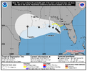
BULLETIN
Tropical Depression Two Advisory Number 5
NWS National Hurricane Center Miami FL AL022026
1000 AM CDT Mon Jul 20 2026

...DEPRESSION GETTING BETTER ORGANIZED...
...NEW WATCHES ISSUED FOR PORTIONS OF THE GULF COAST...


SUMMARY OF 1000 AM CDT...1500 UTC...INFORMATION
-----------------------------------------------
LOCATION...28.5N 85.6W
ABOUT 120 MI...190 KM S OF PANAMA CITY FLORIDA
ABOUT 215 MI...345 KM SE OF MOBILE ALABAMA
MAXIMUM SUSTAINED WINDS...35 MPH...55 KM/H
PRESENT MOVEMENT...NW OR 310 DEGREES AT 3 MPH...6 KM/H
MINIMUM CENTRAL PRESSURE...1007 MB...29.74 INCHES


WATCHES AND WARNINGS
--------------------
CHANGES WITH THIS ADVISORY:

A Storm Surge Watch has been issued for the U.S. Gulf Coast from
the Alabama/Florida Border to the Mouth of the Mississippi River,
Louisiana.

A Tropical Storm Watch has been issued for the coasts of
Mississippi and Louisiana from the Mississippi/Alabama border to
the Jefferson/Plaquemines parish border.

DISCUSSION AND OUTLOOK
----------------------
At 1000 AM CDT (1500 UTC), the center of Tropical Depression Two was
located near latitude 28.5 North, longitude 85.6 West. The
depression is moving erratically toward the northwest near 3 mph (6
km/h). A slow northwestward motion is expected through tonight,
followed by a turn toward the west-northwest or west. On the
forecast track, the depression will move near or along the northern
Gulf coast during the next several days.

Maximum sustained winds are near 35 mph (55 km/h) with higher gusts.
Satellite imagery and coastal Doppler radar data indicate that the
depression is getting better organized, and it is expected to
become a tropical storm later today. After that, additional
gradual strengthening is expected through Tuesday.


The minimum central pressure estimated from a combination of Air
Force Reserve Hurricane Hunter aircraft data and surface
observations is 1007 mb (29.74 inches).
 
Jim Cantore thinks it will become Bertha:


Names are given out like candy now. It will be Bertha. Looks like trash. Dry air and shear will eat it up, but it will still bring some gusts, downpours and will chop up the seas a bit. Not a lot of real estate between the one inchers and the 6 inchers in terms of rainfall.
 
Names are given out like candy now. It will be Bertha. Looks like trash. Dry air and shear will eat it up, but it will still bring some gusts, downpours and will chop up the seas a bit. Not a lot of real estate between the one inchers and the 6 inchers in terms of rainfall.
That’s what she said
 
12Z UKMET is slightly stronger than 0Z with it showing 35 knots/barely TS this time before it dissipates by hour 60 moving W into LA, a similar track to 0Z/6Z runs. It then comes out S of LA but in a weakened state below TD status as it heads into the Galveston vicinity:

TROPICAL DEPRESSION 02L ANALYSED POSITION : 28.4N 85.5W

ATCF IDENTIFIER : AL022026

LEAD CENTRAL MAXIMUM WIND
VERIFYING TIME TIME POSITION PRESSURE (MB) SPEED (KNOTS)
-------------- ---- -------- ------------- -------------
1200UTC 20.07.2026 0 28.4N 85.5W 1008 23
0000UTC 21.07.2026 12 28.8N 85.9W 1006 25
1200UTC 21.07.2026 24 28.7N 86.3W 1005 35
0000UTC 22.07.2026 36 29.4N 86.9W 1004 33
1200UTC 22.07.2026 48 30.1N 87.6W 1006 29
0000UTC 23.07.2026 60 CEASED TRACKING
 
Back
Top