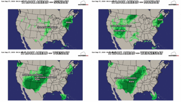
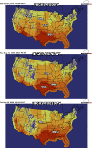
Looks like we cook for about 4 days mid to late next week before we switch back to Fall wx. Then big ridge sets up out west Days 10-15 range on models.


It was way hotter than 64 today? And yes it’s akin to the Sahara right nowMan at least I don't live in Nashville. It hasn't rained at KBNA since August 26th
View attachment 198277




Please visit down here around Jan/Feb, might need your VA winter luck at some point. Can’t hurt at least.In Raleigh today
What a beautiful day

In Raleigh today
What a beautiful day
Would love to help out therePlease visit down here around Jan/Feb, might need your VA winter luck at some point. Can’t hurt at least.
Golfing tomorrow!!!You play golf today?
Sent from my iPhone using Tapatalk
Golfing tomorrow!!!
Honestly couldn’t tell ya, my old college roommate set it up who now lives in RaleighWhere are you playing at?
Sent from my iPhone using Tapatalk


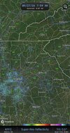
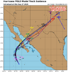
Even with the somewhat cooler air here(yesterday was the first day we didn't hit 80 in 4 months) we are still running over 10 degrees above normal this month. Probably no stopping hottest September on record because the mornings are gonna be really warm this week with Polo near us
Really gonna pump in warm air with that track til it goes away unfortunately
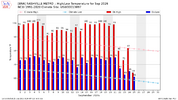
View attachment 198304
I just took a look at this. What Brent has been experiencing in Tulsa this month is nothing short of extraordinary. Based on current projections, he will have experienced a Sept warmer than any other on record (~120 years worth) by ~2 F and warmer than their avg July!!


Got to 46 this morning hereSeveral low 40’s out there!
View attachment 198301
Yeah, that Southern Plains ridge has been relentless.I know we were only 1 short on 100s in September and that was 1939... And yeah it's been crazy all year for the most part
But the flip is kind of interesting already. This is the second morning in a row with storms around and Polo is still hundreds of miles offshore


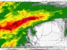
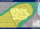
The moistness continues! View attachment 198312View attachment 198313
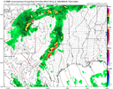
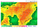
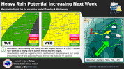
Two maximas have been showing up for a few days!! Gonna be just fun to watch unfold , from a meteorological standpoint!This thing is gonna produce a lot of rain somewhere View attachment 198315
This is a crazy signal for 4 days out
View attachment 198316
I wonder how much snow it will produce in the Colorado Rockies?This thing is gonna produce a lot of rain somewhere View attachment 198315
This is a crazy signal for 4 days out
View attachment 198316

I wonder how much snow it will produce in the Colorado Rockies?
None in most of the mountain areas due to the warmth it is bringing from the Pacific. Instead there are major flooding concerns through much of CO. If there’s any snow, the forecasts only have a pretty short period possible only in some areas way up at 11-12K+ feet, where up to 3-6” would be possible mainly in the S portion.
Snow levels have risen way higher than models like the GFS had been showing for late this week. Their clown maps on some runs had significant accumulations throughout portions of the state. The NWS was even showing rain/snow mix later this week as low as ~7-8K ft. Forget about that now.