• Hello, please take a minute to check out our awesome content, contributed by the wonderful members of our community. We hope you'll add your own thoughts and opinions by making a free account!

Severe Severe Weather February 16th -18 2022

Joined
Jan 5, 2017
Messages
738
Reaction score
1,455
Location
Odenville Alabama
It was inevitable. Trends the last couple days have been clear and these things kind of like to send out big signals in advance. This seems to have a pretty high ceiling.

DISCUSSION...
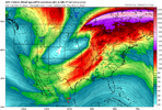
Medium-range guidance is in good agreement that a strong shortwave
trough will drop southward from the Pacific Northwest into southern
CA on D4/Monday and D5/Tuesday. This shortwave is then expected to
eject eastward across the Southwest/northern Mexico into the
southern Plains on D6/Wednesday before continuing northeastward
across the Mid MS Valley and Lower/Middle OH Valley on D7/Thursday.

Very strong mid-level flow will accompany the shortwave, with strong
low-level flow anticipated throughout the warm sector ahead of the
shortwave as well. This strong low-level flow will contribute to
robust moisture advection, with upper 50s dewpoints into southern OK
and low 60s dewpoints through much of central TX by early
D6/Wednesday evening. This moisture advection will continue on
D7/Thursday, with upper 50s dewpoints likely reaching into the
middle OH Valley by D7/Thursday evening.

The combination of lift, strong vertical shear, low-level moisture,
and buoyancy will likely result in severe thunderstorms. Current
guidance indicates the most probable location for severe storms on
D6/Wednesday is from central TX northeastward across eastern OK,
central/western AR, and northwest LA. For D7/Thursday, the severe
risk extends from the Lower MS Valley through the Mid-South into the
Lower OH Valley.
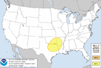
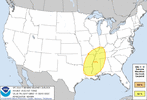
day6prob.gifday7prob.gif
 
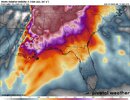
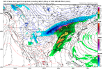
Checked the CMC for funnies. And it's exactly the same as the GFS and EURO. But more pronounced on a dry line. Can't believe global models are locking down so consistently already. This has potential for a pretty high end day. Models usually lockdown pretty well on high end events from a decent ways out. Shear is out of the roof on this one. Which may be a downfall if there's not enough substance in the way of instability. But there's no way that global models are correct right now on instability. If history tells me right a big jump on in CAPE will come. @Arcc what do you think on this event, fellow alabamian.
 
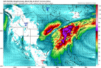
This is downright silly. SRH Helcity is off the charts on the GFS. A global model! Timing will be a key factor in things, you'll want the event to roll around in the 12 o'clock to 5 o'clock timeframe if your maximizing instability, which this event will need for the high shear. 20220211_065324.jpg
 
Spann Fwiw:
NEXT WEEK: The cold snap won’t last long. The weather will be dry Monday through Wednesday with sunny days and a warming trend… we reach the low 50s Monday, low 60s Tuesday, followed by upper 60s Wednesday. Then, a dynamic weather system will bring rain and thunderstorms into the state Thursday and Thursday night. There is still some model disagreement on how the scenario plays out, but it increasingly looks like it will bring potential for strong to severe thunderstorms to Alabama and the Deep South. Way too early, of course, for details, but be aware that next Thursday could be a very active weather day. Drier air returns Friday… See the Weather Xtreme video for maps, graphics, and more details.
 
The more I continue to look at it the more I'm amazed. It's been a bit since we've seen a setup this good. Go back to the march 2020 outbreaks. But tune up the wind shear more. Also of note. Disregard the big blobs of simulated radar on global models. They do that for some events. Globals models had big blobs for April 27th and we all know how that ended up. Very dynamic systems aren't always good at having global models determining storm mode
 
All signs are legit screaming tornado outbreak at this point. And the consistency between all global models is INCREDIBLY uncanny. We will likely see a upgrade in risk to 30% by tommorow or the next day. Mesoscale models can undercut some of the severity or make it greater but overall the synoptic scale favors a tornado outbreak.
 
All signs are legit screaming tornado outbreak at this point. And the consistency between all global models is INCREDIBLY uncanny. We will likely see a upgrade in risk to 30% by tommorow or the next day. Mesoscale models can undercut some of the severity or make it greater but overall the synoptic scale favors a tornado outbreak.
I agreee! That’s a great look!
 
Believe this is looking like a mid-day threat for Memphis vs late afternoon at this juncture right?
Impact time will shift around, but with how dynamic it is, everybody within the risk area will likely have a shot at bad weather no matter what time of day. Won't really know specifics probably till about 2 or 3 days out on general timing. But the areas that are in prime heating will benefit with more instability.
 
A few things to watch for, the EML, dryline/cold front?, Lapse rates and amount of instability. Those are the question marks I have at this point in time. Instability will go up, but with the amount for shear your probably going to need to hit near the 2000+ cape mark for staying power with the storms. Which I actually kind've expect. Last event here in the south greatly underestimated cape up until about 24 hours out. And this system probably has longer and better moisture to tap into. Another thing. Wind shear is extreme with this event. Any storm that comes surface based will likely start spinning like a top with how much spin there is in the atmosphere. But other factors will determine wether that spin will be put to use
 
A few things to watch for, the EML, dryline/cold front?, Lapse rates and amount of instability. Those are the question marks I have at this point in time. Instability will go up, but with the amount for shear your probably going to need to hit near the 2000+ cape mark for staying power with the storms. Which I actually kind've expect. Last event here in the south greatly underestimated cape up until about 24 hours out. And this system probably has longer and better moisture to tap into.
If the models hold serve, would you tweak the risk areas moving forward? Like the spc had outlined?
 
If the models hold serve, would you tweak the risk areas moving forward? Like the spc had outlined?
I think there current risk outlines are pretty good. new day 7 risk area will probably put up for further east though. It'll be adjusted some in coming days, but I think the real tweaking will be on upgrades and where to put it.
 
I think there current risk outlines are pretty good. It'll be adjusted some in coming days, but I think the real tweaking will be on upgrades and where to put it.
We just want a big system to track in the mid south. Mid December we had some tornadoes close to my area and points north and east.
 
Back
Top