go
-
Hello, please take a minute to check out our awesome content, contributed by the wonderful members of our community. We hope you'll add your own thoughts and opinions by making a free account!
You are using an out of date browser. It may not display this or other websites correctly.
You should upgrade or use an alternative browser.
You should upgrade or use an alternative browser.
Severe Severe Threat 2/16-19
- Thread starter SD
- Start date
Darklordsuperstorm
Member
...Wednesday/Thursday (days 6-7)...
Medium-range models exhibit notable spread in the evolution of a
subsequent upstream mid-level trough forecast to move into the
central states and eventually Great Lakes. However, more
consistency/agreement is becoming evident in the ECMWF/Canadian
operational runs and the ECMWF ensemble mean/GEFS ensemble, with the
operational GFS the outlier. Factors seemingly warranting an
introduction of 15% severe probabilities include the strength of the
model-forecast storm system, and ample time for appreciable
modification of the airmass over the Gulf and Gulf Coast states.
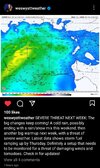
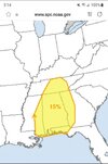
It's never a good sign to have a threat be identified this far. Out especially the ones I have seen over this highlight area. They usually end up being pretty robust
Medium-range models exhibit notable spread in the evolution of a
subsequent upstream mid-level trough forecast to move into the
central states and eventually Great Lakes. However, more
consistency/agreement is becoming evident in the ECMWF/Canadian
operational runs and the ECMWF ensemble mean/GEFS ensemble, with the
operational GFS the outlier. Factors seemingly warranting an
introduction of 15% severe probabilities include the strength of the
model-forecast storm system, and ample time for appreciable
modification of the airmass over the Gulf and Gulf Coast states.


It's never a good sign to have a threat be identified this far. Out especially the ones I have seen over this highlight area. They usually end up being pretty robust
NWMSGuy
Member
NWMSGuy
Member
Downeastnc
Member
You know they dont like the model outputs when they start honking this early....
Darklordsuperstorm
Member
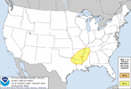
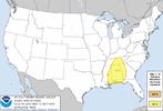
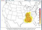
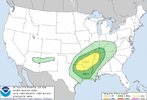
Latest SPC outlooks. Outlook for Thursday has been expanded northward significantly due to confidence in a deep rich airmass supportive of severe storms being present. We have a very potent long wave trough ejecting into a very rich warm sector. As others have noted when folks start this low rumbling this far out they know something is up. I expect a steady uptick in messaging in the days to come.
"The focus for severe is overwhelmingly concentrated on Wednesday
through Thursday across parts of the southern Great Plains eastward
into the MS/OH/TN Valleys. Model guidance continues to show a very
powerful upper-level system ejecting into the southern Great Plains
on Tuesday from the Desert Southwest. Additional modification of
the airmass across the northwest Gulf Coast will aid in
severe-thunderstorm potential. Surface dewpoints will probably
reach the lower-mid 60s in the Arklatex on Wednesday into Wednesday
night. Model variability and greater confidence and a farther-west
edge of low-level moisture/surface low placement in the southern
Great Plains necessitated a shift of the severe probabilities west
on Wednesday (day 5). Once model spread is reduced, a 30-percent
severe area will likely be introduced. A continuation of
thunderstorm activity will likely occur into Thursday as the warm
sector potentially develops as far north as the OH Valley. Have
expanded the severe risk as there is now greater confidence in the
forecast surface-low track on Thursday being across parts of the
Midwest. Model spread increases by late in the extended period
before severe potential likely becomes very low next weekend."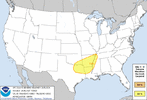
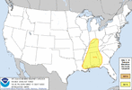


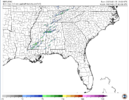
Planning to chase on Thursday. Liking the area from Tuscaloosa to Birmingham the best for right now.
Latest CIPS analogs... Long range MMFS runs will start for Thursday later today.


 <----- Area I like best
Latest CIPS analogs... Long range MMFS runs will start for Thursday later today.


Darklordsuperstorm
Member
Darklordsuperstorm
Member
Darklordsuperstorm
Member
They guy from convective chronicals on YouTube, (I have posted some of his post event analysis on here. Dude knows his stuff) Seems to be pretty alarmed by this one. He should be posting a pre analysis video in the coming days, but has already been saying this has the parameter space to be an upper echelon type event.
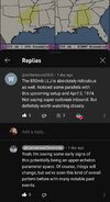

Honestly, while still a pretty good threat, it isn’t as imposing as the Euro runs a few days ago.
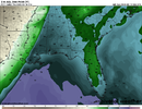
SB Cape from the 12z GFS
View attachment 021223.mp4
View attachment 021223.mp4
Darklordsuperstorm
Member
DO YOU HAPPEN TO HAVE THE LATEST CIPS ANALOG?? I CANT SEEM TO FIND IT
The new CIPS severe analog hasn't come out yet. It usually comes out around 3-4am.DO YOU HAPPEN TO HAVE THE LATEST CIPS ANALOG?? I CANT SEEM TO FIND IT
I APPRECITATE IT. ALSO CAN YOU POST OR DM WHERE TO FIND IT? I MAY HAVE THE WRONG INFO ON THATThe new CIPS severe analog hasn't come out yet. It usually comes out around 3-4am.
FROM NWS BMX
.LONG TERM...
(Wednesday night through Monday)
Issued at 321 AM CST TUE FEB 14 2023
A southern stream upper low that reaches the Four Corners by
Wednesday morning will open up into a wave and shear out as it lifts
northeastward Wednesday night. The associated wave will phase with a
northern stream trough, forming an amplified very positively tilted
trough extending southwestward from the Great Lakes to the Southern
High Plains on Thursday. This trough will move slowly eastward
reaching the Southeast CONUS by Friday. At the surface low pressure
will gradually deepen as it lifts northeastward from Missouri
towards western Lake Erie on Thursday, while the trailing cold front
will move into West Alabama Thursday afternoon with a positive tilt.
A LLJ will strengthen across the Mid-South Wednesday night, causing
the warm front feature/moisture axis over our area to lift
northward. This will place the highest rain chances across our far
northwest counties. There could be a brief uptick in convective
intensity with the increase of the LLJ with some strong to isolated
severe storms still possible as mid-level lapse rates remain steep,
before instability weakens with the further loss of daytime heating.
Continued warm air advection and daytime heating will result in
temperatures warming well into the 70s Thursday with a few locations
in the far southeast counties hitting 80. This combined with mid 60s
dew points and mid-level lapse rates still around 6.5 to 7 C/km will
result in fairly unstable conditions for mid-February with CAPE
values in the 700 to 1500 J/kg range. The main limiting factor
potentially preventing a more significant event with supercells out
in the warm sector will continue to be the lack of height falls with
the trough well to the west and a strong ridge to our southeast,
with mid-level flow being neither cyclonic or anti-cyclonic. This
could be overcome by any mesoscale type waves in the flow aloft, but
these wouldn`t be discernible until much closer to the event. Still,
closer to the front there will be plenty of low-level forcing for a
broken line of supercells and line segments with 65kts of 0-6km bulk
shear with a component normal to the front. With 0-1km SRH values
around 200 to 300 m2/s2 and some hodograph curvature, all modes of
severe weather are possible including tornadoes, large hail, and
damaging winds. Therefore our message remains the same to remain
weather aware no matter the risk color. Have continued to slow the
exit of the higher PoPs Thursday night with the trough hanging back
to the west maintaining post-frontal forcing. Also, with PWATs near
1.7 inches and streamflows currently running at or above normal,
anywhere that gets repeated rainfall Wednesday night through
Thursday could see some localized flooding.
Another transient shot of cold air arrives for Friday and Friday
night, with temperatures once again quickly moderating with zonal
flow over the weekend. This zonal flow continues early next week
between broad troughing over the northern CONUS and a ridge over the
southern Gulf. A cutoff low will be located near the Baja with
models trending slower with any eastward progression. Above normal
temperatures are expected, with some rain chances possible in the
north near a quasi-stationary frontal boundary.
Bulk south wind is really starting to ramp up in the 205. I'm steady at 15-20 mph. Had a gust on the weather station of 42 already. Td's still in the mid 30's.
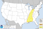
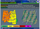
Day 2 Convective Outlook
NWS Storm Prediction Center Norman OK
1251 AM CST Wed Feb 15 2023
Valid 161200Z - 171200Z
...THERE IS AN ENHANCED RISK OF SEVERE THUNDERSTORMS FROM
MISSISSIPPI AND ALABAMA NORTHWARD INTO THE OHIO VALLEY...
...SUMMARY...
Widely scattered severe thunderstorms are likely from the central
Gulf Coast states northward into the Ohio Valley on Thursday and
Thursday evening. Several tornadoes are possible over Mississippi
and Alabama, including the risk for strong tornadoes.
...Central Gulf Coast states...
Showers and thunderstorms will likely be ongoing early Thursday
morning near a cold front over AR/LA with a marginal risk for severe
storms accompanying this early activity. Southerly low-level flow
will advect richer moisture into the coastal plain, while some
heating amidst cloud breaks acts to destabilize the airmass. Models
suggest diurnal thunderstorm development in the warm sector during
peak heating, to the east of the front over parts of MS and
spreading into AL. Large clockwise-curved and elongated hodographs
will favor supercells with the more robust updrafts. Several
tornadoes (some strong) are possible and may focus in a mesoscale
corridor where the greatest buoyancy (1000 J/kg MLCAPE) is indicated
by the models, over parts of MS east into west-central AL during the
early evening. By mid evening, lessening instability due to
nocturnal cooling and storms consolidating into more linear modes
indicate the severe risk (i.e., damaging gusts/tornado) will begin
to wane, as the storms move east into eastern AL/western GA/FL
Panhandle.
...OH Valley into the Lower Great Lakes...
Showers and thunderstorms located within a strong WAA regime will be
widespread across the lower OH Valley at daybreak Thursday. An
isolated risk for strong to severe thunderstorms may continue into
the early part of the morning, before this activity quickly moves
northeast and away from the greater instability by midday. A
rejuvenation in storms is forecast over parts of IN/KY and spreading
east-northeast into OH during the afternoon into the evening.
Forecast soundings over west-central OH southwestward to the
Kentuckiana region show weak buoyancy but large hodographs and
strong speed shear in the lowest 3-6 km. It is uncertain whether a
few low-topped supercells will develop within this area of
potentially greater buoyancy, but convective coverage is forecast to
increase during the afternoon as storms quickly move east-northeast
on the northern periphery of a warm sector. Damaging gusts will be
the primary hazard, but some tornado risk may develop with either
supercells and/or line segments, given the moist boundary layer
co-located with strong shear. This activity will likely reach
eastern OH into the lower Great Lakes region after sunset, but
forecast soundings imply these storms may remain surface based, and
perhaps the risk for damaging gusts continues into the late evening.
..Smith.. 02/15/2023
National Weather Service Birmingham AL
310 AM CST Wed Feb 15 2023
.SHORT TERM...
(Today through Thursday)
Issued at 305 AM CST WED FEB 15 2023
An active period of weather the next two days. A weakening upper
level trof located across north Alabama this morning was producing
scattered showers along and north of I-20. This trof axis will be
the focus for showers throughout the day. There will be enough
instability this afternoon for a few thunderstorms, but nothing
severe. The area of showers will gradually shift northward this
afternoon and evening as the trof axis lifts northward. Large scale
lift will increase along the lower MS river region overnight and a
low level jet will also develop in this region. The environment will
become favorable for strong to severe storms west of Alabama
tonight, but some of these storms could develop as far east as
northwest Alabama after midnight and into early Thursday morning.
High values of 0-3km SRH and EHI`s across northwest Alabama will be
sufficient for any storm that develops to become severe, with a
threat of tornadoes. Will re-introduce severe potential for the
northwest counties late tonight and into early Thursday morning.
There should be a break in the action after 8AM Thursday until next
round develops Thursday afternoon. Onset timing of the Thursday
afternoon event is somewhat muddled by morning convection. Model
consensus is for the main line of storms to reach the northwest
counties by mid afternoon. A few hi-res models indicate discrete
cells developing ahead of the line, which would warrant an early
start time for severe. By 12 Noon Thursday, hi-res models already
show surface based CAPE near 1500 J/kg and 0-3km EHI values near
1.5, so start time will be kept at 12 Noon. Severe weather
parameters will be maximized over areas west of I-65 Thursday
afternoon, and SPC has raised the threat level to enhanced for this
area.
58/rose
Last edited:
I thought this may be a big one. Where are the severe people?
It looked like it could have been a big one a week or so ago.I thought this may be a big one. Where are the severe people?
Still could turn out to be a decent event but that will come down to game time stormmode. Does the low forcing positive tilt trough allow for discrete supercells or does the almost unidirectional flow aloft which almost parallel the front create a mostly linear mess.
I’ve seen both scenarios, but leaning to the latter.
Last edited:
tennessee storm
Member
Latest hrrr is starting pick up discrete mode ahead line.It looked like it could have been a big one a week or so ago.
Still could turn out to be a decent event but that will come down to game time stormmode. Does the low forcing positive tilt trough allow for discrete supercells or does the almost unidirectional flow aloft which almost parallel the front create a mostly linear mess.
I’ve seen both scenarios, but leaning to the latter.
tennessee storm
Member
Area from pine bluff Arkansas to Jackson Tennessee needs be watched tonight that’s the area were a storm can get some separation and take off Lowe r level jet 60kts kicks in influences this area
Probably going to chase tomorrow. Trying to decide between aiming north towards Jasper/Cullman or south towards Montgomery-Tuscaloosa.. northern areas have more favorable hodographs progged, southern areas look more discreet with more instability.
Not that it’s wrong, but the HRRR loves to pop discrete convection in the long range. I’d say the higher end threat would probably look more like the ARW with the line breaking into more discrete segments which we’ve seen in the past i setups like this.Latest hrrr is starting pick up discrete mode ahead line.
NWMSGuy
Member
NWMSGuy
Member
Memphis NWS is onboard for an Outbreak:
Area Forecast Discussion
National Weather Service Memphis TN
413 PM CST Wed Feb 15 2023
...New SYNOPSIS, DISCUSSION, AVIATION...
.SYNOPSIS...
Issued at 313 PM CST Wed Feb 15 2023
A nocturnal severe weather outbreak is setting up over the Mid
South this evening. Showers and storms will develop later on this
evening and last through Thursday morning. This will be a long
duration severe event with the possibility of multiple waves of
storms. Dry and cooler conditions return Friday as surface high
pressure shifts across the area. Expect some sub freezing morning
lows Friday and through the weekend. High temperatures will trend
warmer through the weekend, back to near 60 by Sunday and in the
70s early next week. Warm conditions are expected to continue into
next week as showers and thunderstorms return to the forecast.
&&
.DISCUSSION...
(This evening through next Tuesday)
Issued at 313 PM CST Wed Feb 15 2023
A long duration severe weather outbreak looks poised to occur
tonight into Thursday for the Mid South. Now is the time to prepare
for adverse weather. Nighttime severe weather can be particularly
dangerous. All the ingredients are in place shear, moisture,
instability, and lift will all be in place over the region for an
extended period of time. Dewpoints across the region range from
the mid 60s across north MS to the upper 50s and lower 60s across
E AR and W TN. Dewpoints should continue to surge into the region
ahead of the front tonight. Temperatures will remain mild and
winds will remain elevated keeping the area prime for storm
development. Shear will not be an issue either as we will be in a
favorable position under a jet streak as well as 0-3 KM SRH
values will be anywhere between 300-500 m2/s2 over the region
tonight. We have been capped for the most part today, and that is
why we have been mostly quiet on the radar. Looking at the current
vis sat there is a large area of cloud streaks across the Lower
Mississippi Valley. This is indicative of horizontal shear and
the atmosphere starting to uncap and destabilize. Latest guidance
suggests that we could have between 1000-2000 J/KG of CAPE over
the Mid South tonight...this is concerning as this event we should
have the instability in place. This has been the missing link
over the last few systems. With all of that being said the Storm
Prediction Center has a large portion of the forecast area in an
Enhanced Risk of Severe weather tonight. All modes of severe
weather will be on the table. Tornadoes will be possible...some of
those tornadoes could be strong meaning EF2 or better. I am
concerned with this aspect of the threat. Large hail and damaging
winds will be possible.
Storm mode will also be important as this event should start out
as supercells, and possibly congealing into a QLCS or cluster of
storms. The supercells pose the greatest threat for the stronger
tornadoes early in the event. The best time for that is from 7PM
tonight through about 2AM tonight. The mode should congeal to a
large area of storms and tornadoes could be embedded in that, but
the heavy rain and damaging wind threat then increases during that
timeframe. Rainfall totals through tomorrow should mostly stay
just under 2 inches, but any locally higher amounts could result
in localized flooding issues. The WPC has included most of the
Midsouth in a marginal risk for Excessive Rainfall for tonight.
Portions of northeast MS and west TN near the TN river are also
included in a Slight Risk for Day 2.
The severe threat continues into Thursday as the front finally
starts to really push through the region. Storms should develop
along the front again on Thursday. Strong to severe storms will
continue and may redevelop especially across NE Mississippi. This
would be the reason why the enhanced risk remains in the area
through Thursday. Storms should be completely out of the region
by Thursday afternoon. Needless to say this is a formidable system
and everyone should stay weather aware overnight and Thursday.
Cooler and dry air will filter across the Midsouth Friday and
remain in place through the weekend. Some sub-freezing
temperatures are expected Friday, Saturday and Sunday mornings.
Highs will trend warmer; from the 40s on Friday, to the 50s on
Saturday and near 60 by Sunday.
Warm conditions are expected early next week but showers and maybe
a few thunderstorms are expected to return to the area.
&&
Darklordsuperstorm
Member
The positive tilt nature of the trough is going to favor a more discrete storm mode. We will be getting a glancing blow from the associated forcing.
Hpdb301
Member
Always go towards south west side of Tuscaloosa! Outside of a football team they don't have luck when it comes to weather ever! Then you can chase all the way up 20 to I65N easily.Probably going to chase tomorrow. Trying to decide between aiming north towards Jasper/Cullman or south towards Montgomery-Tuscaloosa.. northern areas have more favorable hodographs progged, southern areas look more discreet with more instability.
Darklordsuperstorm
Member
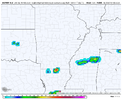
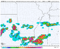
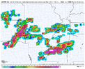
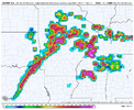
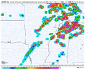
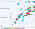
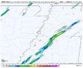
Looke kind of messy.
Looke kind of messy.
To be expected really. Deep SW flow aloft almost completely parallel to the front. Probably gonna have a flash flood threat from training storms.

