• Hello, please take a minute to check out our awesome content, contributed by the wonderful members of our community. We hope you'll add your own thoughts and opinions by making a free account!

Pattern Outside of the SE thread

The bomb cyclone that slammed California brought intense wind and rainfall to the state, including the Bay Area. “The impacts from the event resembled that of a landfalling strong tropical storm – likely the closest San Francisco residents will ever come to experiencing that meteorological phenomenon,” AccuWeather Director of Forecast Operations Dan DePodwin said. Peak gusts in the higher elevations immediately around the Bay Area exceeded 70 mph on Tuesday, according to preliminary reports from the National Weather Service. One of the highest preliminary wind reports Tuesday listed by the National Weather Service’s Storm Prediction Center was a 75 mph gust recorded near Lexington Hills in Santa Clara County. A gust of 73 mph was recorded near Del Rey Oaks in Monterey County.

“Tropical-storm-force wind gusts (39-73 mph) were reported for seven consecutive hours in Oakland,” DePodwin said. “Despite being vastly different in structure than a tropical system, the compact area of low pressure on radar resembled the eye of a hurricane as it moved onshore Tuesday afternoon just south of San Francisco.” Some of the greatest rainfall totals in the Bay Area were recorded in the Santa Cruz Mountains as well as cross portions of the North Bay. Some of the hardest-hit areas received 3-4 inches of rainfall, according to preliminary numbers from the NWS.
 
Heres the Story..

Radar loops showed this storm actually consisted of two smaller areas of low pressure that pinwheeled around each other in a kind of dance known as the Fujiwhara effect.

The easternmost low-pressure center rotated northward into Santa Cruz and the Bay Area first, followed by the second area of low pressure. While not a tropical system, several meteorologists noted it looked like a landfalling tropical storm in radar imagery.

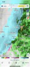
Heres what the Strom looked like on Radar..

 
Storms or snow, what’s gonna win out??74E21871-60A8-4D29-82FB-2BA9C06E9551.png
 
That escalated quickly!! ?????C10C6DF9-0AED-4A9E-971D-C58620B73EEE.png
 
I’ll survive! Currently FBADF1A4-82F3-4486-A07B-E36B07693D59.jpeg
 
Good day to be In Waterloo I reckon90480C5A-FED8-41ED-BD01-C15EED2373F3.png
 
Back
Top