• Hello, please take a minute to check out our awesome content, contributed by the wonderful members of our community. We hope you'll add your own thoughts and opinions by making a free account!

Pattern Octorchber

Where are we at with the Big AI Modeling / solve all the worlds problems? Being sarcastic and serious at the same time. I know what to expect from the physics models. You find me an AI model that can start consistently nailing down the wx 7 days under and Ill jump on board with the AI hype. If they cant solve the wx, then to me they are just part of the lump sum of all the physics models and all other tech. Been said these would get better with time. So here we are a year + latter.
Love to hear some opions on where things stand. Thanks in advance!
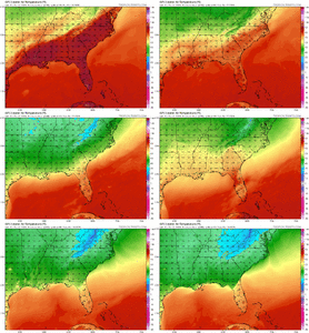
They are too coarse for specifics (which doesn't matter a ton in quiet wx) but I find them to be the best on big scale stuff D4-8 or so. Temps are generally lacking but the error is fairly predictable (usually 2-5F too cool on highs, 3-7F too warm on lows, which is just a resolution thing). Not to say they can't be wrong, obviously. I do like that they don't tend to make big jumps, imo that helps communications. Slow and steady find the right solution vs "oh its gonna do this... now its gonna do this" every 12-24 hours.
 
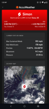
It's interesting to me seeing the NHC use the AI models so heavily. A big reason their Isaias track has always been on the eastern side of the guidance
Looks like the physics models are trending to the AI models in terms of track.
 

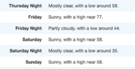
Haha people here ain't believing we could have a frost threat but like if we clear out like forecast...

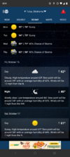
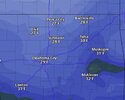
Friday doesn't get out of the 50s on some of the models

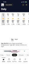
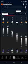
Lol after months of 90s and 100s it's just nice to seeScreenshot_20261012-050000.AccuWeather.png
 
Last edited:
I'm on mission / still anticipating a Halloween / late Oct Hit job/ Big ticket east coast storm ( not Cane/ but extratropical/ Noreaster type with some tropical influence ). Don't see one yet. We shall see. Did see the ole CFS throw its first digital flakes of the season here in NW NC late 1st week NOV.
 
I'm on mission / still anticipating a Halloween / late Oct Hit job/ Big ticket east coast storm ( not Cane/ but extratropical/ Noreaster type with some tropical influence ). Don't see one yet. We shall see. Did see the ole CFS throw its first digital flakes of the season here in NW NC late 1st week NOV.
I would guess we have some type of significant system about 5 days either side of Halloween
 
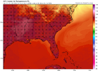
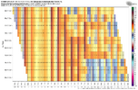
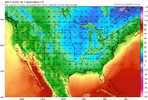
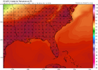
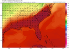
not a huge fan of modeled pattern as you get beyond D8 or so but this cool shot should hang around for some very nice mornings into next week before slop starts to win again around D10
 
I'm on mission / still anticipating a Halloween / late Oct Hit job/ Big ticket east coast storm ( not Cane/ but extratropical/ Noreaster type with some tropical influence ). Don't see one yet. We shall see. Did see the ole CFS throw its first digital flakes of the season here in NW NC late 1st week NOV.
@FallsLake loves these.
 
not a huge fan of modeled pattern as you get beyond D8 or so but this cool shot should hang around for some very nice mornings into next week before slop starts to win again around D10
At least the models are trying to shake things up a bit with some signs of an attempted -NAO and/or a west coast ridge. If there is such a thing as seasonal trend it says the WC ridge is either temporary or just gets totally dominated by the pacific wave train. The NAO attempt has my attention at least
 
At least the models are trying to shake things up a bit with some signs of an attempted -NAO and/or a west coast ridge. If there is such a thing as seasonal trend it says the WC ridge is either temporary or just gets totally dominated by the pacific wave train. The NAO attempt has my attention at least
Is there not some sort of inverse correlation between NAO states in October and DJF NAO states? I feel like I have read that somewhere on one of these forums, but not sure when/where. If I understand it correctly, we would want a +NAO for October, at least for the mean.

Hopefully someone knowledgeable in this department can chime in, or it's possible that I could be imagining this.
 
Man, with how this year is (strangely) evolving, I honestly don't know what to wish for; maybe more Siberian snow cover, continued warm NW Pacific waters. I've seen a lot of YouTube videos with (warm and cold) winter forecast, and I don't believe any of them,
 
Is there not some sort of inverse correlation between NAO states in October and DJF NAO states? I feel like I have read that somewhere on one of these forums, but not sure when/where. If I understand it correctly, we would want a +NAO for October, at least for the mean.

Hopefully someone knowledgeable in this department can chime in, or it's possible that I could be imagining this.
See the latest post by @GaWx in the winter thread. It's not so much as we want to get a -NAO now for cooler weather or the fact it may/may correlate 1:1 to winter it's that you want to start disrupting the polar cap as much as possible early so that we can predispose the PV to a warming later in winter. The best way to do it is to pressure it early imo
 
Back
Top