• Major software update has been applied. Please let us know if you run into any problems.
  • Hello, please take a minute to check out our awesome content, contributed by the wonderful members of our community. We hope you'll add your own thoughts and opinions by making a free account!

Pattern Octorchber

Welcome to October. The pattern change is already underway here!

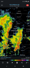
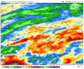
I've already seen somebody claiming this will be a way different month than September. Friday may stay in the 60s all day! We only had 1 day below 85 even in September Screenshot_20261001-001409.RadarScope.png
 
Last edited:
Welcome to October. The pattern change is already underway here!

I've already seen somebody claiming this will be a way different month than September. Friday may stay in the 60s all day! We only had 1 day below 85 even in September View attachment 198361
When it comes to Oklahoma they don’t call it “Stormin’ Norman” for nothing
 
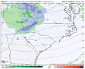
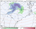
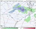
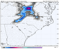
This weekend screams overperformer along the eastern and southern escarpment in NC/SC/GA. I expect 4"+ in a lot of areas along 85 NW.
I was watching this as my first real "upslope" opportunity. Models are from 1 inch to 3 in Brevard/Cedar Mountain. Experience from this forum has educated me on the upslope components and how it can over perform.
 
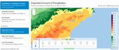
ILM poo-pooing rainfall totals coming up vs what WPC is showing. With the 13 month drought now I'll believe it when I see it. Hopefully we get a soaking in the coastal plains of SC/NC.
 
ILM poo-pooing rainfall totals coming up vs what WPC is showing. With the 13 month drought now I'll believe it when I see it. Hopefully we get a soaking in the coastal plains of SC/NC.
Think you guys will be fine to net a solid 1-2 + between Sat-Mon. Up this way the euro Op and GFS Op look better overnight, but the ukmet,Icon and Can as well as the Nam and RDPS arent giving us much love .5 or less. Get locked in on the wrong side of the wedge boundary / Drizzle fest inbound. Take what we can get. You should benefit from the wedge boundary sitting and stalling right over top of your location, if not spending time on the SE side
 

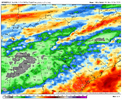
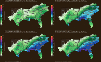
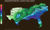
This map shows that I’d get within just the next 96 hrs about as much as I got in all of pretty dry Sept. So, I hope it verifies pretty closely. In reality due to the showery nature of some of this producing isolated heavy amounts, I realize there may be significant variations in totals within pretty short distances though.
 
This map shows that I’d get within just the next 96 hrs about as much as I got in all of pretty dry Sept. So, I hope it verifies pretty closely. In reality due to the showery nature of some of this producing isolated heavy amounts, I realize there may be significant variations in totals within pretty short distances though.
Yeah I do wonder how this product will pan out. I feel like since it's a multimodel consensus it will end up spreading the totals too wide and bust on the high side for quite a few but a good case study to see if there is something I can do to make it better
 
Yeah I do wonder how this product will pan out. I feel like since it's a multimodel consensus it will end up spreading the totals too wide and bust on the high side for quite a few but a good case study to see if there is something I can do to make it better

It’s much appreciated since it’s a useful product with excellent graphics. But I agree that it’s the nature of a multimodal product like this when a not small portion of the precip is convective rather than stratiform that the majority of specific locations will often verify a little too high and a minority will often verify too low including some much too low where heavy enough convection happens to occur. But this combo allows the avg over a broad area to verify well fairly often assuming the model consensus had the right idea of course.
 
Yeah I do wonder how this product will pan out. I feel like since it's a multimodel consensus it will end up spreading the totals too wide and bust on the high side for quite a few but a good case study to see if there is something I can do to make it better
Can't wait to see it tested with snow
 
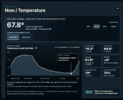
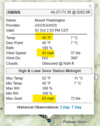
It's not hot everywhere in the CONUS. That wind is nuts!

View attachment 198387
Yeah that place is really cool. I've visited the observatory there when I lived in Massachusetts.
Fun fact, during WW2 and after, the military used the summit as a research facility to determine what cold weather did to newly developed jet engines and helicopters. Also, the highest wind speed on Earth ever recorded not associated with a tropical system or tornado happened there as well.
 
Beautiful sunset tonight!!
8466aca1c8fb5a2b66ee6d7fd0169f69.jpg


Sent from my iPhone using Tapatalk
 
So since this is multi model, I guess those with higher totals can somewhat skew that map. Well guess those with lower totals could as well duh lol. I'm betting the streak and unfortunately saying it's overdone for northern portions anyway
 
  • Like
Reactions: SD
The heavier rain totals have shifted to the south and east for this weekends rain. We certainly could use the heavier rain but more times than not this year most of us have been on the outside looking in. At least the heat abates next week and the models are showing another chance of rain just in time for next weekend.
 
Unbelievably considering the heat deep into September, the leaves are still starting to change now. Noticed it yesterday and it's definitely fall color as there has been "just" enough rain.

Have been noticing wunderground predictions start to creep up though, but NWS is still projecting a couple low 70's days.
 
80/77 here right now. Thats gotta be close to a record high dew point for October. Lawrenceville is showing a dew point of 79 as well.

Already picked up a decent amount of rain this morning as well. 0.77”
No doubt. I just came inside from yard work, and I'm soaked in sweat. Missed the rain here...so far.
 

I’ve already gotten >1/2 of this 2.61”. Here I’ve been getting rain since 12:45PM moving NE with some of it very heavy. This is in addition to a quick shower this morning and moderate rain (few tenths) late yest. afternoon from popups. It appears I’ve received 1.5”+ from all of this with most of it just since 12:45PM with it still raining lightly. This compares to ~2.55” for all of Sep!

Update at 5: been getting additional mod to heavy rain since 4:45. I’m now likely at 2”+ since yest.

Edit: Final total for Fri-Sat 10/2-3 was ~2.1”.
 
Last edited:
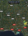
What’s the deal with all the radars along the Gulf coast being down? IMG_3768.jpeg
 
This event is already an overperformer at my residence. I just got back in and I have 1.36 inches in the rain gauge at my house near Lake Wheeler. This might end up putting a dent in the drought we've been experiencing for the past several months now when all is said and done.
It's been so long since we've had any heavy rain that some people have forgotten how to drive in it. I counted six cars that had run off the highway in different locations and endured two traffic delays due to that on my drive to Selma and back on Highway 70 East.
 
Last edited:
That second round has basically gone away now. Our rain chances went from 90% down to 40 for tomorrow. It's either tonight or nothing at all now.
 
Back
Top