Brent
Member
You're in the part of the country where rapid changes from warm to cold (and back to warm) are normal. I lived in Denver for a while (many years back) and the daily changes were insane. We would be in the 50s at lunch time and then in the teens with heavy snow by supper. Then the next day (or two) it would clear up, temps would jump into the 50s again and the snow would be gone. Denver is a little colder than your location but the general weather setups are the same (continental climate with an unimpeded airflow to your north).Oh no it's starting alreadynow we've only had like 2 days below 40 for a low so far
and it's pushing 80 til FridayView attachment 175997
I had been wondering when a model was gonna do this. It’s such a beast of a trough on modeling that you figure eventually one of em’s gonna try for some mischief0Z Euro trying to drop some precip east of mtns in this cold airmass. A Novelty Graupel shower would be a huge win for early November
View attachment 175998
View attachment 175999
You're in the part of the country where rapid changes from warm to cold (and back to warm) are normal. I lived in Denver for a while (many years back) and the daily changes were insane. We would be in the 50s at lunch time and then in the teens with heavy snow by supper. Then the next day (or two) it would clear up, temps would jump into the 50s again and the snow would be gone. Denver is a little colder than your location but the general weather setups are the same (continental climate with an unimpeded airflow to your north).
Oh no it's starting alreadynow we've only had like 2 days below 40 for a low so far
and it's pushing 80 til FridayView attachment 175997
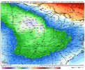
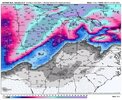
Crazy one run change from the euro. definitely a time to lean on ensembles!
View attachment 176016
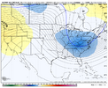
as you'd expect! for my own sake i think i hope this just goes back to being a cold few days and not having to model watch for a flizzard that will never happen.View attachment 176020
EPS follows.
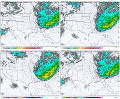
For sure man, just glad to be back to tracking Winter stuff. Crazy look off the EPS with these temp anomalies..as you'd expect! for my own sake i think i hope this just goes back to being a cold few days and not having to model watch for a flizzard that will never happen.
can't ignore this sort of swing, but i think its best everyone keeps expectations at a nice chilly monday-tuesday until proven otherwise. i will say given the fact that the 540 line is approaching the I-40 corridor on the ensemble mean, i wouldn't call you crazy for rooting for some silliness under such an anomalous trough. but what you really need is something like the euro op shows, where you've got that extra little shortwave thing south of that closed contour in the northeast, just to squeeze some extra synoptic oomf for any precip to develop
View attachment 176021
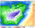
Would be cool to go early season wavelengths and continue to pound the Strat PV with N Central Pac low Wave 1, while still being able to have some level of western ridging to go along with developing blocking. Early climo and all, but whateverStarting to get flashes at the end of the some ens of the beginning of the pattern that the weeklies have been advertising, prob to early but the -NAO looks legit and starting to see some changes in the pac
LolSoil temps will limit accums guys let’s temper expectations!
It doesn’t matter how you load! Front or back, when you see flakes fly in the South, it’s magicalI still for the life of me don’t understand why people get excited for cold in Nov or Dec. Show me some temps well below delta in Jan and Feb and I’ll get excited. We have never been a front loaded winter area.
Anytime it’s cold is exciting. Plus it’s rarely cold in November or December honestly. It’s fun to try something different and see where it goes.I still for the life of me don’t understand why people get excited for cold in Nov or Dec. Show me some temps well below delta in Jan and Feb and I’ll get excited. We have never been a front loaded winter area.
Cold regardless should always be celebrated. We roast 6 months out of the year.I still for the life of me don’t understand why people get excited for cold in Nov or Dec. Show me some temps well below delta in Jan and Feb and I’ll get excited. We have never been a front loaded winter area.
I don't understand why anyone would not want a cold & wintry December. I mean unless you just don't give a darn about snow around Christmas. Personally, if I had to pick a month to have a Winter storm & I had to pick between December, January & February it would be December every time. I would sacrifice the rest of Winter to just get a snowstorm in the days/weeks leading up to Christmas. You give me Winter storm rolling in the afternoon of the last day of school for the kids before Christmas break, that is peak life right there.I still for the life of me don’t understand why people get excited for cold in Nov or Dec. Show me some temps well below delta in Jan and Feb and I’ll get excited. We have never been a front loaded winter area.
I don't understand why anyone would not want a cold & wintry December. I mean unless you just don't give a darn about snow around Christmas. Personally, if I had to pick a month to have a Winter storm & I had to pick between December, January & February it would be December every time. I would sacrifice the rest of Winter to just get a snowstorm in the days/weeks leading up to Christmas. You give me Winter storm rolling in the afternoon of the last day of school for the kids before Christmas break, that is peak life right there.
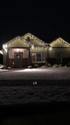
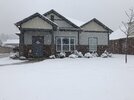

What about December 2002, 2005, and 2010. The Carolinas had major events then. Going farther back, December 1989 was 100% front loaded here.I still for the life of me don’t understand why people get excited for cold in Nov or Dec. Show me some temps well below delta in Jan and Feb and I’ll get excited. We have never been a front loaded winter area.
