-
Hello, please take a minute to check out our awesome content, contributed by the wonderful members of our community. We hope you'll add your own thoughts and opinions by making a free account!
You are using an out of date browser. It may not display this or other websites correctly.
You should upgrade or use an alternative browser.
You should upgrade or use an alternative browser.
November 2025
- Thread starter packfan98
- Start date
Looks like this rain event might over perform .4 so far
Didn’t have a half inch of rain on my bingo card today.
Quite the over performer last night, 1.00 on the nose
Weak La-Nina's never fail to deliver the cold shots. But you have to have some blocking help from Atlantic to keep them locked in for a few days and improve the ole Timing window of opportunity.
Needles are always hard to thread in the south. But I'd rather take my chances with this, than sitting here watching Canada get blasted all winter with a pacific firehose.
Needles are always hard to thread in the south. But I'd rather take my chances with this, than sitting here watching Canada get blasted all winter with a pacific firehose.
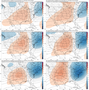
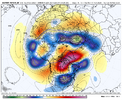
if that ridge over greenland can't stick around this looks like how you get a clear-sky high of 50 and a high of 70 within a few days of each other this time of year. that's what the euro OP does on the 0z run, nothing to stop our (albiet stout) trough from slipping away and failing to reload with ridging nudging in from the SW and nrn atlantic blocking shifting eastward.
the EPS and AIFS ens keep 2m anom means down through the end of the week thanks to a secondary weaker trough rotating in, but i'd put low confidence on that until we figure out that greenland situation
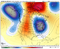
the EPS and AIFS ens keep 2m anom means down through the end of the week thanks to a secondary weaker trough rotating in, but i'd put low confidence on that until we figure out that greenland situation

Bigedd09
Member
First freeze for many definitely looking likely early next week
Yeah, we can bloviate about epic Decembers all we want, but the reality is if this doesn't change that is going to be a struggle.if that ridge over greenland can't stick around this looks like how you get a clear-sky high of 50 and a high of 70 within a few days of each other this time of year. that's what the euro OP does on the 0z run, nothing to stop our (albiet stout) trough from slipping away and failing to reload with ridging nudging in from the SW and nrn atlantic blocking shifting eastward.
the EPS and AIFS ens keep 2m anom means down through the end of the week thanks to a secondary weaker trough rotating in, but i'd put low confidence on that until we figure out that greenland situation
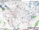
View attachment 175959
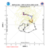
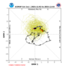
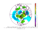
I definitely do not intend (won't say never lol) of falling into the trap of looking at the weeklies or these long range ensemble runs ever again with any expectation they won't change inside D7-10, because the reality is LR ensembles still suck - badly.
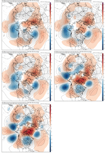
well hey that's not a bad trend with atlantic ridges trying to connect there lolYeah, we can bloviate about epic Decembers all we want, but the reality is if this doesn't change that is going to be a struggle.
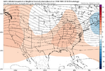
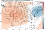
View attachment 175960View attachment 175961
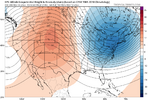
View attachment 175962
I definitely do not intend (won't say never lol) of falling into the trap of looking at the weeklies or these long range ensemble runs ever again with any expectation they won't change inside D7-10, because the reality is LR ensembles still suck - badly.
View attachment 175963
If only they'd fail this way all winter lol. Somehow, whenever it's the heart of winter they seem to always fail the opposite way.well hey that's not a bad trend with atlantic ridges trying to connect there lol
We've seen quite a bit of ridging near Greenland over the last couple of months, but it definitely has lacked staying power.
Webberweather53
Meteorologist
The base state has not (& still does not) support prolonged western troughing through early winter.
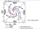
We might get a brief blip of -PNA mid-November on the back of a weak -EAMT before we likely go right back to the well of +PNA that has dominated the fall thus far as the MJO orbit goes into the Western Hemisphere.
Although the GEFS is usually overamped, the EPS's achilles heel with MJO forecasts is propagating the MJO across the Maritime Continent & into the Western Pacific and that's likely once again why its amplitude is so low here. This long-standing MJO bias w/ the EPS was documented over a decade ago & even despite all the improvements since, not much has fundamentally changed here from what I have seen.
https://webster.eas.gatech.edu/Papers/Kim2014.pdf

Webberweather53
Meteorologist
Also, the first "warning-worthy" westerly wind event here in New Mexico usually shows up by the middle of October. Looks like we're going to be at least a month behind schedule on that this year and are likely to go the longest into the cold season without a wind event since our reliable high-res station records began nearly 40 years ago. Just a testament to how persistent/strong the western ridge has been.
MRKEVIN7575
Member
The euro weeklies are fun to look at, especially when they look cold and stormy way out in lala land lol. I guess when they get in the 7-10 day range, they become somewhat more believable. Hoping for a front loaded winter, which if it can carry over through beginning of Feb, i will take my chances from thereAlso, the first "warning-worthy" westerly wind event here in New Mexico usually shows up by the middle of October. Looks like we're going to be at least a month behind schedule on that this year and are likely to go the longest into the cold season without a wind event since our reliable high-res station records began nearly 40 years ago. Just a testament to how persistent/strong the western ridge has been.
Webberweather53
Meteorologist
The euro weeklies are fun to look at, especially when they look cold and stormy way out in lala land lol. I guess when they get in the 7-10 day range, they become somewhat more believable. Hoping for a front loaded winter, which if it can carry over through beginning of Feb, i will take my chances from there
The Euro weeklies have looked generally believable for weeks to me.
NBAcentel
Member
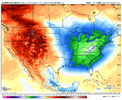
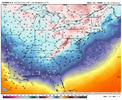
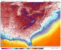
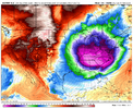
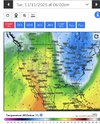
This is impressive for November, barely getting out the 30s during the day. Also wind chills in the teens after the front View attachment 175971View attachment 175972View attachment 175973

This is impressive for November, barely getting out the 30s during the day. Also wind chills in the teens after the front View attachment 175971View attachment 175972View attachment 175973
Guess who’s going on a cruise next week in the Bahamas.
LukeBarrette
im north of 90% of people on here so yeah
Meteorology Student
Member
2024 Supporter
2017-2023 Supporter
This is impressive for November, barely getting out the 30s during the day. Also wind chills in the teens after the front View attachment 175971View attachment 175972View attachment 175973
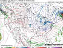
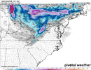
This look with warm lakes would produce helluva NW flow mountain snow regardless of what a global model shows at this point. Great look at this range!
MRKEVIN7575
Member
I

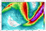
Definitely looking colder than a few days agoView attachment 175974
View attachment 175975
This look with warm lakes would produce helluva NW flow mountain snow regardless of what a global model shows at this point. Great look at this range!
Yea I was looking for 1st big LES out of this somewhere up there. That's some cold air coming across an unfrozen lake. You would think cleveland, northern IN or PA areas would cash in biggly with this type of trajectory. We shall see. Must be awesome living in a lake effect area, knowing if the wind direction dials into a certain trajectory, you win the snow globe lotto.View attachment 175974
View attachment 175975
This look with warm lakes would produce helluva NW flow mountain snow regardless of what a global model shows at this point. Great look at this range!
I got .64 inches in the rain gauge to add to the 2.25 inches at my residence that fell during last week's two day rain event. It was nice to catch up on some of the precipitation we had been missing in the past couple of months. I rode through the park at Lake Wheeler and noticed that signs were up stating that the boat ramps were closed due to low water levels even after last week's rain.
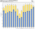
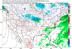
even this update seems a bit timid from the CPC
Put it in January.Is this good?View attachment 175981
Yup. It always sucked when I went to the Abaco's in the winter and a stout cold front would push through to Miami. As they say over Bahamian radio "It gonna blow". Cold as balls too.Guess who’s going on a cruise next week in the Bahamas.I’m not trying to have it be in the 60’s down there what the heck. That’s impressive cold for November
In my opinion....
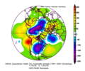
GFS / GEFS is the worst modeling with high latitude blocking. EPS and CMCE are better...and this year we have the Euro AI ensemble to supplement, and it has been good with it too
I will give the GEFS this - it was better than the EPS and CMCE in the medium range with the big, slow moving cold outbreak last January that setup the cajun winter storm

Iceagewhereartthou
Member
Still hurts to this day!I swore I’d never look at the Canadian again after it gave me 2 feet 2 days out from the Gulf coast blizzard. Only to end up with flurries. But here I am. It absolutely unloads the cold air
View attachment 175996


