lexxnchloe
Member
Waiting is what we do best."Later" lol
Waiting is what we do best."Later" lol

Not reallyWaiting is what we do best.
I love a good day where you get into the mid to upper 60's early morning to lunch time with a true cold front coming through and temps drop 20-30 degrees behind it with NW winds pushing 20-30 mph. 65-70 at 10 am and 40 by 2 pm. Classic late fall and winter stuff.Could get a strong cold front ( March Style ) 11/8-11/14 ish. One where you get severe, followed by cold drop in temps backside. See it being advertised on the ops out in la-la land pretty consistently.
Scenario , would mesh with the forecasted pattern and climo.
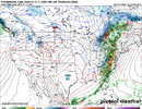
Here's GFS latest coughed up scenario. Actually spits out a whopper of one on 11/8 and my fav,a few days latter. We shall see, but we tend to get a nasty front or two to plow through each November.
Chasing a steamroller front and watching cable news reports of the first Big Lake Effect Snowstorm of the season, generally describe the November highlights as a wx watcher.
View attachment 175864
We might do better in the morning36, what am I doing wrong
Yep first freeze comingD7-10 trending colder due to -NAO trend and pacific slowing a bit, trending towards the coldest air of the fall season View attachment 175921View attachment 175923View attachment 175922
Ahh the ole 35 degree CAD cold rain pattern is back just in time. Nobody does it like usThis looks like our typical 2020s winter pattern...great Atlantic, horrible Pacific.
View attachment 175928
On the SS Southernwx?I’ve got a long family cruise in mid/late November so let’s keep the tropics quiet and the cold out west. Pump that SER into Thanksgiving

Loving what's going on up north.Trending to the coldest air of the season on the euro, & mountain snow View attachment 175937View attachment 175938View attachment 175939
