-
Hello, please take a minute to check out our awesome content, contributed by the wonderful members of our community. We hope you'll add your own thoughts and opinions by making a free account!
You are using an out of date browser. It may not display this or other websites correctly.
You should upgrade or use an alternative browser.
You should upgrade or use an alternative browser.
Pattern November 2024 💤 🔥
- Thread starter SD
- Start date
What has happened can happen again.
Georgia Weather History for November 19th
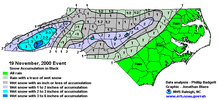
In 2000, an unusually early winter storm brought sleet and snow to much of north Georgia, particularly the northeast Georgia mountains. Amounts of 1 to 3 inches were common but Fannin County received 4 inches! This event caused numerous automobile accidents, particularly in Floyd County, where bridges and overpasses became icy and hazardous during the morning hours.Drizzle Snizzle
Member
The following month, December 2000, was pretty snowy as well.What has happened can happen again.
Georgia Weather History for November 19th
In 2000, an unusually early winter storm brought sleet and snow to much of north Georgia, particularly the northeast Georgia mountains. Amounts of 1 to 3 inches were common but Fannin County received 4 inches! This event caused numerous automobile accidents, particularly in Floyd County, where bridges and overpasses became icy and hazardous during the morning hours.
I don't recall December 2020 being snowy in the Atlanta area. I do recall the last big ice storm in January 2000, though.The following month, December 2000, was pretty snowy as well.
Drizzle Snizzle
Member
Remember the Mid December storm in 2000 that dumped 3-5” in the North Metro ? I think there was also a light snow event around New Years Eve in 2000.I don't recall December 2020 being snowy in the Atlanta area. I do recall the last big ice storm in January 2000, though.
ATLwxfan
Member
KATL is +8.4 for the month through 18 days. Between no real cold air anytime soon, few cloudy days, and absurdly in accurate overnight lows, they have to be making a run at the record.
Been the same up here in the Midwest. Finally the source region is getting cold. Should filter your way in due time!
Sent from my iPhone using Tapatalk
CAD is always stronger with a good snowpack to our northeast. I believe the 2014 winter storm was a good example of that.That is because we can not get a snowpack in the right place. Get 1 foot plus down from VA on to the north, east of the mountains, put a 1040+ MB high over upstate NY and a low that tracks from south of Louisiana to off the Carolina coast in Jan and see what happens. I think many on here would love the result.
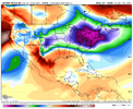
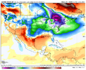
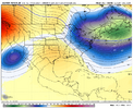
OPs looking very meh tonight so no eye candy there, but something to watch that they print is little pieces of energy rounding the ridge and messing things up. Been something that has ruined patterns in the past
NCSNOW
Member
- Joined
- Dec 2, 2016
- Messages
- 9,557
- Reaction score
- 19,024
Last edited:
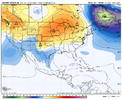
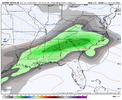
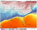
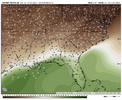
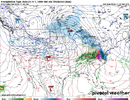
Yeah, the models have been back and forth on if it's going to be warm or cold for Thanksgiving. This morning/overnight they're (mostly) signaling cold(er).Love how the 6z GFS gets the rain out of here next wed, Turkey day is dry but cold. So Cold Turkey is on the menu, then it has a close call Saturday as we close Nov out.
Edit: Checked the 6Z Euro. It is also Dry and Cold Turkey Day. It's not a white Thanksgiving, buts its a win in my book!
View attachment 154405
Ron Burgundy
Member
Dang - picked up another 1.20” overnight. Total of 2.29” since yesterday. Big over-performer.
AJ1013
Member
I'm interested to see if we can get some flurries Friday am
KATL is +8.4 for the month through 18 days. Between no real cold air anytime soon, few cloudy days, and absurdly in accurate overnight lows, they have to be making a run at the record.
RDU is +7.9F. It’s been noticeably warm so I am almost surprised it wasn’t even warmer.
weather bubba
Member
That would be a nice birthday present just to see some snowflakes in the air. The largest accumulation of snow ever reported at KRDU on my birthday is only a trace so I am not expecting any miracles.I'm interested to see if we can get some flurries Friday am
I remember this in GSO. Caused some power outages as I don’t believe all the leaves were even off yet (I know our front yard Bradford Pear’s certainly weren’t, at least).What has happened can happen again.
Georgia Weather History for November 19th
In 2000, an unusually early winter storm brought sleet and snow to much of north Georgia, particularly the northeast Georgia mountains. Amounts of 1 to 3 inches were common but Fannin County received 4 inches! This event caused numerous automobile accidents, particularly in Floyd County, where bridges and overpasses became icy and hazardous during the morning hours.
This pattern has some December 2017 into Jan 2018 feels to it. Not sure we can duplicate that kind of cold but it's not far off from being able to deliver some goods
Looks like locally we are losing Thanksgiving as a warm day on the last few sets of runs. Gfs keeps most of NC either side of 40 through the day.

