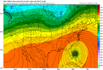
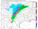
November pattern discussion, getting close.... let'er rip ladies and gents.
-
Hello, please take a minute to check out our awesome content, contributed by the wonderful members of our community. We hope you'll add your own thoughts and opinions by making a free account!
You are using an out of date browser. It may not display this or other websites correctly.
You should upgrade or use an alternative browser.
You should upgrade or use an alternative browser.
Pattern November 2022
- Thread starter Metwannabe
- Start date
- Status
- Not open for further replies.
Broken024
Member
Just turn that L above Michigan to an H and we have our blizzardcane
Brent
Member
Avalanche
Member
Maybe some of the drought stricken areas of the south (such as mine) can get a dose of rain.
Iceagewhereartthou
Member
Nothing resembling cold anywhere in US East of the Rockies for the end of the month or into Nov with the recent GFS runs. Hopefully that changes and we see some more cold showing up, as well as some more rain somewhere. This current pattern is nice for a general fall feel, but it's quite static and not very conducive to fronts or any rain.
JHS
Member
This is going a lot like 2001 and somewhat like 2016, which means any real rain is probably about a month away. We probably will not see anymore really cold shots until Dec either.Nothing resembling cold anywhere in US East of the Rockies for the end of the month or into Nov with the recent GFS runs. Hopefully that changes and we see some more cold showing up, as well as some more rain somewhere. This current pattern is nice for a general fall feel, but it's quite static and not very conducive to fronts or any rain.
L
Logan Is An Idiot 02
Guest
This is going a lot like 2001 and somewhat like 2016, which means any real rain is probably about a month away. We probably will not see anymore really cold shots until Dec either.
I personally think we have potential of getting cooler with chances of precipitation between thanksgiving and the end of the year
Sent from my iPhone using Tapatalk
I thought triple dipsy doo La Nina, means front loaded winter and torch from late January on??? That’s what most have been saying about this winter!This is going a lot like 2001 and somewhat like 2016, which means any real rain is probably about a month away. We probably will not see anymore really cold shots until Dec either.
Apparently, the atmosphere is behaving like an El Nino, so that all goes out the window.I thought triple dipsy doo La Nina, means front loaded winter and torch from late January on??? That’s what most have been saying about this winter!
Well, my first Niña here was fantastic for snow! Last winter was mediocre at best, about half the snow as 20/21, so hopefully 3rd Niña is the charm!Apparently, the atmosphere is behaving like an El Nino, so that all goes out the window.
This is why I’m really paying close attention to the winter of 2000-01. It’s the last time there was a 3rd year Niña and there is a definite similarity in that the Niña is showing signs of weakening and at least switching to a neutral EnsoApparently, the atmosphere is behaving like an El Nino, so that all goes out the window.
SimeonNC
Member
How the big indices such as AO, NAO, PNA and so on behave this upcoming month is very important since we are about only six weeks away from the beginning of the met winter.
NCSNOW
Member
- Joined
- Dec 2, 2016
- Messages
- 9,482
- Reaction score
- 18,761
Everything I'm looking at is pretty much zonal through 1st half Nov. Haven't queued in on indices, but EPS,CFS show Canada/US border states as the transition line between true winter wx. Consistent and not in any hurry to sink south. This can and will change. So climo on the temps and BN on qpf still the theme. Need moisture and I just dont see it. We should net .25-.50 western part of NC Sun night per NWs discussion, but farther east you get, NADA. Need a shakeup in NOV and get out of this dry pattern. If we roll through winter BN qpf, we will be in big trouble come next next spring/summer.
iGRXY
Member
MJO is the driver, always is. ENSO doesn’t have the pull that it use to. You get in favorable MJO phases like last year and we will freeze. Don’t know about snow as that’s a timing factor but cold for sure. There’s never a wall to wall scenario whether is be cold or warmth. Even during the worst winters you’re going to get periods of cold. Even during the best winters you’re going to get periods of warmth. We went through about a month of heavy east coast troughs from the end of Sep through most of OCt. now we’ve switched to ridging which will likely last 3-4 weeks (More CAD though) before a flip back towards the last 10 days of November.
tennessee storm
Member
Can tell u this. Pna looks go fairly negative perhaps through mid NovemberHow the big indices such as AO, NAO, PNA and so on behave this upcoming month is very important since we are about only six weeks away from the beginning of the met winter.
NCSNOW
Member
- Joined
- Dec 2, 2016
- Messages
- 9,482
- Reaction score
- 18,761
Its the big Kahuna in my book. Numero UNO! Get it to lock in Positive and Ill take my chances with everything else.Can tell u this. Pna looks go fairly negative perhaps through mid November
Itryatgolf
Member
From ERIC WEBB: Fwiw, the ECMWF weeklies, extended GEFS, and JMA weeklies are all on board w/ the idea of a legit -NAO developing in late November. Tried to briefly outline a few reasons why a -NAO is favored (much more than usual) ~ 3-4 weeks from now in this thread yesterday.
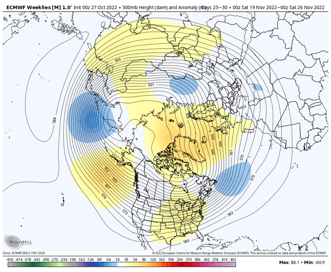
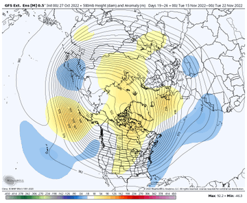
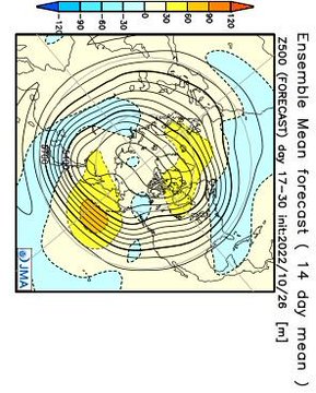
Quote Tweet

Eric Webb


@webberweather
·
21h
Oth, wrt the long-term NH circulation pattern, this CCKW might make it easier for next week’s Scandinavia block to retrograde towards Greenland/evolve into a -NAO in weeks 3-4.


Quote Tweet

Eric Webb


@webberweather
·
21h
Oth, wrt the long-term NH circulation pattern, this CCKW might make it easier for next week’s Scandinavia block to retrograde towards Greenland/evolve into a -NAO in weeks 3-4.
Feel like we heard this all last winter, till it finally hit for y’all in January! It’s always 3-4 weeks away from glory! ?From ERIC WEBB: Fwiw, the ECMWF weeklies, extended GEFS, and JMA weeklies are all on board w/ the idea of a legit -NAO developing in late November. Tried to briefly outline a few reasons why a -NAO is favored (much more than usual) ~ 3-4 weeks from now in this thread yesterday.
Quote Tweet

Eric Webb

@webberweather
·
21h
Oth, wrt the long-term NH circulation pattern, this CCKW might make it easier for next week’s Scandinavia block to retrograde towards Greenland/evolve into a -NAO in weeks 3-4.
Fortunately, 3-4 weeks away is December. We can toss NovemberFeel like we heard this all last winter, till it finally hit for y’all in January! It’s always 3-4 weeks away from glory! ?️
- Status
- Not open for further replies.

