• Hello, please take a minute to check out our awesome content, contributed by the wonderful members of our community. We hope you'll add your own thoughts and opinions by making a free account!

Severe New Years Severe Weather Event

Is this a daytime event for Alabama?
I really haven't looked too much at this event. I will later. Had to give myself a rest after yesterday. I think yesterday's event gave us a hint at models being biased to cape yesterday. From what I remember the nam 3km was more accurate than the HRRR for the most part. Correct me if I'm wrong. I wonder how much a messy storm mode will hinder severe chances. And also the mcs possibility on the gulf. I haven't checked to see if it's still there.
 
I really haven't looked too much at this event. I will later. Had to give myself a rest after yesterday. I think yesterday's event gave us a hint at models being biased to cape yesterday. From what I remember the nam 3km was more accurate than the HRRR for the most part. Correct me if I'm wrong. I wonder how much a messy storm mode will hinder severe chances. And also the mcs possibility on the gulf. I haven't checked to see if it's still there.
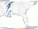
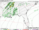
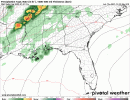
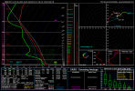
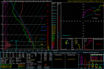
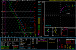
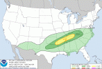
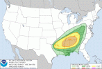
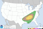
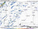
The timing on the models are a little different. NAM has Saturday night event, Euro the fastest and GFS in the middle. I also remember the 3KM seemed the handle the cape better yesterday. Dew points are a little higher on the EURo the the NAM and GFS for Alabama 7470E80E-FBEF-406F-8CAC-22C2D9DD1CCD.gif9B81952E-05C4-42A5-8328-5E4CF38BFA40.gifC0DB702D-0784-44B1-AE8F-BE716B0699EF.gif
 
Not sure how to feel about the severe threat new years day. Instability is a big question mark for me, shear though is really good. Hodo is almost a sickle. I'd like to see some convection pop ahead of the line on model simulations before I go all in on a tornado threat. Models have been wonky lately. About to just start looking at plain weather parameters , not composites and go off solely my judgment lol. Times like these when you go old school in a way.
 
Models are picking up the speed some. I'm impressed. It's getting closer to a peak heating event. 21z RAP really paints a ugly picture with tornadic cells firing way ahead and along the line. going to have to keep a eye on the RAP. Seen some people use it, don't know how realiable it is compared to 3km nam and HRRR though
 
Speed shear is phenomenal with this event, directional shear is pretty good as well. It would be optimal If there was a bit more turning near the surface but hey, 400srh helicity at 3km and 300+ at 1km is really good. Rap trended up with near 1500 cape around the central Alabama area. Which I feel is about right compared to the below 1000 HRRR and nam 3km print.
 
Sorry for the information dump guys. I finally sat down and started to pour through some data. The NWS of bham states they expect a upgrade in risk area by tomorrow's update for central Alabama and probably some sourounding areas.
 
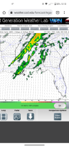
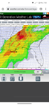
This spot in Georgia has no severe or snow.. its mild and wet, or hot and moist
 
Day 2 Convective Outlook CORR 1
NWS Storm Prediction Center Norman OK
0114 AM CST Fri Dec 31 2021

Valid 011200Z - 021200Z

...THERE IS AN ENHANCED RISK OF SEVERE THUNDERSTORMS ACROSS PORTIONS
OF THE DEEP SOUTH AND TENNESSEE VALLEY....

CORRECTED FOR SIGNIFICANT TORNADO LINE TYPE

...SUMMARY...
Widespread thunderstorms are expected from the ArkLaTex to the
Western Appalachians on New Year's Day. All severe-weather hazards
are possible including large hail, damaging winds, and tornadoes, a
couple of which may be strong.

...Synopsis...
A positively tilted upper-level trough will be centered near the
Great Basin to start the period. This trough will maintain its
positive tilt as it shifts eastward across the Plains and into the
Midwest by 12Z Sunday. An embedded mid-level shortwave trough will
move quickly from the southern High Plains across the Midwest and
Ohio Valley Saturday to the Northeast by Sunday morning. A surface
reflection of this mid-level shortwave trough is expected to travel
along the front from the Ozarks to the Ohio Valley and into the
Mid-Atlantic.

...Ohio Valley into the central Appalachians...
There is still considerable uncertainty regarding the northward
extent of the destabilization and severe-weather threat based on the
position of the position of the surface front and the strength of
the surface low. The NAM is stronger with the surface low with a
much farther north warm front bringing low 60s dewpoints north of
the Ohio River into southern Illinois, southern Indiana, and
Southwest Ohio. However, the operational GFS is much weaker and
southeast with the surface low and only brings low 60s dewpoints
into south-central Kentucky. The ECMWF solution is between these two
locations with the frontal position, which also closely resembles
the GEFS mean. Therefore, the northern extent of the marginal and
slight risk threat areas match the ECMWF and GEFS mean.

A line of storms is expected to move through this region during the
afternoon and early evening hours. Forecast soundings show more than
50 knots of flow only a few hundred meters above the surface.
Therefore, mixing this strong flow to the surface should not be that
difficult, even in a weak buoyancy environment. Low 60s dewpoints
should yield MLCAPE around 250 to 500 J/kg across southern Kentucky,
which increases the confidence for severe winds as the squall line
moves through. In addition, a QLCS tornado threat will exist given
the strong low-level speed shear present ahead of this line of
storms. However, the limited instability and veered surface flow
will be limiting factors to a greater tornado threat along this
portion of the line.

...Portions of the Deep South into the Tennessee Valley...
A large area of thunderstorms, some of which may be severe, is
expected to be ongoing from western Kentucky to northern Texas
Saturday morning. As the surface low moves from the Plains into the
Ozarks Saturday morning, this convection is expected to become
better organized, likely into a squall line, and start to advance
eastward. Dewpoints are forecast in the mid to upper 60s ahead of
these storms, which should yield MLCAPE around 500 to 1500 J/kg from
north to south. This should be more than sufficient to maintain a
strong squall line through the afternoon and into the overnight
hours across eastern Arkansas, most of Tennessee, and northern
Mississippi and Alabama. A 50 to 60 knot low-level jet will result
in strong low-level speed shear across the entire warm sector.
Forecast soundings show mostly unidirectional flow in the lowest 1
km due to the veered surface flow across most of the warm sector as
a result of the elongated nature of the surface pressure pattern.
This should temper the tornado threat somewhat, but with the strong
speed shear and the expectation of a well balanced squall line, the
environment will still be supportive for QLCS tornadoes.

Most guidance hints at the potential for some warm sector supercell
development across portions of Mississippi, Alabama, and Tennessee
Saturday afternoon/evening. The ECMWF has been especially bullish
with pre-frontal convection for the last several days, which
continues through the latest 00Z run. Any strong supercells which
can develop in the open warm sector will likely have the greatest
threat for significant to potentially intense tornadoes. The most
likely region for pre-frontal supercell development will be from
eastern Arkansas to northern Alabama and possibly southern Tennessee
where greater instability is forecast. Veered low-level flow will
keep low-level directional shear limited during the first half of
the day. However, at least slightly greater low-level turning is
shown by forecast soundings during the late afternoon into the
evening hours as surface flow remains south-southwest, while the
low-level jet starts to veer more westerly as the main wave shifts
east. This may result in a slightly higher tornado threat into the
overnight hours from far eastern Mississippi into northern/central
Alabama and northwest Georgia.

..Bentley.. 12/31/2021
 
12z hrrr comes out in a couple hours. Feels like a tornado outbreak is shaping up. I'm no proffesional though, just my intuition. A lot of things are coming together for a "red letter day". Anybody else have a analysis?
 
.SHORT TERM...
/Updated at 0400 AM CST Fri Dec 31 2021/

Today through Saturday.

This AM, satellite and observations indicate lots of low stratus and
dense fog across Central Alabama. Visibilities are varying widely as
they tank, go up temporarily, and then go back down again. A dense
fog advisory remains in effect until 9 AM for the entire forecast
area. Otherwise, we have some light rain showers/drizzle across
portions of the area as well at this time. Temperatures this AM are
cooler than they have been the last few days for many with a surface
boundary stretched across the SRN fringes of the CWA. This boundary
is expected to make its way NWD today as a warm front. This will
allow for those mild overnight temperatures and higher dew points to
rebound tonight as it does so. Fog will be possible again tonight,
but it should not be as dense.

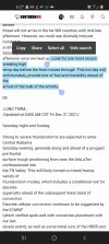
Our main frontal system is not expected to be arriving in the NW
counties until Saturday evening. Pre-frontal bands and the severe
threat will not arrive in the far NW counties until mid-late
afternoon. However, we could see diurnally induced isolated to
scattered convection in the area ahead of that time Saturday
afternoon once we heat up. Look for one more record breaking high
temp day before the front moves through. This hot day will,
unfortunately, provide lots of fuel and instability ahead of the
arrival of the bulk of the activity.

08

.LONG TERM...
/Updated at 0400 AM CST Fri Dec 31 2021/

Saturday night and Sunday.

Strong to severe thunderstorms are expected to enter Central Alabama
Saturday evening, generally along and ahead of a progged pre-frontal
surface trough positioning from near the ArkLaTex northeastward into
the TN Valley. This will likely contain a mixed/messy variety of
thunderstorm modes, which includes a conditional risk for discrete
supercells ahead of the subsequent linear band of convection.
Discrete cellular convection continues to be suggested by the ECMWF
(which verified quite well with convective placement with our last
severe event), as well as some initial runs of the HRRR and HRW
FV3. Pressure falls associated with the pre-frontal surface
trough should keep surface winds backed to a south-southwesterly
direction during this time. These winds will coincide with a 50-60
kt southwesterly low-level jet, and from there, gain further
momentum with height, though not changing direction much. Thus,
deep-layer flow still seems to remain mostly parallel surface
features; this has always been a source of uncertainty for
anticipated severe risks, but a more supportive factor for locally
heavy rainfall. Nonetheless, my overall expectation is for 0-1 km
wind profiles to support 200-300 m2/s2 SRH along with the
expected 60+ kts eff. bulk shear. These kinematic fields support
all modes of severe weather given any robust thunderstorm
updrafts, either discrete or line-embedded supercells. Expected
thermodynamics include 500-1,000 J/kg MLCAPE, particularly after
sunset when guidance suggests height falls occur overtop the
unusually warm, moist warm sector. Height falls/cooling aloft will
help improve mid-level lapse rates, which most guidance suggests
for the majority of the afternoon are not that good. This seems to
be the main reason more muted instability values appear in
guidance despite what could be another record-breaking warm
afternoon Saturday.

For now it appears the best chance for severe convective weather
will be along and north of I-20 from Saturday afternoon through the
early morning hours on Sunday. By later in that period, pressure
falls begin to subside with the northeastward departure of the
surface low. This will allow veering of 0-3 km flow to occur which
will reduce overall severe weather threats, especially the tornado
threat. This should occur as the convective line nears the I-85
corridor. All severe weather should continue to diminish from there
as 850 mb flow becomes westerly behind the exiting low-level jet and
the surging polar air mass infiltrates Central Alabama from the
northwest. By then any lingering thunderstorms should have exited
the area anyway.

Guidance continues to suggest a lagging vort max swinging through
the Deep South at the base of the parent positively tilted upper-
level trough. This has continued to leave the door open for PoPs
throughout Sunday as residual moisture below 700 mb interacts with
lift aloft (PVA). By late Sunday afternoon/evening, most
lingering moisture should now reside below 850 mb. Throughout this
period lies an overlap of critical thickness values supportive of
a glancing transition to light snow/flurries across the northern
part of the forecast area. This is also suggested in various
forecast soundings. Despite this, no accumulation is expected; QPF
is zero. Sunday night will be a huge transition in temperatures
considering the extended period of unusual December warmth.
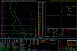
 

Attachments

  • Screenshot_20211231-062701_Chrome.jpg
    Screenshot_20211231-062701_Chrome.jpg
    337.4 KB · Views: 41
12z hrrr comes out in a couple hours. Feels like a tornado outbreak is shaping up. I'm no proffesional though, just my intuition. A lot of things are coming together for a "red letter day". Anybody else have a analysis?

Sure seems like it’s coming together for a red letter day. The last paragraph of the day2 from SPC is interesting, wonder if they go with a moderate somewhere across north MS/AL?


Most guidance hints at the potential for some warm sector supercell
development across portions of Mississippi, Alabama, and Tennessee
Saturday afternoon/evening. The ECMWF has been especially bullish
with pre-frontal convection for the last several days, which
continues through the latest 00Z run. Any strong supercells which
can develop in the open warm sector will likely have the greatest
threat for significant to potentially intense tornadoes. The most
likely region for pre-frontal supercell development will be from
eastern Arkansas to northern Alabama and possibly southern Tennessee
where greater instability is forecast. Veered low-level flow will
keep low-level directional shear limited during the first half of
the day. However, at least slightly greater low-level turning is
shown by forecast soundings during the late afternoon into the
evening hours as surface flow remains south-southwest, while the
low-level jet starts to veer more westerly as the main wave shifts
east. This may result in a slightly higher tornado threat into the
overnight hours from far eastern Mississippi into northern/central
Alabama and northwest Georgia.
I kinda expect a moderate to be honest. Of course if models keep coming in like they are and edge more to prime heating. I don't think it'll be upgraded to moderate by the mid day outlook. But overnight if things stay consistent. High risk is a bit too much to consider right now unless something is just slapping our faces before it happens lol
 
HRRR is doing what the HRRR did for the last event with cape ?. Still on track from my previous thoughts.
 
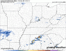
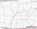
Not to distract from tomorrow main event but parts of AL/GA this afternoon need to be aware as models do show some decent metrics for some cells that could roll thru at end of the day and be pretty strong storms.
 
Not to distract from tomorrow main event but parts of AL/GA this afternoon need to be aware as models do show some decent metrics for some cells that could roll thru at end of the day and be pretty strong storms.
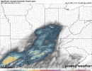
STP increases overnight tonight in north Mississippi and west TN3B397A48-575B-46B1-859F-C12300317537.gif
 
I feel like some of the other factors may help negate in the lower lapse rates. Lapse rates where in the range of 6-6.8 if I remember, on April 27th 2011. So it shouldn't hamper things too much.
Also NO this is not like April 27th guys ?. I know people will start asking and wondering lol
 
Not to distract from tomorrow main event but parts of AL/GA this afternoon need to be aware as models do show some decent metrics for some cells that could roll thru at end of the day and be pretty strong storms.
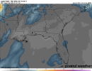
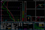
B3729D93-2B01-44AB-A6E4-CA3E95065A01.gifB0D21C68-9905-4AAA-8C86-4D7AD4AC1AD1.gif

This is this evening not the main event tomorrow.
 
Back
Top