• Hello, please take a minute to check out our awesome content, contributed by the wonderful members of our community. We hope you'll add your own thoughts and opinions by making a free account!

Pattern NC Only Thread

Wouldn't be too sure, still looks to hook left after LF and main rain shield goes west of apps. Coastal development of secondary LP not as much a sure thing either.

We will just wait and see I wasn’t saying SD was wrong just what I thought might happen and I could be totally wrong


Sent from my iPhone using Tapatalk
 
I’m not surrendering but been waiting for inland track to shift NNE for 2 days. I guess it’s my bias that once it LFs most gulf TCs turn NNE or NE. But of course there’s always exceptions, and I’m still waiting on that NNE shift and we're running out of time. It’s bound and determined to visit W Kentucky before making a hard right.
 
I’m not surrendering but been waiting for inland track to shift NNE for 2 days. I guess it’s my bias that once it LFs most gulf TCs turn NNE or NE. But of course there’s always exceptions, and I’m still waiting on that NNE shift and we're running out of time. It’s bound and determined to visit W Kentucky before making a hard right.
It could I suppose but seems the quicker movement is allowing it to get further east before the inevitable SER flexes. Hard to make a visit here like this
1791487355775.png
 
I am not trying to be negative, I am just concerned. History tells us that these setups with primary lows to the west and any type of secondary stuff going on the coastal front sets up a minimum across central NC. If we progress like the 12z Euro where anything along the coastal front is not there or fairly insignificant 1-2 inch rain event possibly more, easy. If we start seeing storms along the coast and the moisture flow is interrupt, big trouble and we are relying on convection tied to the sfc trough on Sunday afternoon to catch up.
 
I am not trying to be negative, I am just concerned. History tells us that these setups with primary lows to the west and any type of secondary stuff going on the coastal front sets up a minimum across central NC. If we progress like the 12z Euro where anything along the coastal front is not there or fairly insignificant 1-2 inch rain event possibly more, easy. If we start seeing storms along the coast and the moisture flow is interrupt, big trouble and we are relying on convection tied to the sfc trough on Sunday afternoon to catch up.
Jinx you're it
 
This is almost a Miller b type scenario, with a main LP track west of apps and a coastal LP developing. Except there's tropical moisture involved but still gonna leave some losers between the 2 systems
Yep for us you have to look at this like an amped up winter system more so than the traditional hurricane to the west. This may actually play in our favor if we can do what we see a lot in the winter where the initial convergence in the mid levels and shot of moisture thumps but hell I dont even know how to handle that in this setup or if the models will struggle with it like the do in winter.
 
Miller B tropical variant. Got it.

My internal climo map (in my head) puts that QPF min between hwy 49 and US 1 more often than not.
Not a bad guess. I'm unsure if how quickly, or slowly, it transitions to extratropical affects the coastal development. I'd presume quick transition helps develop a lp along the wedge front quicker sooner but then it's a matter of how far inland the coastal front progresses into the wedge. Way too many variables imho for models to nail down. Hi res models may have a better idea tomorrow evening 🤷‍♂️
 
I shouldnt have looked. What a face slap from the 0z nam.

A.M. Update:
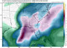
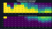
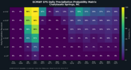
All the Globals Icon/Euro/Can/6z GFS are looking stellar this a.m. Ukmet would be the least enthused , but even it dumps.8-.9 over the least favored areas in NC. All the Ensembles look great.

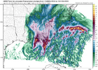
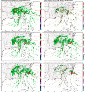
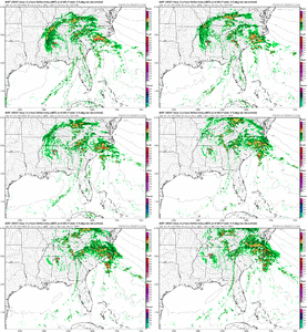
Short range: RDPS is acceptable/ kind of has the 0z Ukmet flavor and atleast gets the minimum crowd painted with 3/4 inch. The Nam causes a pause. On an island compared to all other physics models @ slaps a few folks with only a paisley .25

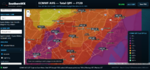
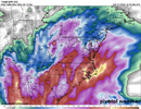
Heres the 6z GFS. 0z Euro looks about as good.

1791542672796.png


Fall wx watch: 0Z Euro has it in upper 30's here back west on 19th / closest we come to seeing a Jack frost appearance: Also hits us with a 4 day stretch of 80-83 degree wx mid late next week.
 
Last edited:
Meh most models still show a minimum somewhere in central NC, seems legit considering the "hybrid Miller b" set up. Just where and how minimal yet TBD. 6z 3k NAM not very pretty for sure
oh yea we definitely gonna get a minimum central NC. But if the min ends up being 1.0 while the coast and escarpment cash in with 2-4. I want be complaining. Gladly take .75- 1.0 and call it a huge win for mby. Theres no if and buts mby is sitting dead square in the minimum dead zone. Last weekend netted a 5 min drizzle spell that didnt even wet the pavement completely. Can't afford another 0.00001.
 
12z Nam , which by far has been the driest of all guidance , is coming in and has the inland low 75-100 miles futher east up through central Alabama compared to its 6z run. Lets see if the end result bumps up its qpf.

Edit ended up way better over this way. However 3k NAM is ugly still.
 
Last edited:
Globals losing the sfc wedge and coastal combo and spreading heavy rain across the state, hires short range stuff total disaster, pick your fighter here. The 3k NAM so far has a great look Saturday morning with widespread light stuff across the state and deeper echos across much of SC. If that doesnt leak out of the E along the coastal trough and moves north into the area instead it should be good run and start to give a little bit of support to the globals
 
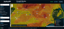
Wilmington has probably had the most amount of rain in the state since July. Somehow we are still running double digit deficits so this rain will help. Just wish there was some wind to go along with it. I'd be concerned along the immediate beaches for the possibility of some spin ups moving onshore
 
Last edited:
goodfellas-goodfellas-laughing.gif
 
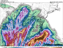
Insane run down your way on the 3k highest I could find so far is 15 inches
It's been a horrible model this summer. No run to run consistency and one of my biggest rain totals with major flooding it only had me getting a 1/4 inch. I have zero confidence in it.

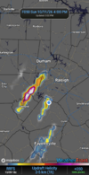
The hrrr painting some UH tracks across the piedmont might be worth watching
 
Back
Top