Avalanche
Member
Man I’m surprised it’s that much, but glad we got it.7 here

Man I’m surprised it’s that much, but glad we got it.7 here




I went through the eye of Ophelia in 2005 when it made landfall in North Carolina. That was the only time I've done that and it is surreal observing the high wind and rain blowing in one direction, then the calm that comes from the eye of a storm, and then the storm begins unleashing its fury with the winds blowing in the opposite direction. The eye itself was not totally clear, it was partly cloudy, but the sense of calm that comes with it was real.If 92L gets named, it'll be Isaias. Notable here for landfalling as cat1 at Ocean Isle August 2020. One of my biggest weather regrets is not chasing that one--Mom ended up in the eye. Might have been my only chance at experiencing that. I don't remember exactly why I didn't go down there. Probably thought it would be OTS or just didn't take an early Aug threat seriously.
Nice! I'd like to go thru the eye of a cat 1 like that. (mayyybe a low cat2 but no more than that--just my preference) I did go down for Matthew which was interesting (cat 1 gusts, but not sustained). The real fun was driving back to Raleigh the next day from the flooding. 3 hr drive turned into 8 hrs. Had to do something like 10 detours..I went through the eye of Ophelia in 2005 when it made landfall in North Carolina. That was the only time I've done that and it is surreal observing the high wind and rain blowing in one direction, then the calm that comes from the eye of a storm, and then the storm begins unleashing its fury with the winds blowing in the opposite direction. The eye itself was not totally clear, it was partly cloudy, but the sense of calm that comes with it was real.


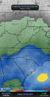
I think we have 100% pops late Friday through at least early Monday but we have some things that typically happen in our area that keep the precip totals in check. I think right around a general .5-1 for our area is a safe bet right now, convective processes may line up some totals of 2 or 3 inch totals but I would suspect the really large totals are tied down toward the beach, deep in the wedge zone of the NW piedmont and over toward the primary low track.Are we finally gonna get a good soaking from something tropical up here?
When AI graphics? Waiting till it gets a name?I think we have 100% pops late Friday through at least early Monday but we have some things that typically happen in our area that keep the precip totals in check. I think right around a general .5-1 for our area is a safe bet right now, convective processes may line up some totals of 2 or 3 inch totals but I would suspect the really large totals are tied down toward the beach, deep in the wedge zone of the NW piedmont and over toward the primary low track.

Euro AI agrees with this assessmentI think we have 100% pops late Friday through at least early Monday but we have some things that typically happen in our area that keep the precip totals in check. I think right around a general .5-1 for our area is a safe bet right now, convective processes may line up some totals of 2 or 3 inch totals but I would suspect the really large totals are tied down toward the beach, deep in the wedge zone of the NW piedmont and over toward the primary low track.

Like the new name btw.

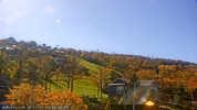


I was just out in the sun and didn’t start sweating.
Good thing too. The wife and I are doing some painting inside this week so we have to have windows open. Feels greatI was just out in the sun and didn’t start sweating.
Was a fine day especially this morning, and we got 40’s tonight. Not too shabby.Did feel like Fall finally today. Gradually increasing activities and outdoor work since my heart procedure, I'm particularly grateful for today's weather. Keep it coming!
20-25, maybe a chance to rip a few big ones out of the south on Sunday if the sun comes outHow breezy are we looking like Sat-Sun? I cant access windgust maps, curious with HP to north and leftover gyre to SW.
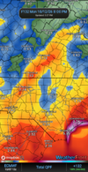
It's funny, but it's not.January lolView attachment 198562

You think we're gonna have higher totals east and west?Just popping in to say rain totals are in big trouble. Tks
You think we're gonna have higher totals east and west?
I gotcha. He might have been referring to this scenario.I think he was being negative about our chances however the further east this storm makes landfall will have an effect on our rain chances I would guess it would increase them here but that’s just me guessing
Sent from my iPhone using Tapatalk
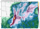
Wouldn't be too sure, still looks to hook left after LF and main rain shield goes west of apps. Coastal development of secondary LP not as much a sure thing either.I think he was being negative about our chances however the further east this storm makes landfall will have an effect on our rain chances I would guess it would increase them here but that’s just me guessing
Sent from my iPhone using Tapatalk
We can't even get sloppy seconds anymoreJust popping in to say rain totals are in big trouble. Tks