
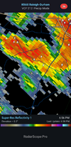
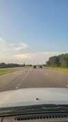
Stuff to my NE looks juicy


.11 now I wait and see if stuff to my north holds.19 we take
They must not read here anymoreSeems NWS dropped the ball today




I’m so over this summerRDU hitting triple digits again today or no?
Yea nvm. The answer was duh.RDU hitting triple digits again today or no?

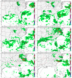
BustyUpper level ridge weakens and shifts slightly west today which may allow for us to get brushed by some weak upper level energy this afternoon. May be a weak surface boundary left today from last nights convection to the north and we may see a weak trough develop along or just north of I40. HRRR bothers me a little with how significantly it's mixing the BL and tanking cape/dews but its tendency to do so and little support today makes it questionable. Think today has the better potential to fire enough storms where we start seeing some OFB collisions that really gives us decent coverage. Oh and assuming the front doesnt jump way south on a composite OFB the severe setup is pretty legit for Saturday

Pumpkin96/77 Hi 110 nice fall weather
We are definitely being helped with the seabreeze today. Don't envy you guys at all. It's still hot but not like you guys96/77 Hi 110 nice fall weather

Naw.... only rains here when they don't mention rainRaleigh says yall are playing JV Ball thinking Sat will produce.
Course I cant count the times its been Raleigh NWS looking like the JV squad this summer on some of their AFD's. Not that I could do any better. Hard to pin the tail on the donkey when its heat triggered Pulse type deals.
2) Scattered storms, with a risk of damaging, multi-cell downbursts,
will probably focus across the nrn/ne Piedmont and nrn Coastal Plain
this afternoon-evening, then possibly throughout cntl NC on Sat.
However, influences from lower predictability, early day convection
Sat may hinder storm development or re-intensification over parts of
cntl NC later Sat afternoon.
3) After the passage of the cold front Saturday night into Sunday,
cooler and drier air will filter into central NC.
Congrats in advance for Halifax County. Ground Zero for the Jackpot
Pretty spot on AFD though and a carbon copy of the last 2 good setups. First days prefrontal storms over perform, deposit an OFB, stratus, drizzle, 2nd days storms which is the day the models were most enthusiastic about form on the edges of the stratus layer and someone gets left out in the face of models showing heavy rain and storms for days. The only positive is this setup is a little less likely to hang around stratus and drizzle versus last weekend and the one before. I am just hoping to get something substantial today then if I get smoked tomorrow thats just bonus rain, depending on tomorrow is going to cause some heartburnRaleigh says yall are playing JV Ball thinking Sat will produce.
Course I cant count the times its been Raleigh NWS looking like the JV squad this summer on some of their AFD's. Not that I could do any better. Hard to pin the tail on the donkey when its heat triggered Pulse type deals.
2) Scattered storms, with a risk of damaging, multi-cell downbursts,
will probably focus across the nrn/ne Piedmont and nrn Coastal Plain
this afternoon-evening, then possibly throughout cntl NC on Sat.
However, influences from lower predictability, early day convection
Sat may hinder storm development or re-intensification over parts of
cntl NC later Sat afternoon.
3) After the passage of the cold front Saturday night into Sunday,
cooler and drier air will filter into central NC.
Congrats in advance for Halifax County. Ground Zero for the Jackpot
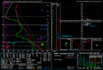
3k still gets to me as that line drops SW down the coast. It's fading quick though and the timing is after 10pm. That moves it into the "I'll believe it when I see it" category12z cams were a fumble at the goal line
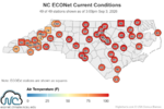
Might as well round that up and call it 100.99.9, Wednesday's .6 of rain is gone
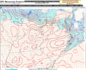
101.5 now, I stand by my sandy land and drought contributes to these readingsMight as well round that up and call it 100.
With the RDU sensor shenanigans, I’m more impressed by triple digits elsewhere. Seems more legit.
Not sure if you'll reap the benefits or not, but you called it. Watch issued and radar starting to get interesting.Satellite is starting to get good. Should see the radar start popping soon, it might be about to go down.
Just saw the MD from WPC. Giddy up

