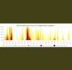
Yeah it’s easy to have very low RH/decent-strong winds with cold NW flow in the winterHere are some wildfire stats, number of fires has been up and down , though acres burned were at their greatest in the 40s and 50s with virtually every year burning anywhere from 250-700k acres. 2016 only burned 77k acres. 2021 is not bad at all, in fact very low at under 10k acres. The 80s also look bad with the greatest number of fires, though not as many acres burned as the 40s. still, multiple years well over 100 and 150k acres burned. Guess cold and dry is a great fire combo based on what happened in the 80s.
North Carolina Forest Service
ncforestservice.gov
View attachment 96419
View attachment 96420
Advances in fire suppression/containment, equipment, etc played a big factor in reduced acreage burnt even with large numbers of fires.Here are some wildfire stats, number of fires has been up and down , though acres burned were at their greatest in the 40s and 50s with virtually every year burning anywhere from 250-700k acres. 2016 only burned 77k acres. 2021 is not bad at all, in fact very low at under 10k acres. The 80s also look bad with the greatest number of fires, though not as many acres burned as the 40s. still, multiple years well over 100 and 150k acres burned. Guess cold and dry is a great fire combo based on what happened in the 80s.
North Carolina Forest Service
ncforestservice.gov
View attachment 96419
View attachment 96420
Upon further review, that possible "plume" is too far NW to be the same fire McDowell is reporting. More SE part of the county for the one he's on.From what I can tell from @Mcdowell_weather posts
The fire is back in this vicinity somewhere, based off the pics somewhere in that holler near Old Glenwood Rd and 226.Google Maps
Find local businesses, view maps and get driving directions in Google Maps.www.google.com
Can also see what may be a plume of smoke on vis sat in northern McDowell Co.
View attachment 96427
Doesn't appear to be bad, just ground leaves. Trees will probably be ok.
Its right behind the prison on Huntsville mtn is what us locals call it. Idk what official maps call it.From what I can tell from @Mcdowell_weather posts
The fire is back in this vicinity somewhere, based off the pics somewhere in that holler near Old Glenwood Rd and 226.Google Maps
Find local businesses, view maps and get driving directions in Google Maps.www.google.com
Can also see what may be a plume of smoke on vis sat in northern McDowell Co.
View attachment 96427
That works. I can find that on mapsIts right behind the prison on Huntsville mtn is what us locals call it. Idk what official maps call it.
I will look into that I haven't heard anything on the radio yet. Whats the time stamp on that sat pic?Upon further review, that possible "plume" is too far NW to be the same fire McDowell is reporting. More SE part of the county for the one he's on.
PILOT MTN FIRE
Doesn't appear to be bad, just ground leaves. Trees will probably be ok.
Couple hours ago. Has since sort of died down, so I'm a bit confused. Its barely a speck on the most recent frameI will look into that I haven't heard anything on the radio yet. Whats the time stamp on that sat pic?
PILOT MTN FIRE
Doesn't appear to be bad, just ground leaves. Trees will probably be ok.
Well I imagine some because they don't know that and some because at some point property may be threatened. Obviously far from that at this stage.That's actually really good for the forest. Not sure why everyone is so upset.
We established its great for the forest . Your missing the point that it was uncontrolled which jeopardizes people.That's actually really good for the forest. Not sure why everyone is so upset.