GeorgiaGirl
Member
That energy in south Texas is interesting. Is there some way to get it out with this?
Well the PV suppressing it ain't helping here hopefully modeled to strongThat energy in south Texas is interesting. Is there some way to get it out with this?
This isn't necessarily true, the biggest snowstorm east of the Apps in NC since at least the mid 19th century in March 1927 dive bombed into NC from the NW perpendicular to the mountains and a surface low rapidly developed offshore producing exceptionally heavy snow. Granted there was apparently another southern stream s/w that provided extra low-mid level moisture transport as it entered the contiguous US from extreme southern Californiaif you're on the Leeside of the Applachians, don't expect snow from this. We don't get snow in NW flow events so it's certainly not happening with this thing. Unless returns make it over the mountain tops and reform on the on the backside, which can't even be accurately forecasted ahead of time, it ain't happening
I've seen stuff make it over the mountains but it's extremely rare and even more unpredictable. We have about the same odds of scoring from a NW flow event. Odds aren't 0% but they're damn close. Now, if we can tap the gulf that's a different story but I don't see anything suggesting that. Trends maybe better but we are getting so close to the event it would take a modern miracle to see that happenBut you said in your first and second sentences no snow. Then in your third you said it might happen. Which is it? I'm confused
Sent from my SM-G955U using Tapatalk
There's no feature in this event that would suggest getting precip to stream in on the Leeside. I mean you have 5,000 ft+ mountain peaks blocking the precip being pushed in along the front and they're also delaying the arrival of cold air. Areas in ENC will not suffer the same fate as those further west. There is a feature supplying moisture from the Atlantic but those further west will not benefit from that. We're solely relying on the precip associated with the front being pushed throughThis isn't necessarily true, the biggest snowstorm east of the Apps in NC since at least the mid 19th century in March 1927 dive bombed into NC from the NW perpendicular to the mountains and a surface low rapidly developed offshore producing exceptionally heavy snow. Granted there was apparently another southern stream s/w that provided extra low-mid level moisture transport as it entered the contiguous US from extreme southern California
yep. Congrats to Memphis yet againAnd a bowling ball behind that... We getting spoiled here LoL
There's no feature in this event that would suggest getting precip to stream in on the Leeside. I mean you have 5,000 ft+ mountain peaks blocking the precip being pushed in along the front and they're also delaying the arrival of cold air. Areas in ENC will not suffer the same fate as those further west. There is a feature supplying moisture from the Atlantic but those further west will not benefit from that. We're solely relying on the precip associated with the front being pushed through. Edit: Webber you're absolutely right. When the wave comes over perpendicular to the mountains THATS when these Leeside troughs set up and people can get a suprise snow
No, there's an appreciable amount of mid level west-southwest to southwesterly flow that's advecting moisture into the central and eastern portions of the Carolinas from the Gulf of Mexico in advance of this positively tilted trough axis.There's no feature in this event that would suggest getting precip to stream in on the Leeside. I mean you have 5,000 ft+ mountain peaks blocking the precip being pushed in along the front and they're also delaying the arrival of cold air. Areas in ENC will not suffer the same fate as those further west. There is a feature supplying moisture from the Atlantic but those further west will not benefit from that. We're solely relying on the precip associated with the front being pushed through
The more this trough axis digs to the south and west the more this becomes an overrunning event for portions of the SE US although the overall setup is more favorable the closer to the Atlantic coast you go in th SE USNo, there's an appreciable amount of mid level west-southwest to southwesterly flow that's advecting moisture into the central and eastern portions of the Carolinas from the Gulf of Mexico in advance of this positively tilted trough axis.

No, there's an appreciable amount of mid level west-southwest to southwesterly flow that's advecting moisture into the central and eastern portions of the Carolinas from the Gulf of Mexico in advance of this positively tilted trough axis.
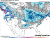
You're also looking at the GFS lol. Yeah this model performs so well in events like this...notView attachment 2826
Looks dry to me
.png")
Sorry about the Nam jet pic (18z run) here is the 0z run
View attachment 2829
To me it's better. I think with that look there should be more precipitationIs that better or worse?
While this pattern is northern stream dominant it's very encouraging to see such strong and moist southwesterly-WSW flow in the mid-levels, which is something we've been lacking since the early Dec stormTo me it's better. I think with that look there should be more precipitation


Like webb said, gfs doesn't do good in events like these. NAM/EURO/UK/CMC/ICON Lol, much better with precip. Lets hopes thats the trend.To me it's better. I think with that look there should be more precipitation
I just saw that as well trended a poopload better0z CMC looked little better as well
Yeah that's a ridiculous right entrance region to the upper level jet the lift to the SE of there will be impressiveOk GFS with your dry output

Unless Pivotal is fooling me with virga, this system wants to toss the SC lowcountry a bone with light snow on the CMC.
Edit: Dewpoints look fine, too.
TT had it too with some precip on the coastal plain of SC
00z cmc


I agree! I would honestly be a little surprised if the doc didn't trend better in a bitI think there would be in subsequent frames. Where have we seen a strong jet streak like that before haha?