Jon
Member
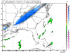
Nam is a hair east with trough location at 51 hours, probably not a big deal but it looks like the southwest trend with the trough has stopped
Sent from my iPhone using Tapatalk
Sent from my iPhone using Tapatalk
Likewise here3 inches for my backyard by 6PM
it is WSW criteria for the ratios NWS will use..at least 15:1Getting close to winter storm warning criteria for north Alabama and Mississippi. With just using 10:1 ratio.
I want to see the clown map
Drying up a bit as it get closer to GA hr54
It's odd though, it seems like the better it looks entering Alabama, the worse it looks exiting Alabama
If we have the double jet structure with a bit of a gulf tap again it doesn't really make sense for that. I'm being lazy but it looks like the bloom in the east will occur again.

Trends are good . Much better vs yesterday's


Which tells me we should still being seeing more qpf
Spoke too soon about a dual jet ...
they really should, though I bet they wait until early tomorrow to see moreWonder if huntsville will pull the trigger and issue winter storm watch.

Yeah, shouldn't that make much more moisture on NAM? Looked fairly anemic?Very encouraging to see persistent 40-50+ KT 700 hPa southwesterlies right off the Gulf of Mexico w/o a whole lot of convection near the Gulf coast to block moisture transport into the Carolinas, GA, & VA...
View attachment 2874