Lee County AL
Member
Hey guys.... where is the front located ?
Wow thats crazy with temps near 50.
Temp is 39 in Sylacauga.Wow thats crazy with temps near 50.
47 in Alex City. How far are you from there ?Temp on my truck last check was 37.
Thanks. I typed in Sylacauga on weather.gov and the station from Alex City came up and showed 47. Obviously there is a sharp contrast in temps.Temp is 39 in Sylacauga.
Thanks. I typed in Sylacauga on weather.gov and the station from Alex City came up and showed 47. Obviously there is a sharp contrast in temps.
Looks like about 1/4 to 1/5th of an inch. I'm being generous. Seems like Madison will be dry-slotted the rest of the day. You mught see an additional 1/10th - 1/20th of an inch if you get EXTREMELY lucky. Madison may end up having the lowest snow total of anywhere in the state.My measuring stick

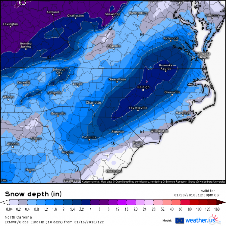
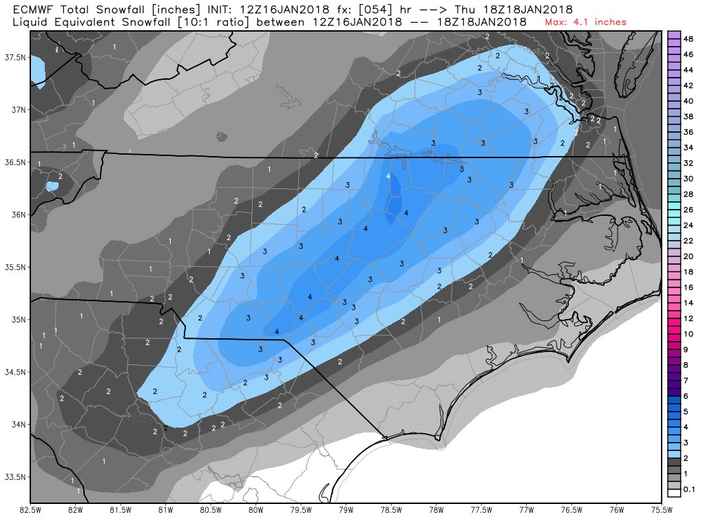
Major Increase for Columbia SC!!12z Euro: