day 3
 reposted here since I saw the other thread ends today, lol
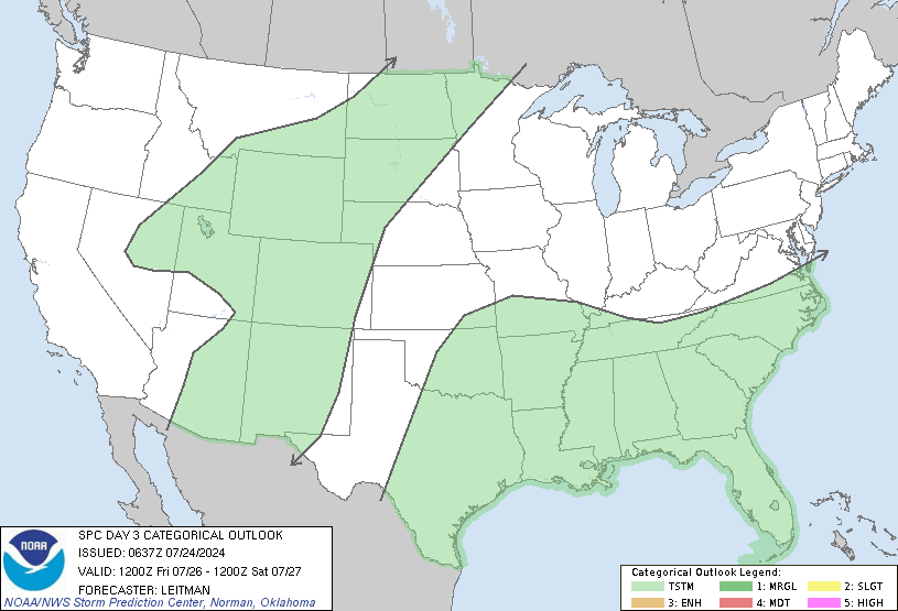
It usually is! This just looks like a sloppy set up, lots of slop showers and clouds to not allow a lot of destabilization, either day, IMOGeez I hope the NAM 3km is wrong, sounding on Sunday would support very large/damaging hail, large CAPE, especially at the the HGZ, pretty cold 500mb temps/steep 700-500 mb lapse rates, moderate amounts of 0-6km bulk shear, I mean the SHIPs speaks for itself !!View attachment 19500
day 3
Geez I hope the NAM 3km is wrong, sounding on Sunday would support very large/damaging hail, large CAPE, especially at the the HGZ, pretty cold 500mb temps/steep 700-500 mb lapse rates, moderate amounts of 0-6km bulk shear, I mean the SHIPs speaks for itself View attachment 19501reposted here since I saw the other thread ends today, lol
It usually is! This just looks like a sloppy set up, lots of slop showers and clouds to not allow a lot of destabilization, either day, IMO
I bet it'll just be mainly rain here this weekend...again.
")
I'll bite my tongue ... LOL ... In all seriousness, no prob keeping up Wiki, just sometimes it seems that threads get started for far less than significant events ... but Wiki will stay current ...Hope it was ok to do so but I changed the title to include Sunday as well and moved the post from the May thread back over here. I know 5 days is a long time for a thread but severe weather threads in the south are far more different then winter threads. Besides I figured @pcbjr would appreciate the fact that another thread isn't started for the Sunday threat.


The backdoor front needs to be watched this weekend for some spin ups as well. Any west to east moving storm that can ride along that boundary will have a tendency to rotateNam 3km still hinging on a large hail threat in parts of NC/SC sunday, plume of steep mid level lapse rates with some surface heating + large low level moisture is the reason for large cape based off the Nam, even if cloud cover was to never break up, 1000-2000 jkg of SBcape would still be likely, the thing tho is that this sounding is saturated View attachment 19509

The backdoor front needs to be watched this weekend for some spin ups as well. Any west to east moving storm that can ride along that boundary will have a tendency to rotate
Sent from my SM-G955U using Tapatalk
It’s supposed to stay hung up in VA.
Sent from my iPhone using Tapatalk


A couple solutions get it into the area and needs to be watched for eastern NC. This is from morehead city overnight disco.
11/00Z NAM/GEM_regional has
backdoor cold front dipping into the nrn tier of counties and
Albemarle sound by Sunday evening, and if this happens, we may
see a tornado risk develop with decent helicity vals in place in
vcnty of the stalled front. The EMCWF/GFS keeps the front to
the north of the VA/NC border.

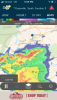
Likely a beastly shelf cloud with this View attachment 19522[/QUOTE
]

Tornado warned storm is headed right for where I’m at in kannapolis, looks like there may be a TVS
View attachment 19526
Looks pretty solid. Wouldnt be surprised if it produces
Tornado warned storm is headed right for where I’m at in kannapolis, looks like there may be a TVS
View attachment 19526

Hearing any damage reports?
Rotation broadening out east of Ansonville. Tornado doesn’t look imminent
Continues...Total whiff fest
View attachment 19527
Pretty impressive cell that's been moving across the state.