• Hello, please take a minute to check out our awesome content, contributed by the wonderful members of our community. We hope you'll add your own thoughts and opinions by making a free account!

Pattern May 2026

Thank you!
I just told them that. They responded by saying that yesterday downtown got flooded but they got none. They were originally hoping they’d get enough rain this weekend to be able to leave it and take a trip but are now afraid it might ruin the seed if they don't get enough rain and aren’t there to water.

But:
1) I thought ATL area was forecasted to only get scattered storms yesterday (50% pops), which did verify. So them getting none yesterday wasn’t a surprise.

2) Am I correct in saying that the next few days are forecasted to be quite wet everywhere in metro ATL as opposed to just scattered showers?

3) If so, the lack of rain at their place yesterday isn’t a reason to worry about getting missed the next few days. Thus they should not water and could even travel without worry if they want. Is this correct?
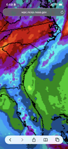
Yeah, I missed all of the storms yesterday, too.

That said, the lowest rain chances per FFC for metro Atlanta on any given day for the next week is 50%. Several days, including Monday, are 90%. That's quite bullish and tells me that widespread rains will fall with certainty over at least several days over the next week. And, the chances of heavy rain in T-storms are also quite high.

Unsurprisingly, there is significant model support as well.
1779387936851.png
 
Meso discussion with an interesting snippet

“Increasing storm coverage may result in a southward-acceleration of the cold front across southern VA/northern NC through late afternoon, which could result in a broader area of strong but generally subsevere gusts and localized wind-damage potential.”

Anyone seen that before ?


Sent from my iPhone using Tapatalk
 
today was never going to be much; tomorrow evening throughout the weekend

True. WPC doesn't seem to have budged on totals for us along the coast yet. Really hoping the Euro solutions are more along the lines of what we get. Otherwise we're looking at 2 straight months of less than a 1/2" of rain total. Whatever rain we get should finally push us past 5" year to date.
 

Attachments

  • IMG_0297.png
    IMG_0297.png
    3.3 MB · Views: 10
Day 1 of this so called wet pattern is a bust in SC.

Here's a street in Jonesville. Pan around and you'll see nothing but green trees. No sand dunes.

Here's your forecast:

  • Tonight
    Tonight: Showers and thunderstorms before 11pm, then showers likely and possibly a thunderstorm between 11pm and 2am, then a chance of showers and thunderstorms after 2am.  Low around 64. Calm wind.  Chance of precipitation is 80%. New rainfall amounts of less than a tenth of an inch, except higher amounts possible in thunderstorms.

    Low: 64 °F
    Showers
  • Friday
    Friday: Showers and thunderstorms likely, then showers and possibly a thunderstorm after 4pm.  Patchy fog before 1pm. High near 77. Light northeast wind.  Chance of precipitation is 80%. New rainfall amounts between a tenth and quarter of an inch, except higher amounts possible in thunderstorms.

    High: 77 °F
    Showers and
    Patchy Fog
  • Friday Night
    Friday Night: Showers and thunderstorms, mainly before 1am, then showers likely and possibly a thunderstorm after 2am.  Patchy fog. Low around 63. Calm wind.  Chance of precipitation is 100%. New rainfall amounts between a half and three quarters of an inch possible.

    Low: 63 °F
    Showers and
    Patchy Fog
  • Saturday
    Saturday: Showers and possibly a thunderstorm.  Patchy fog before 9am. High near 76. Light south wind.  Chance of precipitation is 90%. New rainfall amounts between a half and three quarters of an inch possible.

    High: 76 °F
    Showers and
    Patchy Fog
  • Saturday Night
    Saturday Night: Showers and possibly a thunderstorm before 5am, then showers likely.  Low around 63. Calm wind.  Chance of precipitation is 90%.

    Low: 63 °F
    Showers
  • Sunday
    Sunday: Showers likely before 11am, then a chance of showers and thunderstorms between 11am and 2pm, then showers likely and possibly a thunderstorm after 2pm.  Mostly cloudy, with a high near 82. Chance of precipitation is 70%.

    High: 82 °F
    Showers
    Likely
  • Sunday Night
    Sunday Night: Showers and possibly a thunderstorm before 2am, then a chance of showers.  Low around 64. Chance of precipitation is 80%.

    Low: 64 °F
    Showers
  • Memorial Day
    Memorial Day: A chance of showers, then showers and possibly a thunderstorm after 2pm.  High near 82. Chance of precipitation is 90%.

    High: 82 °F
    Chance
    Showers then
    Showers
  • Monday Night
    Monday Night: Showers and possibly a thunderstorm before 2am, then showers likely.  Low around 64. Chance of precipitation is 80%.

    Low: 64 °F
    Showers

  • As always... you'll be just fine

  • 👍
Yea but you know the drill. An 80% chance tonight means a 20% chance of nothing! ;)
 
I hate that we will get CAD. This will leave many, if not all of us with MUCH less rain than is forecast. Some of us will be lucky to get .25 total over the next 7 days. It's another story for Tenn, AL, and GA. They will rack up on rainfall.

the wedge boundary enhances precipitation. someone's going to get lucky right along it, somewhere
 
I'm not sold on the upcoming "wet" pattern for my local area. I've missed every opportunity this week, and short range models have a conspicuous precipitation hole over my county today. The Euro also depicts the lowest total preprecipitation totals over me. I fear a big drought forming here.
 
I'm not sold on the upcoming "wet" pattern for my local area. I've missed every opportunity this week, and short range models have a conspicuous precipitation hole over my county today. The Euro also depicts the lowest total preprecipitation totals over me. I fear a big drought forming here.
The rain chances should have been 20-40%, not 60-100% like they have been. It has been very isolated.

1779455307450.png

Very sharp cutoff, east of that it has been a few select spots.
 
While we're flooding DFW has seen almost no rain at all. Crazy

The real rain has definitely been isolated even here so far
 
This week we have gone from setting record high temperatures during the earlier part of the week at KRDU to setting what will probably be a record high minimum temperature today with the passage of the cold front. As of 4:00 PM the temperature is 65 degrees and the record minimum high for this date was 72 degrees. Tomorrow's record minimum high temperature record looks like it might be in jeopardy too.
 
Back
Top