• Hello, please take a minute to check out our awesome content, contributed by the wonderful members of our community. We hope you'll add your own thoughts and opinions by making a free account!

Tropical Major Hurricane Maria

A run that shows Jose still being strong well past realistic is the "most realistic"? Ummmmm. What? :confused:
Compared to the GFS and Euro, it is to a degree. However, the big problem is the CMC allows Lee to persist later on, pulling Jose away. If Lee dies and doesn't return, then the CMC is clearly wrong on the Jose going due east aspect. If right, we very well will be on a different path for everything.
gem_mslp_wind_atl_12.png
gfs_mslp_wind_atl_12.png

ecmwf_mslpa_atl_4.png
 
Something to note is how Maria has yet to make a sharper NW turn. Each come has shifted ever so further south than the last one up to the Antilles, but has remained the same for around PR. I wonder if this will impact the overall track.
114940_current_wind_sm.png
 
Well, she's definitely strengthening. Cat 4 FL winds now.

143900 1450N 05952W 6973 03016 9901 +099 +093 139085 087 072 005 00
143930 1449N 05953W 6965 03008 9867 +105 +087 140093 095 074 003 00
144000 1447N 05954W 6961 02982 9828 +112 +080 139101 104 079 008 03
144030 1446N 05955W 6974 02933 9794 +114 +106 140101 105 085 043 00
144100 1445N 05956W 6966 02897 9764 +114 //// 137112 115 092 070 01
144130 1444N 05957W 6936 02902 9704 +128 +128 136085 113 104 041 00
144200 1443N 05959W 6971 02820 9643 +131 +127 131048 073 111 025 03
144230 1442N 06000W 6967 02813 9620 +140 +102 114022 036 049 003 03
144300 1440N 06001W 6967 02804 9603 +147 +093 093017 018 034 001 00
144330 1438N 06001W 6973 02787 9580 +160 +105 034005 017 031 001 00
144400 1437N 06002W 6970 02807 9592 +162 +114 283032 038 043 002 03
144430 1435N 06003W 6965 02841 9635 +147 +125 277063 074 078 003 00
144500 1434N 06003W 6965 02879 9686 +137 +119 278084 089 086 005 00
 
Extrapolated MSLP is ~ 950-955 hPa this pass given the 35 knot winds accompanying the 958 hPa estimated SLP. That's a very big drop since the last pass a few hours ago
recon_AF305-0215A-MARIA_zoom.png
 
Extrapolated MSLP is ~ 950-955 hPa this pass given the 35 knot winds accompanying the 958 hPa estimated SLP. That's a very big drop since the last pass a few hours ago
View attachment 1298

As usual, the dropsonde measurements were several mb higher ~ 958-959 hPa but the pressure fell almost 10mb since the last pass of 966 hPa. Nuts
 
This is reflected in the intensity forecast, which now calls for
Maria to become a category 4 hurricane in 12 h and reach a possibly
conservative peak intensity of 130 kt
in about 36 h.
 
As usual, the dropsonde measurements were several mb higher ~ 958-959 hPa but the pressure fell almost 10mb since the last pass of 966 hPa. Nuts
It was higher likely because of the surface winds being so strong at the surface. If the satellite is true about the eye being tiny, then it would be hard to get dead center or near it like Irma had.
recon_AF305-0215A-MARIA_dropsonde8_20170918-1443.png
 
It was higher likely because of the surface winds being so strong at the surface. If the satellite is true about the eye being tiny, then it would be hard to get dead center or near it like Irma had.
recon_AF305-0215A-MARIA_dropsonde8_20170918-1443.png

Yeah very true, we'll have to wait for an eyewall replacement cycle or two and/or interaction with the Greater Antilles before we can get a bigger eye & windfield....
 
Yeah very true, we'll have to wait for an eyewall replacement cycle or two and/or interaction with the Greater Antilles before we can get a bigger eye & windfield....
Let's hope this thing does more traditional ERC's as opposed to Irma's whacked out interpretation of them.
 
While its intensity forecasts are often horrendous and way overdone to the lack of ocean coupling, the HMON's short term forecast for Maria valid at 12z this morning was right on the money & significantly better than the HWRF, granted its forecasts last night were calling for Maria to already be in the 940s so take it w/ a massive grain of salt.

hmon_mslp_wind_15L_3.png
 
While its intensity forecasts are often horrendous and way overdone to the lack of ocean coupling, the HMON's short term forecast for Maria valid at 12z this morning was right on the money & significantly better than the HWRF, granted its forecasts last night were calling for Maria to already be in the 940s so take it w/ a massive grain of salt.

View attachment 1299
Something I learned with the HMON from Harvey and Irma is that it does great with winds, but horrible with pressure. It showing a cat 5 on its runs is a sign to me that it is going to get very strong. If we see those ridiculous 200 knot upper level winds in a run, a cat 5 is likely in my opinion. I believe Irma's max upper winds were around 190 to 197 knots, and the HMON peaked at 225 knots a run or two for 850 mb.
 
Something I learned with the HMON from Harvey and Irma is that it does great with winds, but horrible with pressure. It showing a cat 5 on its runs is a sign to me that it is going to get very strong. If we see those ridiculous 200 knot upper level winds in a run, a cat 5 is likely in my opinion. I believe Irma's max upper winds were around 190 to 197 knots, and the HMON peaked at 225 knots a run or two for 850 mb.

Yeah hurricane hunters confirmed flight level winds of 200 knots, the strongest they've ever measured for any tropical cyclone at flight level since they started doing missions into hurricanes after World War II. Mind boggling...
 
Let's hope this thing does more traditional ERC's as opposed to Irma's whacked out interpretation of them.
Everything about Irma seemed nontraditional, come to think of it this whole hurricane season is a little nontraditional....
 
Dominica looks to get it straight on. Hopefully can get an ERC going in the next 12 hours may limit some of the stronger winds making it to the surface. You can get some good real time updates from the islands here...
http://stormcarib.com/
So just went to this site, clicked on Dominica and read some comments.... wow what a dire situation, gonna be tragic I'm afraid
 
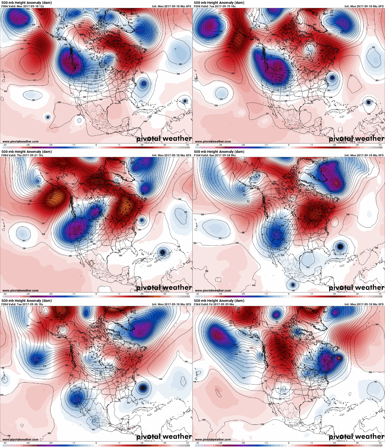
Maria is a bit further west and Jose a bit further NE at hour 96 of the 12Z GFS vs the 102 of the 6Z GFS. So, I'm guessing Maria will at least be closer to the east coast of the US than it was on the 6Z run.
 
GFS continues to look unrealistic with Jose's intensity, why am I even bothering lol

But yeah it is west
 
Back
Top