• Hello, please take a minute to check out our awesome content, contributed by the wonderful members of our community. We hope you'll add your own thoughts and opinions by making a free account!

Tropical Major Hurricane Isaias

All good here just south of Birmingham. Never lost power and no damage around us. We have a ton of trees, so normally doesn’t take much here. Will be headed to Tuscaloosa later on for the big game. Hope everyone else faired well
 
326k power outages in Alabama alone. Wow. That's pretty up there for them and I didn't even think it was as crazy as it could have been from the reports I saw. Highest in BMX CWA officially was only 58

I did for a bit yesterday wonder if it was gonna be Opal
 
I’m somewhere around 1.6” or so and never got more than a little gusty. We are sheltered by a ridge which helped. Much needed rain.
 
I’m somewhere around 1.6” or so and never got more than a little gusty. We are sheltered by a ridge which helped. Much needed rain.
we record a whopping 8.5 mph gust at some point this am. Its amazing the wind difference between Winder and Buford.
 
Nice rain event overnight and into morning that kept me asleep or wanting to sleep for a while. Has gone to scattered rain showers for now, but a couple short range models are still suggesting a possible severe weather outbreak.

Not sure there was really meaningful gusts, but I haven't checked the official station (but the forecast was only suggesting up to 30 MPH).

And yeah, the HAFS tried to trend towards the core remaining intact into landfall, but in the end, comparing to some of their model suggestions, it's clear it was transitioning before landfall.
 
Just over 2" of rain since about 1 am last night here in Huntsville. Just a steady very beneficial rain here. Winds have picked up this morning, but my sensor is located in a spot that is relatively sheltered from winds from the NE, so I don't have any good data for that.
 
we record a whopping 8.5 mph gust at some point this am. Its amazing the wind difference between Winder and Buford.
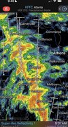
IDK the wax gusts here overnight, but given the number of small branches on the ground, 25-30 seems quite reasonable. I suspect winds will be gustier later this morning and in the afternoon as daytime heating increases instability. And wind is always muted here in my little micro valley.
 
Due to the pressure gradient between Isaias’ remnants and the wedge, along with sig. ongoing rain, together with a secondary astronomical tidal max due to the new moon, the NE winds were long and strong enough to produce moderate coastal flooding in CHS and minor S of there to Ft. Pulaski.

0842 AM COASTAL FLOOD 1 E CHARLESTON 32.78N 79.93W
10/10/2026 CHARLESTON SC OTHER FEDERAL

A MAXIMUM TIDE LEVEL OF 7.76 FT MLLW (2.00 FT MHHW) WAS
OBSERVED AT THE CHARLESTON HARBOR TIDE GAGE. MODERATE
COASTAL FLOODING TYPICALLY BEGINS ALONG THE COASTS OF
CHARLESTON AND COLLETON COUNTIES WHEN TIDE LEVELS REACH
7.5 FT MLLW (1.74 FT MHHW) IN THE CHARLESTON HARBOR.
 
I thought being on the east side of the storm it would be bad here, but we got a lot less rain than predicted and the wind wasn’t bad at all. And now the sun is out !
 
Really despite the pretty good gusts, very little in the way of tree damage from my place through Sylacauga. Saw one powerline down but the cause was a six inch diameter pine tree, so not a behemoth.
 
In my area overnight, we got some beneficial rainfall from rapidly N moving scattered convection. Per Cocorahs, there was ~0.75” in the area. I’ll check my gauge later. Winds were brisk but not too high (20s).
 
Back
Top