-
Hello, please take a minute to check out our awesome content, contributed by the wonderful members of our community. We hope you'll add your own thoughts and opinions by making a free account!
You are using an out of date browser. It may not display this or other websites correctly.
You should upgrade or use an alternative browser.
You should upgrade or use an alternative browser.
Tropical Major Hurricane Florence
- Thread starter ForsythSnow
- Start date

NCSNOW
Member
- Joined
- Dec 2, 2016
- Messages
- 9,545
- Reaction score
- 18,993
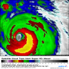
That is one impressive looking sim radar snapshot.Massive
Sent from my SM-G920V using Tapatalk

maineweatherman
Member
Had a few minutes there where the convective appearance seemed for the first time so far to be A+. But thankfully, we're back down to a degraded and lopsided storm. -70C tops are to the SE, with the -60 ring barely hanging on in the NW quad. Perhaps an artifact of Florence moving too fast, a la Gordon in the GOM? Watching closely (1min GOES-16 link in case you don't already have one or are looking for a new one: https://weather.us/satellite/692-w-301-n/top-alert-superhd-1min.html#play2)
Attachments
cyclogent
Member
Im seeing that as well. Lot of warming last 60-90 minutes north and northwest portions of the COD. Seems to be some dry air going by the upper and mid level water vapor viewsHad a few minutes there where the convective appearance seemed for the first time so far to be A+. But thankfully, we're back down to a degraded and lopsided storm. -70C tops are to the SE, with the -60 ring barely hanging on in the NW quad. Perhaps an artifact of Florence moving too fast, a la Gordon in the GOM? Watching closely (1min GOES-16 link in case you don't already have one or are looking for a new one: https://weather.us/satellite/692-w-301-n/top-alert-superhd-1min.html#play2)
Storm5
Member
Look at this S$$$ . Image From Allan

Sent from my iPhone using Tapatalk

Sent from my iPhone using Tapatalk
Definitely becoming better organized and symmetric.
Don’t worry. In about 10 minutes it will start to look foolish again!Definitely becoming better organized and symmetric.
snowlover91
Member
Had a few minutes there where the convective appearance seemed for the first time so far to be A+. But thankfully, we're back down to a degraded and lopsided storm. -70C tops are to the SE, with the -60 ring barely hanging on in the NW quad. Perhaps an artifact of Florence moving too fast, a la Gordon in the GOM? Watching closely (1min GOES-16 link in case you don't already have one or are looking for a new one: https://weather.us/satellite/692-w-301-n/top-alert-superhd-1min.html#play2)
Something worth noting is as Florence slows down and traverses the Gulf Stream it's likely everything will become more symmetrical and we could see some strengthening prior to landfall assuming no EWRC starts.
WeatherAddiction
Member
I think the GFS has the more likely scenario right now and with it forecasting the the stall earlier I think I might be leaning towards it and the FV3 now.
Will be interesting to see just how far north it gets today and tonight, noticed this tidbit from the Rah AFD....
06Z/special release upr air data over the sern US this morning indicates a developing mid-upr level ridge there is already 10-20 meters stronger than even 00Z, 6hr model forecasts.
Sent from my SM-G920V using Tapatalk
06Z/special release upr air data over the sern US this morning indicates a developing mid-upr level ridge there is already 10-20 meters stronger than even 00Z, 6hr model forecasts.
Sent from my SM-G920V using Tapatalk
Y’all, I am still having trouble believing that this thing will perfectly track the SE coastline SW from Wilmington to Charleston and come ashore near the GA/SC line and move WSW int GA. I’m sorry but that’s absurd. I think it may yet go through upper SC.
Everest
Member
Y’all, I am still having trouble believing that this thing will perfectly track the SE coastline SW from Wilmington to Charleston and come ashore near the GA/SC line and move WSW int GA. I’m sorry but that’s absurd. I think it may yet go through upper SC.
I've never seen anything like this; stalling and moving perfectly along the coast.
I agree with you in fact I'm inclined to think this actually starts turning West sooner instead of getting as far north stalling and heading back Southwest. Especially considering the ridge is coming in stronger and I think arcc mention this yesterday
Sent from my SM-G920V using Tapatalk
Y’all, I am still having trouble believing that this thing will perfectly track the SE coastline SW from Wilmington to Charleston and come ashore near the GA/SC line and move WSW int GA. I’m sorry but that’s absurd. I think it may yet go through upper SC.
Sent from my SM-G920V using Tapatalk
packfan98
Moderator
This tweet should give us pause. It may come back north a bit.
Kylo
Member
The coastal flooding. Shaping up to be similar to Matthew. More wind for the I would think.
Though Raleigh will have much less rain with Flo. Don’t have the aid of upper level trough that we had with Matthew.

Though Raleigh will have much less rain with Flo. Don’t have the aid of upper level trough that we had with Matthew.
BHS1975
Member
Will be interesting to see just how far north it gets today and tonight, noticed this tidbit from the Rah AFD....
06Z/special release upr air data over the sern US this morning indicates a developing mid-upr level ridge there is already 10-20 meters stronger than even 00Z, 6hr model forecasts.
Sent from my SM-G920V using Tapatalk
Seems to be the theme these days. Would this bend the track west sooner or just stall her sooner?
Sent from my iPhone using Tapatalk
packfan98
Moderator
Don't we often see strong ridging highs back off a bit in the last 48 hours? Seems like that's always the case with our NW trend with winter systems. I know that this is a different setup and invest 95L has really been pumping the high, but I wouldn't be surprised to see the ridge lift or weaken a bit over the next few runs.
That's a great question I would think it would there would be some stalling before it turn left but I'm really not the one to answer that hahaSeems to be the theme these days. Would this bend the track west sooner or just stall her sooner?
Sent from my iPhone using Tapatalk
Sent from my SM-G920V using Tapatalk
snowlover91
Member
Don't we often see strong ridging highs back off a bit in the last 48 hours? Seems like that's always the case with our NW trend with winter systems. I know that this is a different setup and invest 95L has really been pumping the high, but I wouldn't be surprised to see the ridge lift or weaken a bit over the next few runs.
Something of note I've been tracking since yesterday is the EPS and Euro have been consistently verifying too far SW even 12 hours out from a forecast cycle and the UK ensembles haven't even been close. The 6z GFS and NAM did come in a touch north, the 12z runs will be key to watch and see if we get any additional shifts like that. One thing I'm watching closely is the RGEM. It's not a tropical model but it did exceptionally well a few weeks ago with that tropical storm in the gulf and the further east track that it ended up taking.
