• Hello, please take a minute to check out our awesome content, contributed by the wonderful members of our community. We hope you'll add your own thoughts and opinions by making a free account!

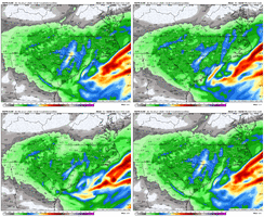
Wintry Machine Learning Mauler 1/30-2/1

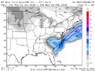
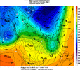
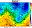
GEFS: How many times have seen that 50/50 out lift out only for heights to rise and our event shift NW....but this time we get the opposite. Unreal.

View attachment 191129
Wouldn’t surprise me to see it go the other way the next 36 hours. Not expecting it to happen but just like the 2018 system we started to get better tilt on short range guidance within 18 hours of starting. We need same movement this time
 
Something to note about the is that often times in the past it has really struggled with the extent of moisture inland directly associated with coastal lows… in both tropical systems and winter storms. If you look at the 1/3/2018 storm, the EURO never brought any precip inland from the coastal areas even as all short range models at the time were coming inland with the precip shield. I’m not saying that’s definitely happening here some of its dryer looks down east like we saw with the 6z run, but it is certainly something to watch

Euro fell on its backside last January for our coastal storm. The NAM was our winner.
 
I am not arguing that, there will be a dry slot. The sub 980 low is what I’m talking about, which is highly anomalous. If anyone with experience with New England nor’easters, how prominent is this dry slot?
Anomalous yes, and I'm no New Englander with experience and I'm sure it may have some surprises in store. But I'd think the stronger the system the stronger the subsidence between the coastal and the ULL. The big question is where will that be
 
Wouldn’t surprise me to see it go the other way the next 36 hours. Not expecting it to happen but just like the 2018 system we started to get better tilt on short range guidance within 18 hours of starting. We need same movement this time
It’s not…Raleigh snow is governed by murphys law. These aren’t real problems though…it’s just snow.
 
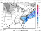
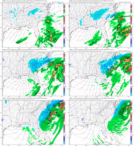
That light blue contour delineates .4 qpf…. With the next blue line at .6qpf. That’s a lot of liquid for the upstate back to charlotte and similar to the 06zeuro.
View attachment 191133
This is evolving what could be an historic SC event. ☃️.

Hopefully someone gets 10”+.
 
It’s not…Raleigh snow is governed by murphys law. These aren’t real problems though…it’s just snow.

I think Raleigh is probably fine. Somebody from Columbia to Aberdeen mind wind up in a dry slotted though. Depending on how the bands set up from the coastal low I wouldn’t be shocked to see another hole in the coastal plain between Myrtle beach and Kinston. .
 
First call
GSO= 6-10
Charlotte= 8-12
Raleigh= 6-8
Greenville/Spartanburg= 4-8
Columbia= 5-7
Wilmington= 5-8
Atlanta= 1-3

Someone here is going to get over a foot and maybe more but where that is I wouldn't hazard a guess yet
Wow your thoughts have changed since a couple days ago. Love it! These ULL'S typically have some tricks up their sleeves
 
I'm confident that more precip from the coastal low will be thrown back in NC than modeled, especially if the low gets cranking soon enough for us.


There probably will be a relative "dry slot" somewhere in between maximums in WNC/Upstate SC and wherever in Eastern NC benefits from the coastal the most but even the dry slot should get a warning criteria snow imo.
 
First call
GSO= 6-10
Charlotte= 8-12
Raleigh= 6-8
Greenville/Spartanburg= 4-8
Columbia= 5-7
Wilmington= 5-8
Atlanta= 1-3

Someone here is going to get over a foot and maybe more but where that is I wouldn't hazard a guess yet

No offense this is a compliment from you. You’re normally pretty conservative. Can’t remember the last time Charlotte Metro was the Ticket to have for anything much less snow. Well, unless you like getting robbed by the Bus station on fifth and trade I guess. Or being Car Jacked on N Tryon


Sent from my iPhone using Tapatalk
 
Last edited:
Usually you want to be just NW of the modeled heavy precip axis. Now how far this thing keeps pushing south is still debatable.

GSP to CLT to FAY looks prime.

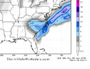
View attachment 191135
If there’s the typical NW tick as we near, that would put the I-85 corridor in the really respectable totals.
 
I think our best path to glory for the 40/85 corridor, really from Greensboro to Durham, is that finger of precip developing overnight Friday into early Saturday Morning. If you can do what the HRRR/RAP/12k NAM are showing and get 3-4" before the main event even starts then you are well on your way to a big event.
 
I think our best path to glory for the 40/85 corridor, really from Greensboro to Durham, is that finger of precip developing overnight Friday into early Saturday Morning. If you can do what the HRRR/RAP/12k NAM are showing and get 3-4" before the main event even starts then you are well on your way to a big event.
I’m not sure that southern Virginia doesn’t get that initial moisture. Easier to get over the mountains and I’ve seen several models with the initial stuff there.
 
I think our best path to glory for the 40/85 corridor, really from Greensboro to Durham, is that finger of precip developing overnight Friday into early Saturday Morning. If you can do what the HRRR/RAP/12k NAM are showing and get 3-4" before the main event even starts then you are well on your way to a big event.
i do not like the long range HRRR but it has a rather stronger band of precip at 26 hours compared to 6z run
 
I’m not sure that southern Virginia doesn’t get that initial moisture. Easier to get over the mountains and I’ve seen several models with the initial stuff there.
The evolution almost looks like that event we had last January where the precip just sagged in from VA and we had surprise snow.
 
One thing I can say with a certainty is the H5 pass we are seeing right now between hours 40-64 is not the final result. It’s going to change strength and tilt, maybe even significantly the next day or so. They always do and I expect this to be no different. Whether for the good or bad remains to be seen.
 
The question I have, though, is how much is dry slot and how much is convective feedback issues? All models often have this with deeply bombing lows. With weaker storms moving south to north, yes, a big dry slot. This is a sub 980 monster moving more west to east. Any opinions?

Nowadays, I don't know but I'm going to have to theorize in the past, several "surprise" storms have occurred as a result. The aforementioned Christmas Snowstorm of 1989 in the Coastal Carolinas was NOT well forecast until last minute and it also was on the heels of a massive Arctic outbreak. This is very, very similar feeling now as you've asked this question.

Also, the infamous Carolina Crusher Jan 2000 was another example. In fact, I believe Raleigh. NC WFO had a great writeup about the ETA failing to capture tjis and instant occlusion that occurred.
 
RGEM and OPs still don’t agree on the degree of tilt around 60 hours. Until that resolves we are going to bounce
Yup i mentioned that after the 06z euro run. More neutral heading to negative had huge implications on output esp for the upstate and Ne Ga. Wont be resolved till the 4th quarter either.
 
Back
Top