rburrel2
Member
Rgem has the event starting here Friday evening… 60hrs out.
Looks terrible.BAMWX Guidance that was released to clients this morning.
(Not official guidance)
View attachment 190472


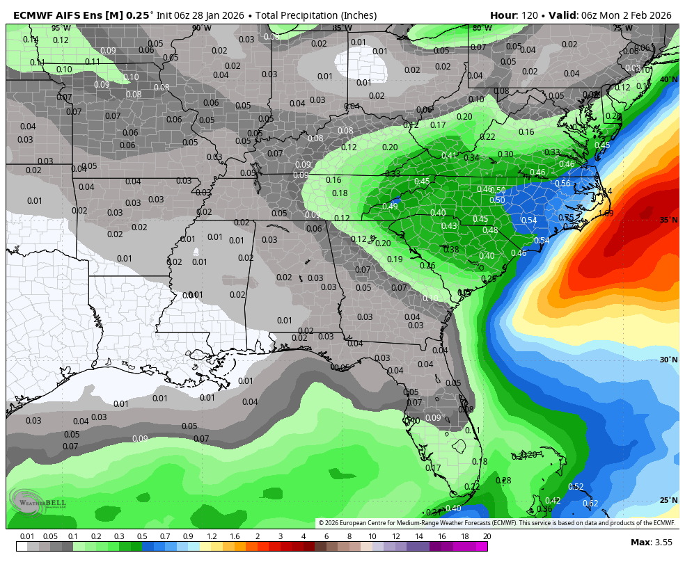
Also a clear trend away from quick coastal development the last 3 runs.GFS AI has been steady in one direction for the last 48 hours or so. No crazy ticks one way or the other. Just a gradual increase in moisture across the Carolinas. View attachment 190475


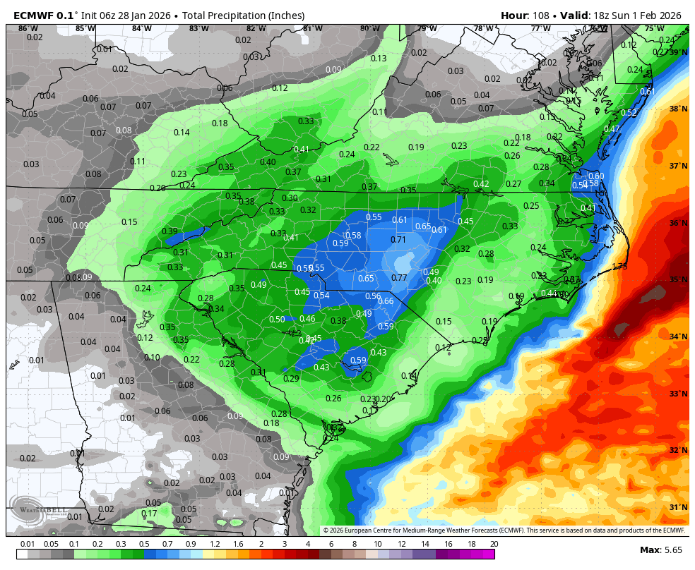
That’s a large area of .75” and I would imagine that would equate to around 10” of accumulation. Very Nice!
This should be what everyone is striving to see. We don't need a 970mb low right off the coast we just need to see increased moisture feeding back into the ULL.GFS AI has been steady in one direction for the last 48 hours or so. No crazy ticks one way or the other. Just a gradual increase in moisture across the Carolinas. View attachment 190475
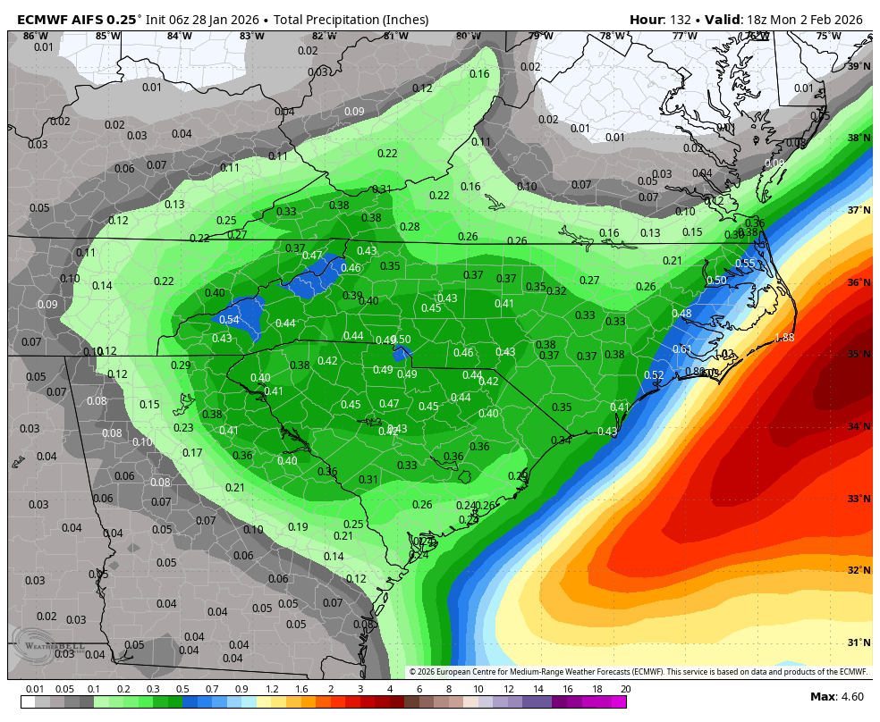


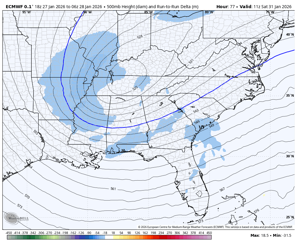
That is weird. You would have to lean towards the setup more than the precip map here. Keep this look and maybe the precip fills in more in subsequent runs or the shorter term hi-res modeling.
With a 987 low right off Hatteras I'd expect the GFS type of precip map.
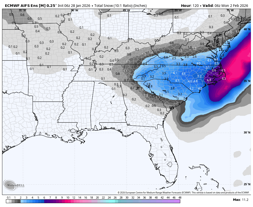
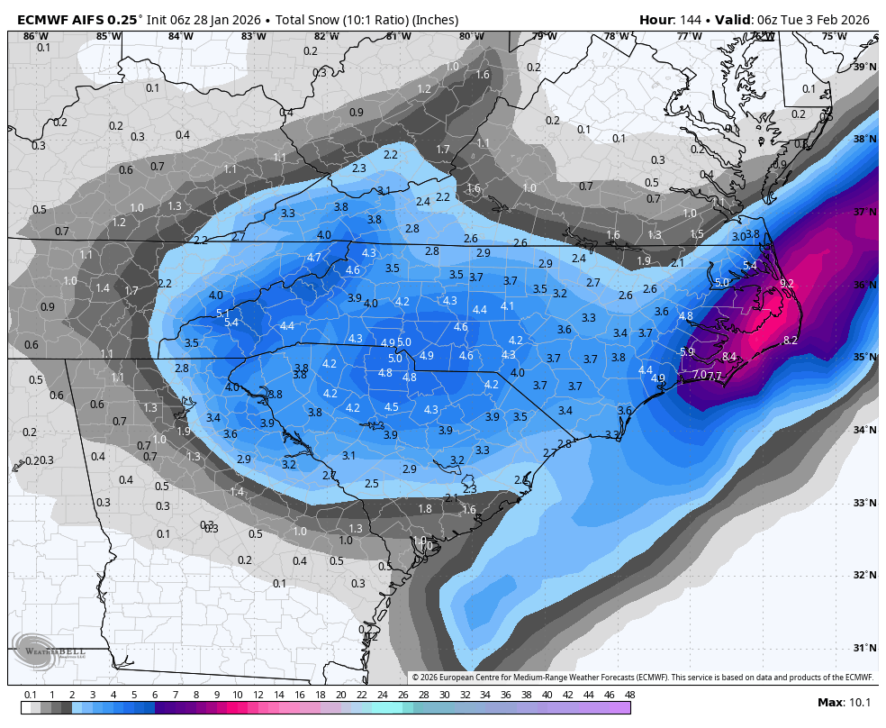
6z AIGS Ensemble