-
Hello, please take a minute to check out our awesome content, contributed by the wonderful members of our community. We hope you'll add your own thoughts and opinions by making a free account!
You are using an out of date browser. It may not display this or other websites correctly.
You should upgrade or use an alternative browser.
You should upgrade or use an alternative browser.
Wintry Machine Learning Mauler 1/30-2/1
- Thread starter SD
- Start date
CNCsnwfan1210
Member
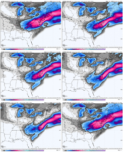
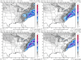
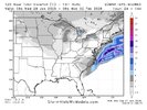
Snowfall extended further SW on the latest run
Sent from my iPhone using Tapatalk
Do you have the 2am google run?
Posted aboveDo you have the 2am google run?
Brandon10
Member
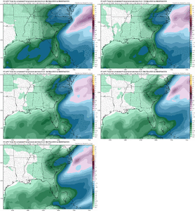
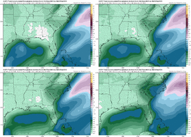
Seems we are seeing another AI( south and east) vs Tradional (NW) model war again and throw in the WeatherNext.
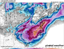
This map now holds the record for the highest snowfall totals I have seen in a model run. I don't believe Raleigh will get forty inches of snow this weekend but it was a sight to behold.View attachment 189868Still snowing at the outer banks
Those overnight model runs were incredible. I've never seen snowfall totals like this for the Carolinas. I know it's still too early to be running victory laps but the potential for something special is in the air.
packfan98
Moderator
I agree. Great disco overnight. The ULL energy and precip is still there on all of the modeling and looks to kickoff late night Friday. You would have to think it’s almost a given. The coastal low is more of a wild card with the boom potential. The midatlantic and Northeast crews can sweat out whether or not the low gets captured and crawls up the coast, but the die is being cast for the initial part of the storm for the Carolinas it seems.Those overnight model runs were incredible. I've never seen snowfall totals like this for the Carolinas. I know it's still too early to be running victory laps but the potential for something special is in the air.
JMA
Canadian
Ukmet
6Z GFS
Spire
Where like Major League Crush Jobs
Euro, AI's are nice hits as well as ensembles. Feeling real good this a.m. about the ole backyard. But I want us to go for it. Canadian Op style. Today will be very telling at 12z and 0Z tonight. Cause as the sun rises tomorrow morning we will be solidly under 72 hours before start time.
rburrel2
Member
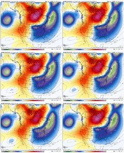
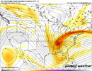
The trend on the euro ai and gfs ai has been for a further south and more tilted vort pass. They’ve also trended a little quicker. These trends seem to be helping the upper level precip but possibly hurting the coastal bomb/hugger chances. Possibly bc the trough has broadened a bit?
These changes are also putting them more in line with weathernext.
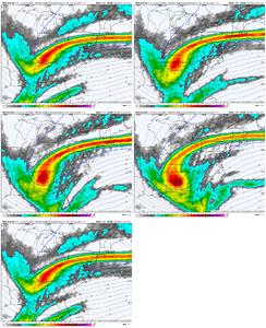
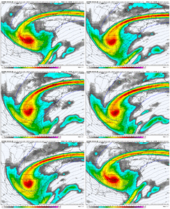
These changes are also putting them more in line with weathernext.


Good gracious that Canadian run is the stuff of legend. Of course after such an excellent performance at this range last week, it'll probably fall flat on its face when we need it. I'll never shake the Jan '25 CMC Mania Disasterclass. Euro is probably the best middle ground at the moment and it still positively buries eastern NC.
If you need to know if a run is looking "better" or "worse" at hour 72 today, go look at the 0z Canadian. That's the blueprint.
If you need to know if a run is looking "better" or "worse" at hour 72 today, go look at the 0z Canadian. That's the blueprint.
RAH’s take on it this morning. (Abbreviated)
.WHAT HAS CHANGED...
As of 400 AM Tuesday...
* Confidence is increasing for coastal cyclogenesis favorable for a period of snow and bitter cold in the Carolinas some time between Fri night into Sun morning, although amounts and impacts remain uncertain.
This synoptic setup is the most favorable pattern to produce significant snowfall totals for the Carolinas, but are not a guarantee that we would see impactful snow accumulations
everywhere/anywhere. The finer details within the mesoscale still need to be resolved, and the placement of the mid/upper low and
surface cyclone need to remain in close proximity to the Carolinas to increase confidence in an impactful event. For now, greatest confidence to see at least minor impacts from this system would be from the eastern Piedmont towards the Carolina coast where greater and more prolonged rates within the deformation band are most probable.
Bigedd09
Member
6z eps…yuck
Is this the turning point for this one like we had last week.
View attachment 189889View attachment 189890
Kinda seems like it’s on and island right now. Euro Ai and Ai ensembles actually went a little further south and west
packfan98
Moderator
Enjoy every fantasy run and inch of digital snow folks. The eventual outcome is not guaranteed.
Brandon10
Member
Wonder if we are going to see some of the more extreme forecasts and the drier ones meet in the middle next few days.6z eps…yuck
Is this the turning point for this one like we had last week.
View attachment 189889View attachment 189890
AIFS ENS looks to be shedding noise and honing in on a main region of QPF to me
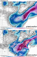
Gold standard 0z Canadian:
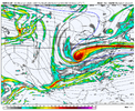
New AIFS ENS
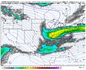
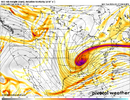
Canadian with a shorter western ridge and bit further southwest dug in with the vortmax. Later in the run the same differences, but downstream effects means CMC is more neg tilt by then
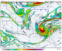
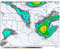
Just to give an idea of what to look for esp if you are west of I-77
Gold standard 0z Canadian:

New AIFS ENS

Canadian with a shorter western ridge and bit further southwest dug in with the vortmax. Later in the run the same differences, but downstream effects means CMC is more neg tilt by then


Just to give an idea of what to look for esp if you are west of I-77
NCPROGRAMMER
Member
A few more east shifts and poof, no stormEnjoy every fantasy run and inch of digital snow folks. The eventual outcome is not guaranteed.
Insane how fast that site is. Weatherbell isn't showing 06 Euro or EPS yet. It's behind.6z eps…yuck
Is this the turning point for this one like we had last week.
View attachment 189889View attachment 189890
iGRXY
Member
Euro/EPS vs everybody right now.
Cary_Snow95
Member
One thing that has appeared since the 00z runs is the orientation of the footprint has changed from more SSW-NNE to more SW-NE. Less into the northeast and further backing the footprint over the Carolina’s and into Georgia slightly
wow
Member
Weathernext has been ticking east as well.Euro/EPS vs everybody right now.
This is not a pairing I want to be up against especially with weathernext trending drierEuro/EPS vs everybody right now.
Brandon10
Member
8am Weathernext...does it stop or keep trending east...lets hope ICON isnt leading the way
znel52
Member
Yeah it was bad news for pretty much everyone. Drier and East.Did 6z operational euro run yet?
rburrel2
Member
Weathernext has ticked east. Euro ai and gfs ai have been ticking west… they’re now all on top of each other.
Why are we concerning ourselves with the euro that’s not even in the same ballpark?
CMC/gfs also probably wrong with 30+inch bomb stuff too.
I’m betting on the AI consensus right now.
Why are we concerning ourselves with the euro that’s not even in the same ballpark?
CMC/gfs also probably wrong with 30+inch bomb stuff too.
I’m betting on the AI consensus right now.
iGRXY
Member
I still haven't seen the overnight snowfall map. Anybody got it?Weathernext has been ticking east as well.
Tokenfreak
Member
Cary_Snow95
Member
Biggest ? for me is it’s drier but extends further south offshore
iGRXY
Member
Yikes big time. Usually it's pretty locked in by now. My guess is it's still a nice 4-6"+ (kuchera since this is 10:1)over the western carolinas but that trend needs to relax big time.
It seems like google led the way with the trend east the last 2 days as well as the precip over the upstate. Other models have seemed to all fall in line overnight. Now we need to see if google gives us a westward expansion w precip today, fingers crossed.
Cary_Snow95
Member

