-
Hello, please take a minute to check out our awesome content, contributed by the wonderful members of our community. We hope you'll add your own thoughts and opinions by making a free account!
You are using an out of date browser. It may not display this or other websites correctly.
You should upgrade or use an alternative browser.
You should upgrade or use an alternative browser.
Wintry Machine Learning Mauler 1/30-2/1
- Thread starter SD
- Start date
bud006
Member
Thank you for doing this. I’ve become far more intrigued at the potential for my part of the world as the afternoon has turned to evening, and the signals are present that moisture could work far enough west to get north of Atlanta into the game. Here we go with the intense model watching again!
—30—
CNCsnwfan1210
Member
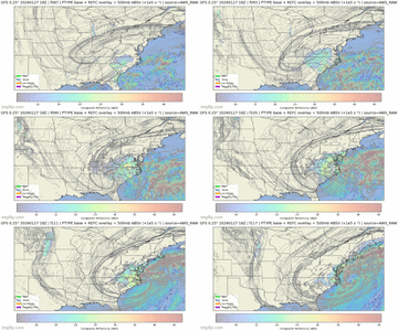
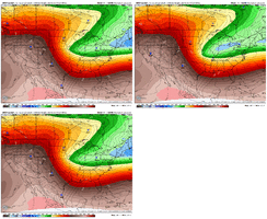
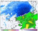
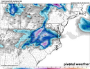
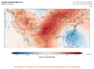
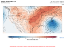
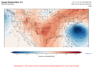
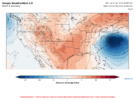
Here's member 2: I don't want to clutter up the thread with these images, but you get the idea..
View attachment 190309View attachment 190310View attachment 190311View attachment 190312
View attachment 190313
980mb low on that one
Sent from my iPhone using Tapatalk
iGRXY
Member
Ah didn’t realize it was individual members, at the gym and skimming. Still love the lookIt's hard to tell because I haven't seen the full ensemble yet. Part of the reason it is so consistent is because it is a 68-member well-dispersed ensemble.
The second member may have even been better than the first. Keep the good news coming!
iGRXY
Member
Yeah for whatever reason the data was only available on the server for a short period and I was only able to download 6 members before it failed, now it won't download any of them. The 6 all look really good though.Ah didn’t realize it was individual members, at the gym and skimming. Still love the look
wow
Member
bncho
Member
wow
Member
BrickTamland
Member
Brandon10
Member
And warm nose. Great.
Your gifs are at light speed lolIt's happening
View attachment 190319
Looks amazing though. We're going to remember this one...and this winter.
Lol at the poor tv mets an nws tommorrow having to start telling public a 1 foot plus snowstorm is heading our wAy. Starts in 48 hours
BrickTamland
Member
iGRXY
Member
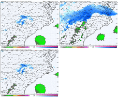
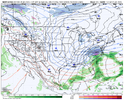
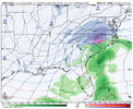
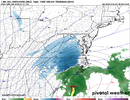
NAM feedback issues in the long range people.At 84.. this is further NW than the GFS. Rain in SE NC!
View attachment 190321
No way we fumble this look right? We have the GFS, Euro, and CMC on our side, with weathernext trending in the right direction...
BrickTamland
Member
LukeBarrette
im north of 90% of people on here so yeah
Meteorology Student
Member
2024 Supporter
2017-2023 Supporter
Before it begins to probably tilt and throw more precip back to the SW
Dont panic on the pink shades. You have about a 10 mile transition line in these miller A bombs. It retreats off you fast as column cools top down.
Blue_Ridge_Escarpment
Member
ULL still hadn't swung through yetwhere’s all the precip that should be thrown back into upstate sc? Looks slim.
Nam was pulling 0c at 700mb back to about my house and the 850 low was over near Asheville. Not that great along and E of 95.
With the 540 almost sitting on the coast line? I really hope this is not the beginning of NAM sniffing out a warm nose. Obviously I feel confident that everything switches back to snow as the low deepens and pulls in more cold air, but you’d hate lose a lot of QPF to a mixAt 84.. this is further NW than the GFS. Rain in SE NC!
View attachment 190321
I just don't see mixing becoming an issue with this system. I feel like it's either going to be rain or snow.
It's the 84 hour NAM. You might as well get the crayons out and draw your own maps.where’s all the precip that should be thrown back into upstate sc? Looks slim.
It was just getting started. Will be hoot to look at tommorowULL still hadn't swung through yet
Yeah not comfortable at this range but it is the NAM at 84 and precip types/totals are suspect. Also that 540line was down on the coast.Nam was pulling 0c at 700mb back to about my house and the 850 low was over near Asheville. Not that great along and E of 95.
iGRXY
Member
Relax on the NAM precip maps in the long range people. That comma head will be there and the ULL hasn’t swung through yet.
Yeah that thing was about to wrap up and destroy two (edit: three)states it appearedIt's the 84 hour NAM. You might as well get the crayons out and draw your own maps.
AJ1013
Member
Never seen a forecast this cold here. Unbelievable. Rooting for you guys to get your snowstorm but us in the tropics are also invested.


Yeah look at the map, you can still see the ULL is still back over middle Tennessee and is about to to change tilt. If that went out 3 more hours, precip probably explodesRelax on the NAM precip maps in the long range people. That comma head will be there and the ULL hasn’t swung through yet.
Brandon10
Member
Ive lived in ENC long enough to know the warm nose loves to cause rain east of 17 while west is a winter wonderland. GFS was hinting at this. Hopefully it doesnt verifyWith the 540 almost sitting on the coast line? I really hope this is not the beginning of NAM sniffing out a warm nose. Obviously I feel confident that everything switches back to snow as the low deepens and pulls in more cold air, but you’d hate lose a lot of QPF to a mix
Brad P just released a Vlog update on Facebook. He’s raising his snow meter to 4. I think he’s getting excited
Tokenfreak
Member
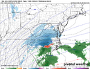
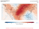
I just seen this graphic from the weather channel


