• Hello, please take a minute to check out our awesome content, contributed by the wonderful members of our community. We hope you'll add your own thoughts and opinions by making a free account!

Pattern July Fry

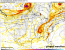
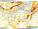
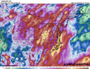
HRRR and RRFS worlds apart awesome. RRFS wallops WNC and HRRR goes for GSO-CLT-RDU and down east. I feel like the latter is more likely but it may just end up being "place that had less junk in the morning"

at the same time the july sun is gonna be pretty good at recovering very quickly for places that do have junk

REFS is pretty similar to RRFS (go figure)
RRFS had the entire state of WI covered in supercells this morning. In reality, there was a regional cluster of storms in the UP of MI. 😆
 
Looks like if we can get the rain to the NW to come through quick enough we could get some clearing to help fire up storms later this evening and tonight.
 
Good news, cloud cover and rain is limiting storm chances, somewhat.
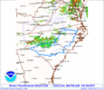
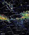
Also, SEVERE THUNDERSTORM WATCH #526 HAS BEEN ISSUED TO WESTERN NC TILL 8PM
ww0526_radar.gif

AND FOR US TOO. SEVERE THUNDERSTORM WATCH #530 IN EFFECT UNTIL 1AM
ww0530_radar.gif
EDIT: ANOTHER -------- ONE!
 
Last edited:
If that storm moving towards RDU stays together and really dumps, this could be the wettest July on record. Doubtful it’ll rain enough to do that (I think we need one and a quarter inches or so), though.
 
If that storm moving towards RDU stays together and really dumps, this could be the wettest July on record. Doubtful it’ll rain enough to do that (I think we need one and a quarter inches or so), though.
One extreme to the other. Mother Nature has to swing the pendulum back the other way to even out things.
 
Radar looks looks gross. You don’t see this line of attack out of the north very often
That was very much a snoozefest. Rained exactly 3 mins and just barely wet everything. Next! Nevemind, been like this all summer. Next will be more of the same. Maybe next summer will be different?
 
That was very much a snoozefest. Rained exactly 3 mins and just barely wet everything. Next! Nevemind, been like this all summer. Next will be more of the same. Maybe next summer will be different?
Downsloping doing gods work in the typical places. Wintering in the summertime IMG_0827.jpeg
 
If that storm moving towards RDU stays together and really dumps, this could be the wettest July on record. Doubtful it’ll rain enough to do that (I think we need one and a quarter inches or so), though.
It delivered, but not quite enough! From NWS RAH:

After this evening's storms, 12.16" of rain has now fallen this month at RDU Airport. This makes July 2026 the 2nd-wettest July on record at RDU, only 0.20" from the wettest July in 1931. This is more than what fell during the entire first 6 months of the year (11.88", which was the driest January-June period on record). Quite a contrast, to say the least! #ncwx
 
Local stations didn’t have the storms getting here but that was quite the violent .8”. Temp was still 84 at 11:30 before the line rolled through, 72 now.
It knocked out power out and gave us another inch for the month.
 
INLAND CHATHAM-
INCLUDING THE CITIES OF GARDEN CITY, POOLER, AND SAVANNAH
707 AM EDT WED JUL 29 2026

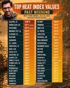
...EXTREME HEAT WARNING IN EFFECT FROM 11 AM THIS MORNING TO 7 PM
EDT THIS EVENING...

TODAY
MOSTLY SUNNY. A SLIGHT CHANCE OF SHOWERS AND
THUNDERSTORMS THIS AFTERNOON. HIGHS IN THE UPPER 90S. HEAT INDEX
VALUES UP TO 112. WEST WINDS 5 TO 10 MPH. CHANCE OF RAIN
20 PERCENT.

—————————


INCLUDING THE CITIES OF WILMINGTON ISLAND AND TYBEE ISLAND
707 AM EDT WED JUL 29 2026

...EXTREME HEAT WARNING IN EFFECT FROM 11 AM THIS MORNING TO 7 PM
EDT THIS EVENING...

TODAY
MOSTLY SUNNY. A CHANCE OF SHOWERS AND THUNDERSTORMS THIS
AFTERNOON. HIGHS IN THE UPPER 90S. HEAT INDEX VALUES UP TO 115.
WEST WINDS 5 TO 10 MPH. CHANCE OF RAIN 30 PERCENT
————

The low so far today at KSAV is 82! Will they get convection and/or outflow from nearby convection to get below that by this evening? Not likely but possible. If not, the 82 would tie a record high low.
 
Last edited:
We got wind and thunder/lightning last not but not more than a few drops of rain. The Union county shield continues, at least my neck of the woods!
 
It already hit 99.5 at 2:15PM at my place! The highest so far this season that I’ve seen here is 101.1, which was at 2:35PM on July 12th.

Winds are from the SW, keeping the seabreeze away. Skies are mostly to partly sunny with an ugly haze.
———

*Edit: 100.5 at 2:30PM!
Since I don’t have RH, I don’t have a heat index. However, based on surrounding stations, it’s likely ~113!
————
*Edit: 100.9 at 2:46PM!
————
*Edit: 101.1 at 3:22PM, which ties with my hottest of the summer to date on July 12th!
 
Last edited:
Atlanta mets may want to reconsider their in-house models. They forecasted no rain last night and a high of 94 today.

Severe storms with numerous warnings and it is currently in the low 80s, I mean not even close.
 
Atlanta mets may want to reconsider their in-house models. They forecasted no rain last night and a high of 94 today.

Severe storms with numerous warnings and it is currently in the low 80s, I mean not even close.
They also kept talking about the dry air and it still seems pretty muggy.
 
Should be a pretty sunset. It’s smoky as hell I guess from the Canadian fires. You could barely see John’s mountain coming down 75 into Adairsville.
 
Scattered convection moving ESE like 3 days ago has been occurring throughout the area since ~7:45PM. I’m away from home and so have no idea how much I got there. The cooldown from today’s 99-101 in the area has been dramatic!

Edit on 7/30: I only got 0.1” yesterday (7/29), which puts me at 4.4” MTD.
 
Last edited:
Back
Top