• Hello, please take a minute to check out our awesome content, contributed by the wonderful members of our community. We hope you'll add your own thoughts and opinions by making a free account!

Pattern July Fry

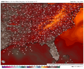
Somebody between Savannah and Morehead City is gonna have an overnight low of 85 or higher later this week. Shallow water inshore is heating up like crazy and if winds go calm that'll do it.
 
This is as much about the high dewpoints (in or near upper 70s) as it is about the heat, itself (mid to upper 90s) as the forecasted HIs are worse closer to the coast:

EXTREME HEAT WARNING IN EFFECT FROM 11 AM THIS MORNING TO 7 PM EDT THIS EVENING
* WHAT...Dangerously hot conditions with heat index values 112 to 116
possible.

* WHERE...Coastal southeast Georgia and southeast South Carolina.

* WHEN...From 11 AM this morning to 7 PM EDT this evening.

* IMPACTS...Heat related illnesses increase significantly during
extreme heat and high humidity events.
Drink plenty of fluids, stay in an air-conditioned room, stay out of
the sun, and check up on relatives and neighbors.
 
Another day, another PAIN moment for me. Rain is falling right now. 🙄
 
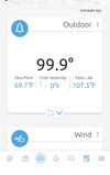
It’s still an oppressive 97.3 at my place with mostly sunny skies. I don’t know what the high was but my guess would be ~99 (about the hottest this year so far) and HI’s way up there. :(
 
Last edited:
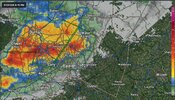
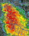
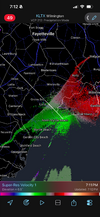
6:29PM: Looking like a downburst with winds of 50-60MPH is occurring just south of Raleigh right now from South of Tryon Road to 540. Damaging winds are possible; this could work into Southern Raleigh as well.

1000061288.jpg
 
Lotsa Thunder & lighting.. here/around Topsail Beach/Hampstead,,

When (WE), talk about Mesoscale weather..

I find this interesting.. I rode to Wilmington, where it was around 95F on My Car thermometer..
Riding back--> though Hampstead/surf city, temps reached 100F/101F, going towards Jacksonville it lowered to 95/96F (again on My car thermometer), with showers in the vicinity..

Coming back to MY AO /Homestead .. (From Jacksonville) Temps Raised yet again too 100F too 101F.. With strong winds coming off the Ocean..
Is it a Anomaly, soil(s) composition(s), Or what?


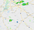
Incoming storm..

As I'm very close to the (across the street) from the Holly Shelter Game lands.. ) ..
 

Attachments

  • Capture.JPG
    Capture.JPG
    53.8 KB · Views: 5
The National Weather Service in Raleigh has issued a

* Severe Thunderstorm Warning for...
Southwestern Nash County in central North Carolina...
Northeastern Wake County in central North Carolina...
Western Wilson County in central North Carolina...
Northeastern Johnston County in central North Carolina...
Southwestern Franklin County in central North Carolina...

* Until 815 PM EDT.

* At 720 PM EDT, a severe thunderstorm was located 7 miles southeast
of Zebulon, or 15 miles north of Smithfield, moving northeast at
15 mph. a severe thunderstorm was located near Wake Forest, or 7
miles northeast of Raleigh, moving northeast at 20 mph.

HAZARD...60 mph wind gusts.

SOURCE...Radar indicated.

IMPACT...Expect damage to roofs, siding, and trees.

* Locations impacted include...
Raleigh, Wilson, Wake Forest, Clayton, Zebulon, Franklinton,
Bailey, Bunn, Knightdale, and Micro.

This includes the following highways...
Interstate 95 between Mile Markers 127 and 116, and between Mile
Markers 102 and 98.
Interstate 440 between Mile Markers 7 and 16.
Interstate 540 between Mile Markers 12 and 24.
NC Highway 264 between Mile Markers 20 and 38.

PRECAUTIONARY/PREPAREDNESS ACTIONS...

For your protection move to an interior room on the lowest floor of a
building.
 
Working my part time job at one of the community centers and there is a woman in the park with a baby and toddler on the swings and it is thundering like crazy.
 
Lotsa Thunder & lighting.. here/around Topsail Beach/Hampstead,,

When (WE), talk about Mesoscale weather..

I find this interesting.. I rode to Wilmington, where it was around 95F on My Car thermometer..
Riding back--> though Hampstead/surf city, temps reached 100F/101F, going towards Jacksonville it lowered to 95/96F (again on My car thermometer), with showers in the vicinity..

Coming back to MY AO /Homestead .. (From Jacksonville) Temps Raised yet again too 100F too 101F.. With strong winds coming off the Ocean..
Is it a Anomaly, soil(s) composition(s), Or what?


Incoming storm..

As I'm very close to the (across the street) from the Holly Shelter Game lands.. ) ..
Just heat wave things. You can get temperature rise ahead of a seabreeze front from the compression to show up on a PWS. It came through here earlier and only dropped from 99F to 96F. The near shore waters are heating up so much the seabreeze just isn't cool as it otherwise would be.
 
NW flow gonna make me wish the CCC had cut a 10 mile gap through the mountains back in the 30s. Gap winds would be hellacious but at least these events would be more interesting for those of us east of the Appalachians.

1783554600673.png
 
SPOTTER REPORTS
NATIONAL WEATHER SERVICE CHARLESTON SC
352 PM EDT WED JUL 08 2026

THE FOLLOWING ARE UNOFFICIAL OBSERVATIONS TAKEN BY VARIOUS QUALITY
CONTROLLED OBSERVATIONS SYSTEMS FROM ACROSS SOUTHEAST SOUTH CAROLINA
AND SOUTHEAST GEORGIA.

*************MAXIMUM HEAT INDEX (113F AND ABOVE)*************

LOCATION MAXIMUM TIME/DATE COMMENTS
HT INDEX MEASURED
(DEG F)

SOUTH CAROLINA

..BEAUFORT COUNTY

BEAUFORT MCAS 114.0 256 PM 7/08 ASOS

..BERKELEY COUNTY

HUGER 114.0 114 PM 7/08 MESONET
WITHERBEE 113.0 1215 PM 7/08 OTHER FEDERAL

..CHARLESTON COUNTY

AWENDAW/WAMBW 116.0 147 PM 7/08 OTHER FEDERAL
CHARLESTON INTL ARPT 114.0 308 PM 7/08 ASOS
CHARLESTON EXE ARPT 113.0 1255 PM 7/08 AWOS
DOWNTOWN CHARLESTON 113.0 200 PM 7/08 OFFICIAL NWS OB.

..COLLETON COUNTY

BENNETTS POINT 113.0 1200 PM 7/08 OTHER FEDERAL
 
Westerly wind is fading and the sea breeze is coming inland. Bye bye low dew point.
 

Attachments

  • IMG_0441.png
    IMG_0441.png
    1 MB · Views: 6
Still haven't hit 100 here and people thought we would today. That's pretty good for July 9th

If we don't do it tomorrow it's gonna be awhile

Accuweather(ha) has none through the beginning of August
 
Last edited:
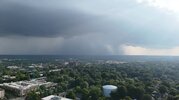
Very strong storm incoming! Very windy and fierce looking skies just to west! Small limbs falling! A few big raindrops.

So far just a few big drops. This batch formed per radar from collision of inland outflow and seabreeze boundaries. Cool stuff! Rarely a dull moment this time of year.

Edit 9:20 PM: There was never more than a trace from those aforementioned few drops at my place. However, there was heavy rain for a pretty short period from the NW part of the county to downtown and also from Skidaway and Wilmington Islands to Tybee. In addition, much of the coastal counties of S SC got plentiful rain.
 
Last edited:
Back
Top